


3 min walk · Paris 18e Arrondissement
Jardins d'Éole
- High
- Nature site
Language · 1 published
Historic monument · Paris 18e Arrondissement, Paris
Bataille de Paris
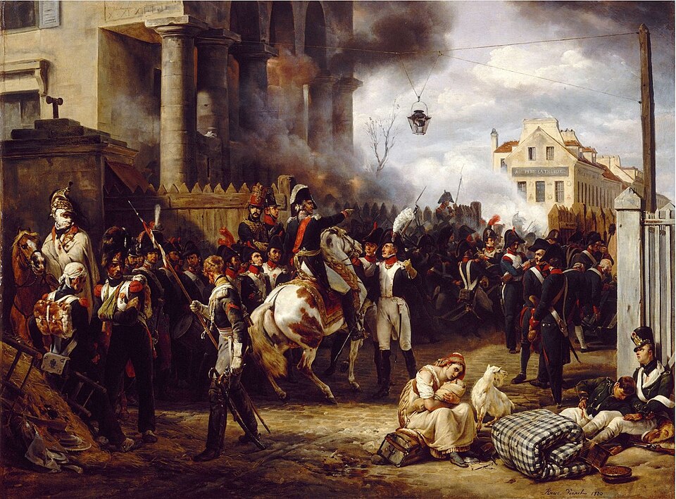
This point marks ground fought over during the Battle of Paris of 30-31 March 1814, the engagement that ended the War of the Sixth Coalition on French soil and forced Napoleon's abdication weeks later.
Roughly 107,000 Allied troops under Tsar Alexander I of Russia — Russian, Prussian and Austrian corps together — advanced on the capital, defended by about 23,000 French troops under Marshals Auguste de Marmont and Adolphe Mortier, with Napoleon himself still campaigning east of the city.
Fighting broke out on the northern and eastern approaches — the heights of Montmartre, and the villages of Romainville, Pantin and Belleville that are now inside the city. Marmont signed the capitulation of Paris on the evening of 31 March 1814, and the Allied sovereigns entered the city the next day.
Checked 2026-08-24 · Source
There is no fortification or building to walk through here — the 1814 fighting was open engagement across hillside and village ground that has since been entirely built over by the modern city.
What this point records is the historical association with the battle rather than a surviving structure. The specific form of the marker itself — plaque, stone or inscription — is not recorded on the sources this page draws on, and no on-site interpretive display is confirmed to exist.
The wider battle left its most visible trace at Montmartre, where the defence made its final stand on the butte before the capitulation, and at Pere Lachaise cemetery, whose walls Marmont's troops used as a defensive position on the eastern side of the city.
Checked 2026-08-24 · Source

A few minutes at the marker itself. The battle's ground is spread across several kilometres of the northern and eastern city — Montmartre, Belleville, Pantin, Romainville — and seeing it in context means treating it as a walk between neighbourhoods rather than a single stop.
Pairing it with the Montmartre hill, where the defence collapsed on 30 March, gives the visit a clearer shape than the marker on its own.
Checked 2026-08-24 · Source
Any time — this is a point in the open city with no gate and no closing hour. There is no annual commemoration event confirmed for this specific site, unlike the 11 November and 8 May ceremonies tied to the two World Wars.
30 and 31 March mark the battle's anniversary in the historical record, but that is a date for context rather than a day the site itself observes.
Checked 2026-08-24 · Source

No ticket and no door — this is an open point in the public city, not an enclosed monument or museum. There is nothing to buy and no admission of any kind.
Nothing here is run by an operator, a heritage body or a ticketing office, which is normal for a marker of this kind rather than an omission — the same is true of most battlefield sites once they have been absorbed into a modern city rather than preserved as a standalone historical park.
Checked 2026-08-24 · Source
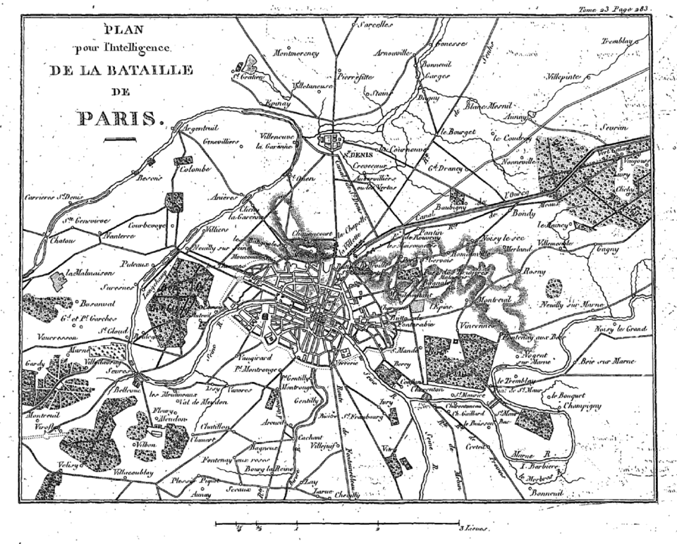
The fighting of 1814 spread across the north and east of what is now Paris, so the nearest access point depends on which sector of the battle is being traced; the precise metro stop for this exact coordinate is not confirmed on the sources this page uses.
Montmartre is reached from Anvers or Abbesses on line 2 and line 12 respectively; Belleville and Pere Lachaise, the eastern sector of the fighting, are reached from Belleville on lines 2 and 11 or Pere Lachaise on lines 2 and 3.
Checked 2026-08-24 · Source
There is no physical hazard at an open urban point like this — the caution is about expectation rather than safety. A visitor arriving looking for a battlefield in the conventional sense will find ordinary streets and buildings; almost nothing of the 1814 terrain reads as a battlefield today.
The Battle of Paris is sometimes confused with the later 1870-71 Siege of Paris and with the August 1944 fighting for the Liberation of Paris — three separate events, a century apart, that share the same city as their setting.
Checked 2026-08-24 · Source
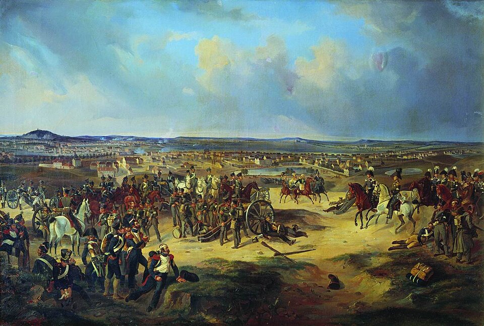
No photography restriction applies to an open street point. The more useful shot for understanding the battle is from the top of Montmartre, looking north and east over the ground the Allied corps advanced across in 1814, which is now entirely built up.
There is no monument facade or plaque confirmed at this coordinate to photograph as a subject in its own right.
Checked 2026-08-24 · Source
The engagement of 30-31 March 1814 in which about 107,000 Allied troops under Tsar Alexander I forced the capitulation of Paris, defended by roughly 23,000 French troops under Marshals Marmont and Mortier.
Marmont's capitulation on 31 March 1814, the Allied entry into Paris the next day, and Napoleon's abdication weeks later, ending the War of the Sixth Coalition.
The northern and eastern approaches to the city — Montmartre, and the then-outlying villages of Romainville, Pantin and Belleville, all now inside Paris.
The marker's exact form is not recorded on the sources this page draws on; what is confirmed is the site's association with the 1814 fighting.
No. The August 1944 fighting for the Liberation of Paris is a separate event, 130 years later, sometimes confused with the 1814 battle because both share the name.
No. This is an open point in the public city with no ticket and no gate.
Loading the interactive map…
The interactive map could not be loaded.
Last updated:
Source: OpenStreetMap contributors, Wikidata ·