

.jpg)
.jpg)


1 min walk
Uetliberg Aussichtsturm
- Must see
- Historic monument
Language · 1 published
Viewpoint · Zurich
Uetliberg
| Monday | 00:00 – 23:59 |
|---|---|
| Tuesday | 00:00 – 23:59 |
| Wednesday | 00:00 – 23:59 |
| Thursday | 00:00 – 23:59 |
| Friday | 00:00 – 23:59 |
| Saturday | 00:00 – 23:59 |
| Sunday | 00:00 – 23:59 |
Checked 2026-08-26 · Source
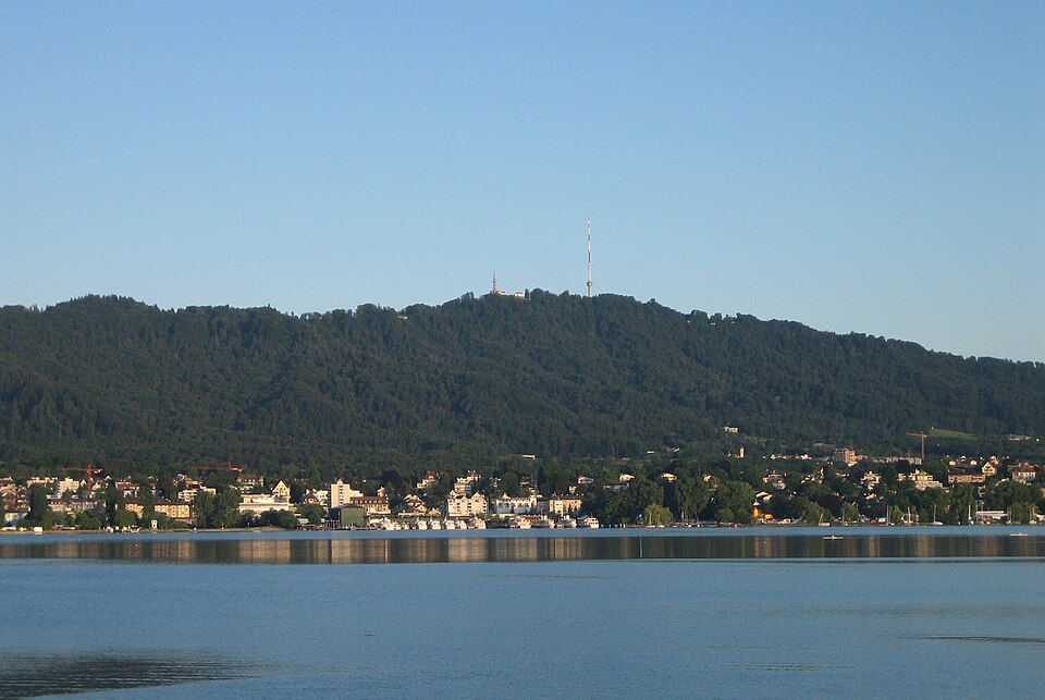
Uetliberg is the wooded ridge that closes Zurich off to the south-west, and the Uto Kulm, its summit, stands at 871 metres above sea level — the figure the summit hotel gives on its own hiking page, and the elevation carried on the OpenStreetMap summit node. Zurich calls it the Hausberg, the house mountain, and treats it as an extension of the city rather than an excursion. The railway from the centre reaches the top station in twenty minutes, and a seven-minute walk through the trees brings you out at the summit buildings.
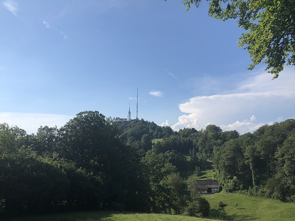
What waits up there is deliberately unspectacular. The UTO KULM hotel and its restaurant occupy the high point, a broadcasting antenna rises behind them, and a terrace faces the lake and, in clear weather, the Alps beyond it. The mountain itself is public forest, owned by the city of Zurich, with no gate, no ticket desk and no closing hour.
That is the thing to grasp before planning a visit. Uetliberg is not an attraction that admits you at a counter; it is a hill you ride or walk up, and everything that costs money — the train, a coffee, a bed for the night — is a service laid on top of ground that is free to stand on.
Checked 2026-08-26 · Source
The best-known thing on the ridge is the Planet Trail, which runs from the railway terminus at Uetliberg along the Albis to Felsenegg and takes about two hours. It was designed by Arnold von Rotz and opened on 26 April 1979, and it is laid out at a scale of one to a billion, so one metre of path stands for one million kilometres of solar system. The sun is a yellow globe on a mast just behind the terminus, on the path towards the hotel; the planets sit on erratic boulders left by the Linth and Reuss glaciers, the small ones glassed into a niche in the rock, the large ones mounted on the boulder's tip, each with a plaque giving equatorial diameter, rotation and orbital speed. Ceres and Pluto are included alongside the eight planets.
The city has also built two official mountain-bike trails here. The Triemli trail, usually called the Antenna Trail, starts beneath the transmitting mast at the large barbecue area and finishes just above Triemli station: 3.5 kilometres, about 350 metres of descent, a track only thirty to sixty centimetres wide, roughly eleven minutes down. The shorter Höckler trail runs 500 metres and is steep in places.
Checked 2026-08-26 · Source
Two hours on the summit itself is the honest figure for most visitors. That covers the seven-minute walk up from the station, a slow circuit of the ridge top, time on the terrace with the view, and the walk back down to the platform — and it assumes you are not eating a full meal. Add the journey and a return trip from central Zurich occupies something closer to three hours door to door.
The variations matter more here than the base figure. Walking up instead of riding adds three quarters of an hour to an hour, depending on which of the approaches you take. Walking the Planet Trail to Felsenegg adds about two hours on top of your time at the summit, and it is a one-way commitment: you come down by the Adliswil cable car and the Sihltal line rather than back the way you came. Lunch in the restaurant, with the hot kitchen open only between noon and two, turns a two-hour outing into a four-hour one.
For a first visit with an ordinary afternoon to spend, budget two hours up there and treat anything longer as a walk rather than a sightseeing stop.
Checked 2026-08-26
The mountain is open at every hour of every day, so the question is only what the weather is doing. The Uetliberg-Verein publishes long-run sunshine averages for the ridge, and they make the case for the place better than any description: the Uto Kulm records about 1,752 hours of sunshine a year against 1,492 at Zurich airport down in the valley. July is the brightest month at 239 hours, August 216, June 208.
The interesting number is December. The summit averages 61 hours of sunshine that month and the airport 32 — barely half. A winter day when the city sits under low cloud is exactly the day the twenty-minute train ride earns its fare, and the reason locals treat a grey December morning as a reason to go up rather than to stay home.
Within the day, weekends bring the heaviest traffic and the railway runs every twenty minutes to absorb it, against every thirty on weekdays. A weekday morning is the quiet end of the range. Late afternoon into dusk gives the best of the view over the city, at the cost of sharing the terrace with everyone else who worked that out.
Checked 2026-08-26 · Source
There is nothing to buy to visit Uetliberg. The summit is unenclosed public forest with no ticket office, no turnstile and no admission charge, and the operator of the summit hotel describes the arrival in terms of trains and footpaths only, never of tickets to the mountain.
What you do pay for is the journey. The Uetlibergbahn, the S10, is an ordinary line of the Zurich regional network, and it is charged at the standard fare for the zones you cross rather than as an excursion ticket. The exact fare for a Zurich centre to Uetliberg journey is not recorded here: the railway's own site would not load when it was checked on 26 August 2026, and no figure is worth quoting from anywhere else. Check the price at a machine or in the ZVV app before travelling. The hotel points visitors at the Zurich Card, the city's one-to-three-day pass, as the usual way to cover it alongside the rest of a short stay.
The other costs are optional and ordinary: a drink or a meal at the summit restaurant, or a room if you stay. Sunday brunch there is taken by reservation only.
Checked 2026-08-26 · Source
The S10 from Zurich main station reaches the Uetliberg terminus in twenty minutes, from platform 22, every thirty minutes on weekdays and every twenty at weekends. From the terminus a seven-minute walk through the forest brings you to the summit. Note one substantial change: between 29 April and 18 October 2026 the SZU platforms at the main station are closed for building work and the S10 starts and ends at Zurich Selnau instead. Selnau is about eight minutes' flat walk from the main station, or a tram ride to Stauffacher followed by two minutes on foot.
On foot from the city, the operator gives three approaches: from Uitikon-Waldegg about forty-five minutes, from Albisgüetli about forty-five minutes, from Triemli about an hour. Albisgüetli is the terminus of tram 13 and offers both the direct Denzlerweg and the Laternenweg slightly further west; Triemli is the terminus of tram 14, and the Hohensteinweg climbs a shoulder from there.
A car will not get you to the top. Uetliberg is a car-free recreation area and the last stretch is only reachable by train or on foot. The free Feldermoos car park at Uitikon-Waldegg is the recommended place to leave one, seven to ten minutes' walk from Uitikon-Waldegg station.
Checked 2026-08-26 · Source
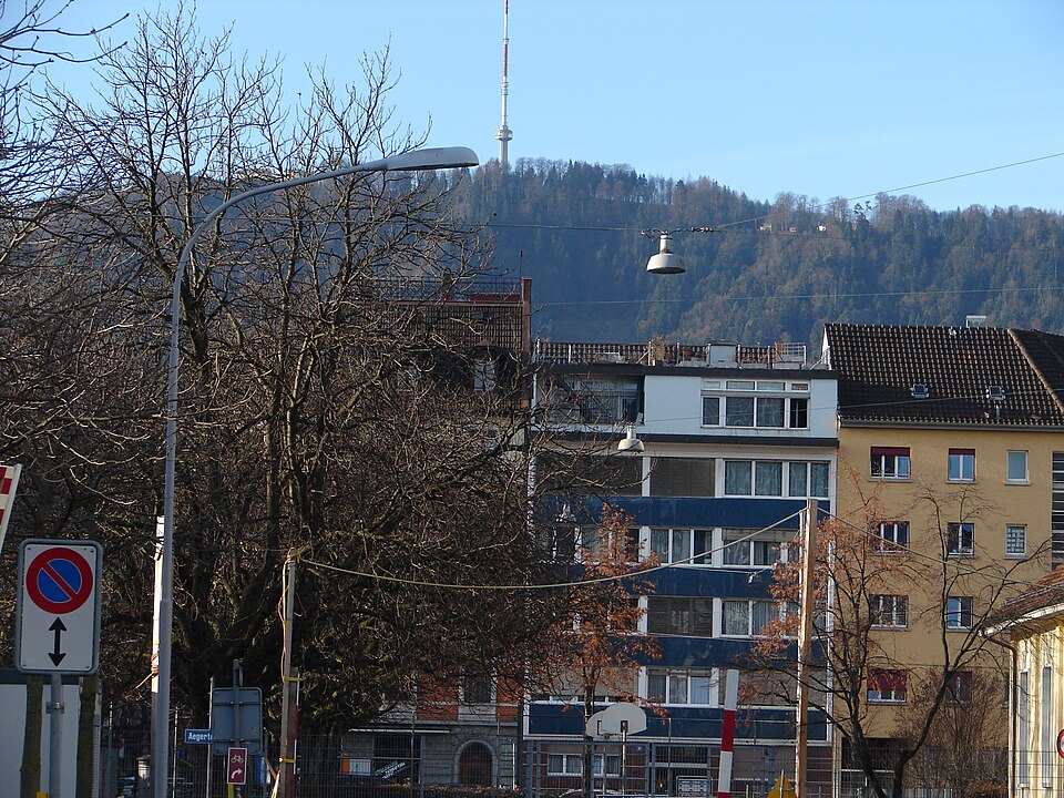
The car-free rule is the trap people fall into. You cannot drive to the hotel, and a satnav pointed at the summit will strand you; plan around the train from the start, or leave the car at Feldermoos and take the S10 up from Uitikon-Waldegg.
The kitchen is the second trap. The summit restaurant is open from seven in the morning until eleven at night, but hot food is served only between noon and two and again between six and half past nine. Arrive hungry at three in the afternoon and you are looking at the outdoor stand in good weather, or a slice of cake.
A lookout tower stands beside the hotel and is the reason many visitors come up. Its opening times and any charge for climbing it are not published on the operator's own website, and no figure is given here rather than repeating one from an aggregator; ask at the hotel or read the sign at the foot of the tower.
In winter the Hohensteinweg from Triemli doubles as a sledging run, which makes it a poor choice as a walking route on a snowy weekend. The mountain-bike trails are thirty to sixty centimetres wide and are not walking paths.
Checked 2026-08-26

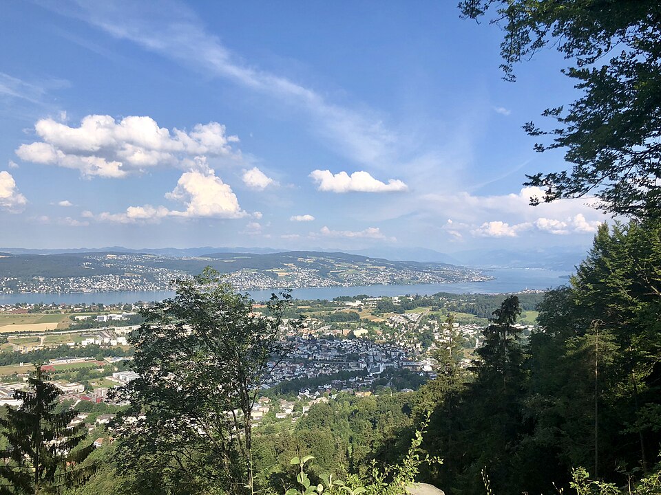
The view is the picture, and it is one long panorama rather than a single frame: the city below to the north-east, Lake Zurich running away to the south-east, and the Alps closing the horizon behind it on a clear day. The terrace beside the restaurant faces that arc across roughly a hundred and eighty degrees, which is more than a standard lens will hold — either accept a slice of it or shoot a sweep and stitch.
Because the city lies east and north-east of the ridge, morning light falls onto Zurich and the lake and gives the cleanest detail in the rooftops; late afternoon puts the sun behind you over the Albis and turns the same scene flat, then good again as it drops. Blue hour is the strongest time here: the ridge stays open after dark, the lit city reads well against the water, and there is no closing bell to hurry you.
Winter rewards the trip more than summer does. The summit records nearly twice the December sunshine of the valley floor, so the classic image — a sea of low cloud lying over the city with the Alps standing clear above it — is a winter one, and it needs an inversion day rather than simply a cold one.
Checked 2026-08-26
No. Uetliberg is a car-free recreation area and the summit hotel states plainly that arriving at the door by car is not possible; the last stretch is reachable only by the Uetlibergbahn or on foot. The recommended place to leave a car is the free Feldermoos car park at Uitikon-Waldegg, from which it is a seven-minute walk through the forest to Uitikon-Waldegg station, or ten minutes along the asphalt road, and then a short ride on the S10 to the terminus.
Take the S10 to its terminus at Uetliberg: twenty minutes from Zurich main station, departing from platform 22, every thirty minutes on weekdays and every twenty at weekends. From the terminus a seven-minute walk through the forest reaches the summit. Between 29 April and 18 October 2026 the SZU platforms at the main station are closed for building work and the S10 runs from Zurich Selnau instead — about eight minutes on foot from the main station, or a tram to Stauffacher and two minutes' walk.
No. The summit is unenclosed public forest with no ticket office and no entrance fee, and it has no closing time. The cost of a visit is the train fare, charged at the ordinary Zurich regional-network rate for the zones crossed; the exact amount is not quoted here because the railway's own site could not be reached when this page was checked on 26 August 2026. Food, drink and a hotel room at the summit are separate and optional.
Two hours on the summit suits most visitors, which covers the walk up from the station, a circuit of the ridge top, time at the view and the walk back to the platform. With the journey from central Zurich at each end, that is about three hours door to door. Walking up rather than riding adds three quarters of an hour to an hour; continuing along the Planet Trail to Felsenegg adds roughly two more; a sit-down lunch adds another hour or so.
Yes, and the operator gives three standard approaches from the city: about forty-five minutes from Uitikon-Waldegg, about forty-five minutes from Albisgüetli, and about an hour from Triemli. Albisgüetli is the terminus of tram 13 and offers the fairly direct Denzlerweg as well as the Laternenweg a little further west; Triemli is the terminus of tram 14, from which the Hohensteinweg climbs a shoulder of the hill. The forest path up from the Uitikon-Waldegg car park is the least steep of them.
Yes. The UTO KULM restaurant at the summit serves from seven in the morning until eleven at night, seven days a week, but the hot kitchen runs only from noon to two and from six to half past nine. Breakfast is served daily from seven to eleven, and Sunday brunch from eleven to two by reservation only. In good weather an outdoor self-service stand sells street food from nine in the morning until about nine at night on Mondays and Tuesdays, and until ten from Wednesday to Sunday.
Loading the interactive map…
The interactive map could not be loaded.
Last updated:
Source: OpenStreetMap contributors, Wikidata ·