Monumento histórico · Chicago
Map of Bronzeville
Fotografía
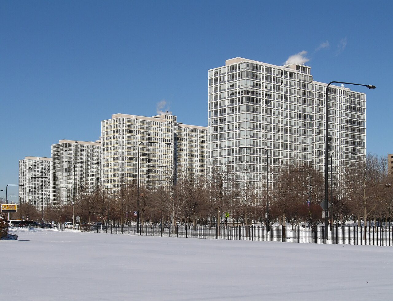

- hoy
- Horario no registrado
- Duración de la visita
- 45 min
- Accesibilidad
- No registrado
- Precio
- No registrado
- Posición
- Alto · Sitio patrimonial
- Rango
- Rango 90 de 7,563
Acerca de Map of Bronzeville
Bronzeville is a historic neighborhood on Chicago's South Side, recognized as a node on OpenStreetMap. The area served as a major destination during the Great Migration, when African Americans relocated from the southern United States. Bronzeville became known for its cultural, political, and economic significance within Black Chicago. The neighborhood contains various buildings and sites that reflect this layered history. Visitors today encounter a community that continues to evolve while maintaining connections to its past. The OpenStreetMap entry identifies this location through node 9584056388, which serves as a geographic reference point for the broader Bronzeville area rather than a single contained attraction.
Comprobado 2026-08-26
¿Qué hay dentro?
The Bronzeville area contains multiple points of interest distributed across several blocks rather than one enclosed site. Visitors will find churches, residential architecture, and commercial corridors that have served the community for generations. Specific named attractions within the broader Bronzeville district may include monuments, historic structures, and cultural institutions, though these operate as separate entities with their own access arrangements. The OpenStreetMap node marks a general area reference rather than defining precise boundaries of what visitors can enter. Individual buildings and their interiors require separate verification for public access. The neighborhood's character emerges from walking its streets and observing the built environment.
Comprobado 2026-08-26
Cuánto tiempo dedicar
The appropriate duration for visiting Bronzeville depends entirely on individual interests and which specific sites a visitor intends to explore. A brief pass through the neighborhood might occupy under an hour, while a more thorough engagement with multiple points of interest could extend to half a day or longer. The OpenStreetMap node does not indicate any managed visitor experience with recommended time allocations. Without defined boundaries or a single entry point, visitors must plan their own itinerary based on independently researched destinations within the area. Those interested in architectural observation, historical research, or community exploration will naturally require different time commitments.
Comprobado 2026-08-26
Temporada y multitudes
Bronzeville functions as an urban neighborhood without centralized operating hours or seasonal closure. Individual businesses, institutions, and attractions within the area maintain their own schedules. Operator-confirmed hours for any specific venue are Not recorded pending review. The neighborhood itself remains physically accessible at all times as public streets, though nighttime visitors should exercise standard urban awareness. Weather conditions in Chicago vary significantly across seasons, with cold winters and warm summers affecting comfortable walking conditions. Visitors should consult current forecasts and dress appropriately for outdoor exploration. Special events or programming at specific venues may occur on particular dates, but these require direct confirmation from organizers.
Comprobado 2026-08-26
Entradas
No general admission fee applies to entering the Bronzeville neighborhood itself, as it comprises public streets and sidewalks. Individual attractions, museums, or venues within the area may charge separate admission fees where applicable. Operator-confirmed prices for any specific site are Not recorded pending review. Visitors should not expect a single ticketing system for the neighborhood as a whole. Any paid experiences would be arranged directly with specific operators. The OpenStreetMap node provides geographic reference only and carries no ticketing function. Visitors planning to enter multiple venues should budget accordingly based on independently verified information from each destination's official channels.
Comprobado 2026-08-26
Llegar allí
Bronzeville occupies the South Side of Chicago, with accessibility depending on visitor starting points. Public transit options include Chicago Transit Authority bus routes and the Red Line and Green Line elevated train services, with stops at varying distances from different parts of the neighborhood. Exact transit routing requires consultation of current CTA schedules and maps. Driving visitors may find street parking, though availability and regulations vary by block and time. The OpenStreetMap node 9584056388 provides geographic coordinates that can guide navigation systems. Visitors unfamiliar with Chicago's grid system should note that address numbering increases outward from the downtown center, with Bronzeville located south of the Loop.
Comprobado 2026-08-26
Que tener en cuenta
Visitors to Bronzeville should apply standard urban awareness appropriate to any unfamiliar city neighborhood. Conditions vary by specific block and time of day. The area contains active traffic on major corridors, requiring pedestrian caution at intersections. Winter weather in Chicago can create hazardous walking conditions with ice and snow accumulation. Visitors should remain attentive to personal belongings and surroundings, as in any urban environment. The neighborhood is a lived community rather than a contained tourist district, meaning visitors should conduct themselves with respect for residents and private property. Photography of individuals without consent may be inappropriate. Specific safety concerns should be verified through current local sources rather than generalized assumptions.
Comprobado 2026-08-26
Fotografía
Photography opportunities in Bronzeville center on architectural subjects, streetscapes, and any publicly visible monuments or artworks. The neighborhood contains buildings representing various periods and styles significant to its historical development. No centralized photography policy exists for the area as a whole, as it remains public urban space. Visitors photographing private property, including residential buildings, should exercise discretion and respect for occupants' privacy. Interior photography at any specific venue would require that venue's permission. Lighting conditions vary by season and time of day, with the low winter sun creating different effects than summer's higher angle. Tripod use on sidewalks may attract attention or interfere with pedestrian traffic flow.
Comprobado 2026-08-26
Preguntas comunes
Is Bronzeville a single attraction or a district?
Bronzeville is a neighborhood district rather than a single contained attraction. The OpenStreetMap node marks a general geographic reference for the broader area.
Are there guided tours available?
Specific tour offerings are not recorded in the provided sources. Visitors would need to verify current tour availability through independent research of local operators.
What is the exact boundary of Bronzeville?
Precise boundaries are not defined by the OpenStreetMap node. The neighborhood's extent is understood approximately rather than through formally demarcated limits.
Is Bronzeville safe to visit?
Safety conditions vary by location and circumstances. Visitors should exercise standard urban awareness and consult current local information rather than relying on generalized assessments.
Are there restaurants or shops to visit?
Commercial establishments exist within the neighborhood, but specific operating businesses are not catalogued in the provided sources and require independent verification.
Does the Wikidata entry provide visitor information?
The Wikidata entry Q4823292 identifies Bronzeville but does not contain practical visitor details such as hours, prices, or specific amenities.
donde esta
Cargando el mapa interactivo…
No se ha podido cargar el mapa interactivo.
cerca
Encajarlo en un plan
Enlaces externos
Última actualización:
Fuente: Colaboradores de OpenStreetMap, Wikidata ·