Guía de ciudad · United States
Chicago
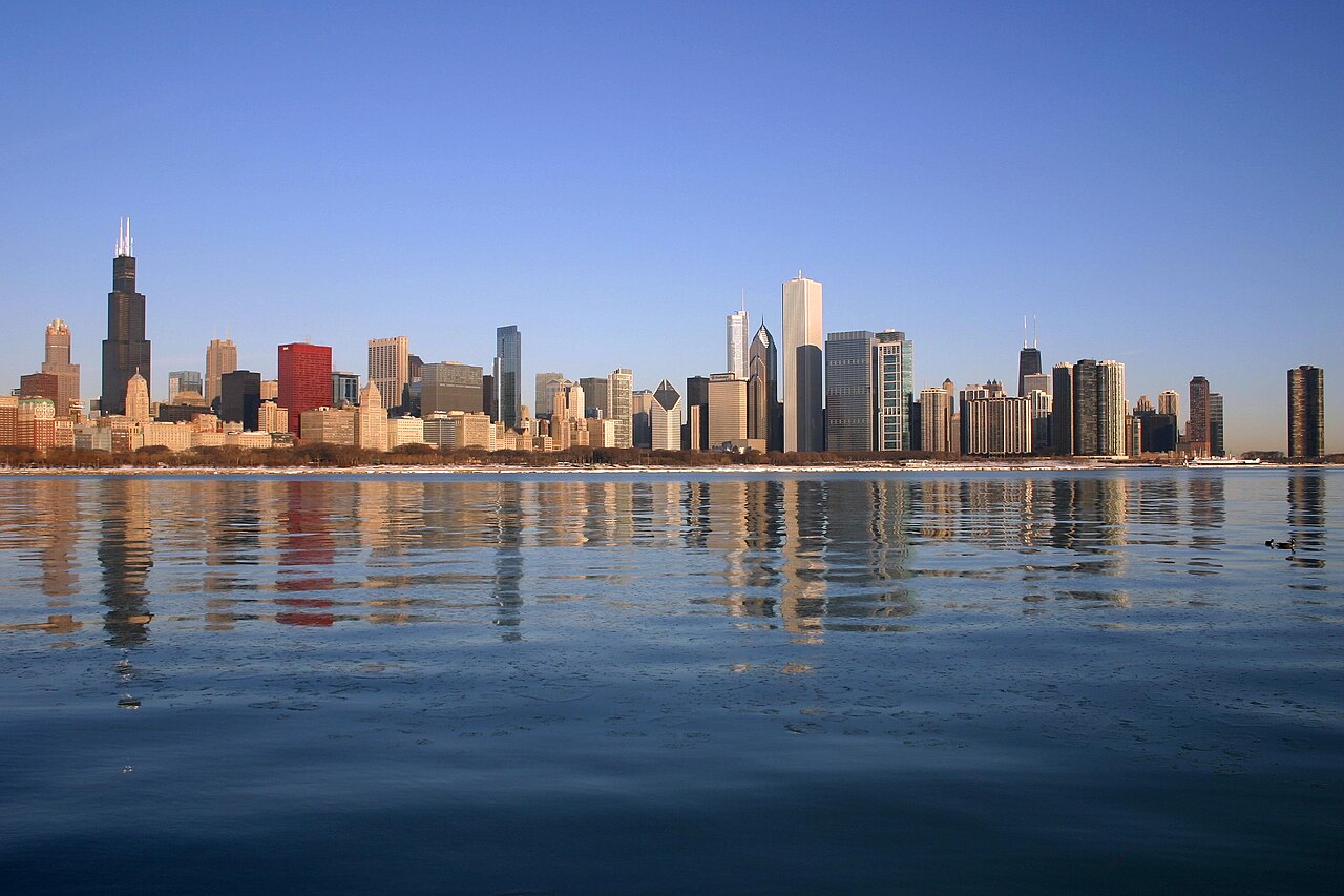

Chicago is organised around Lake Michigan, the Chicago River and a regular street grid. The Loop contains the central business district, major architecture and Millennium Park; museum campuses and lakefront parks extend south, while River North, Lincoln Park and neighbourhood centres continue north and west. A first visit works best when downtown sights are grouped together and separate time is reserved for one or two neighbourhoods beyond the Loop.
Información práctica
Información práctica
- Idioma hablado
- El inglés es el idioma principal; no hay idioma oficial federal
- Orientación práctica nacional; también pueden usarse idiomas regionales y minoritarios
- Prefijo telefónico
- +1
- Código de llamada internacional; aún aplican los prefijos de área local y móvil
- Moneda
- Dólar estadounidense (USD)
- Use la moneda local oficial; la aceptación de tarjeta varía según el lugar
- Número de emergencia
- 911
- Úselo solo para una emergencia; la asistencia turística puede usar un número separado
- Tipo de enchufe
- Tipo A y B · 120 V
- Compruebe que los cargadores admiten el voltaje registrado antes de usar un adaptador
- Agua del grifo
- No registrado
- La calidad del agua se regula a nivel local; consulte el aviso actual para el destino
Convierte esta lista en un plan
Establece tus días, tu ritmo y las horas en las que realmente quieres estar fuera. El planificador tiene en cuenta los días de cierre y el tiempo de desplazamiento, y deja tiempo para comer.
Planificar una visita
- Estancia sugerida
- Not recorded
- Cómo moverse
- Walk, CTA rail and bus
- enero: condiciones difíciles recurrentes
- febrero: condiciones difíciles recurrentes
- marzo: viable con contrapartidas importantes
- abril: buena época para visitar
- mayo: mejor época para visitar
- junio: buena época para visitar
- julio: viable con contrapartidas importantes
- agosto: viable con contrapartidas importantes — mes actual
- septiembre: mejor época para visitar
- octubre: mejor época para visitar
- noviembre: viable con contrapartidas importantes
- diciembre: condiciones difíciles recurrentes
- Mejor época
- Buena época
- Viable con contrapartidas
- Condiciones difíciles
Fuentes
- www.weather.gov Comprobado el 2026-08-28
Lo mejor para ver
Ordenado por importancia — enlaces del sitio, páginas vistas y estatus patrimonial, no por preferencia del editor.
Filtrar la lista
0 lugares coinciden
0 lugares coinciden
Categoría
Duración típica de la visita
Nada en Chicago coincide con todos esos filtros
La lista se construye a partir de datos reales de lugares, así que un resultado vacío significa que la combinación realmente no tiene coincidencias, no que la página haya fallado. Relaja un filtro y la clasificación volverá.
Fuente: Colaboradores de OpenStreetMap, Wikidata ·
Cómo está organizada la ciudad
State Street and Madison Street form the reference point for Chicago's address grid. The Loop sits beside the river and lake, with the Magnificent Mile and River North immediately north. Museum Campus, Hyde Park and Bronzeville lie south; West Loop, Pilsen and Wicker Park extend west and northwest. The lakefront is a continuous orientation line, but neighbourhood distances are substantial, so a map that appears compact can still represent several miles of travel.
Comprobado 2026-08-26
Cómo moverse
Walk within the Loop and along the central riverfront, then use CTA trains and buses for neighbourhoods and the airports. The colour-coded rail network connects downtown with the North, West and South Sides; the Blue Line serves O'Hare and the Orange Line serves Midway. Metra is useful for farther suburban trips rather than most central sightseeing. Check the official service map and alerts before travel because planned work can alter routes.
Comprobado 2026-08-26
Preguntas comunes
How many days should I spend in Chicago?
A fixed stay length is not recorded. Plan one block for the Loop and river, one for the lakefront museums, and additional time for the neighbourhoods that match your interests.
Where is central Chicago?
The Loop is the practical centre, bounded by elevated rail tracks and set beside the river and Lake Michigan. River North and the Magnificent Mile begin immediately north.
Can I visit Chicago without a car?
Yes. Walk downtown and use CTA trains and buses for the lakefront, neighbourhoods and airports. Metra is mainly useful for destinations farther beyond the central city.
Which train connects O'Hare with downtown?
The CTA Blue Line connects O'Hare International Airport with downtown. Consult CTA service alerts before departure because construction or maintenance can affect the normal route.
Are Chicago's neighbourhoods close together?
Not always. The grid makes orientation simple, but the city extends a long way along the lake. Group nearby districts and use transit between the North, West and South Sides.