Stadt-Guide · United States
Washington
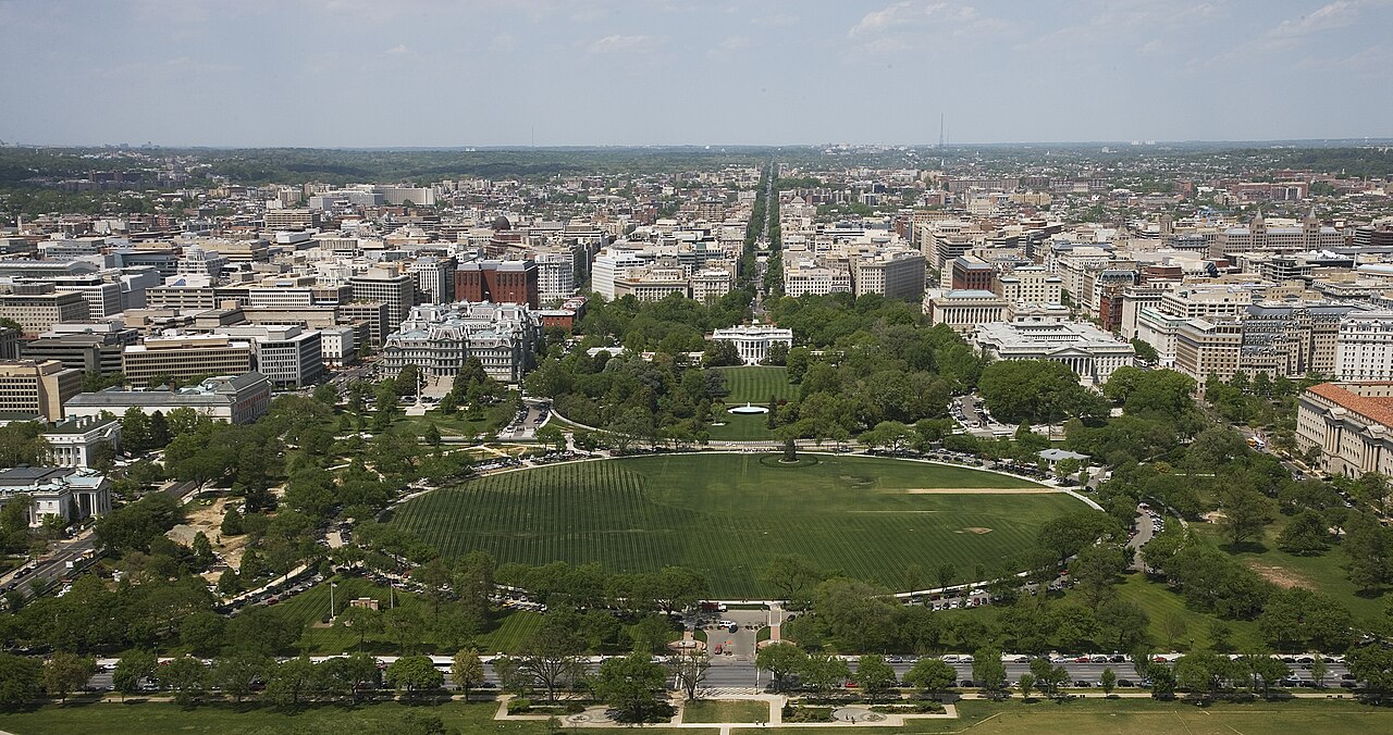

Washington is organised around the National Mall, but the city is much more than its monumental core. The Mall links the Capitol, Smithsonian museums and western memorials; Downtown and Penn Quarter sit north, Capitol Hill and Navy Yard lie east and southeast, and Dupont Circle, Georgetown, Shaw and The Wharf form separate neighbourhood destinations. Plan the Mall on foot and use Metro for movement between neighbourhood clusters.
Praktische Informationen
Praktische Informationen
- Gesprochene Sprache
- Englisch ist die Hauptsprache; keine bundesweite Amtssprache
- Nationale praktische Ausrichtung; regionale und Minderheitensprachen können ebenfalls verwendet werden
- Vorwahl
- +1
- Internationale Vorwahl; lokale Orts- und Mobilfunkvorwahlen gelten weiterhin
- Währung
- US-Dollar (USD)
- Verwenden Sie die offizielle lokale Währung; Kartenzahlung variiert je nach Ort
- Notrufnummer
- 911
- Nur im Notfall verwenden; touristische Hilfe kann eine separate Nummer verwenden
- Steckertyp
- Typ A und B · 120 V
- Prüfen Sie vor der Verwendung eines Adapters, ob die Ladegeräte die angegebene Spannung unterstützen
- Leitungswasser
- Nicht erfasst
- Die Wasserqualität wird lokal geregelt; prüfen Sie die aktuelle Mitteilung für das Reiseziel
Aus dieser Liste einen Plan machen
Legen Sie Ihre Tage, Ihr Tempo und die Stunden fest, in denen Sie tatsächlich unterwegs sein möchten. Der Planer berücksichtigt Schließtage und Fahrzeiten und lässt Zeit zum Essen.
Einen Besuch planen
- Empfohlener Aufenthalt
- Not recorded
- Fortbewegung
- Walk, Metrorail and Metrobus
- Beste Reisezeit
- Gute Reisezeit
- Mit Abstrichen geeignet
- Schwierige Bedingungen
Top-Sehenswürdigkeiten
Nach Wichtigkeit sortiert — Sitelinks, Seitenaufrufe und Denkmalschutzstatus, nicht nach Redakteursvorliebe.
Liste filtern
0 Orte passen
0 Orte passen
Kategorie
Typische Besuchsdauer
Nichts in Washington entspricht allen diesen Filtern
Die Liste wird aus echten Ortsdaten erstellt, daher bedeutet ein leeres Ergebnis, dass die Kombination tatsächlich keine Treffer liefert – nicht, dass die Seite fehlgeschlagen ist. Lockern Sie einen Filter, und das Ranking erscheint wieder.
Quelle: OpenStreetMap-Mitwirkende, Wikidata ·
Wie die Stadt aufgebaut ist
The National Mall is the main east-west axis, with the Capitol at its eastern end and the Lincoln Memorial toward the Potomac. Downtown and Penn Quarter are north of the Mall; Capitol Hill continues east; The Wharf and Navy Yard occupy separate waterfronts to the south. Dupont Circle and Adams Morgan are northwest, while Georgetown sits west without a Metrorail station. Distances across the Mall are longer than they appear on a diagram.
Geprüft 2026-08-26
Fortbewegung
Walk within the National Mall and use Metrorail for longer connections between central districts. Metrobus fills gaps, particularly where rail does not reach directly, and Capital Bikeshare provides another option for waterfronts and broad avenues. Most visitors do not need a car because parking and traffic complicate central trips. Use WMATA's current trip planner and service notices for station access, closures and transfers.
Geprüft 2026-08-26
Häufige Fragen
How many days should I spend in Washington, DC?
A fixed stay length is not recorded. Plan the National Mall and its museums first, then add Capitol Hill, Georgetown or another neighbourhood according to your priorities.
Can I walk the entire National Mall?
Yes, but it is longer than it looks on a map. Divide the Capitol and museum end from the western memorials if you want time inside institutions.
Do I need a car in Washington?
Most visitors do not. Walking, Metrorail and Metrobus cover the principal visitor districts, while a car adds traffic and parking constraints in the centre.
Does Metrorail go directly to Georgetown?
No. Georgetown has no Metrorail station, so reach it by bus, walking, cycling or a connection from a nearby rail station.
Which areas are easiest to combine?
Combine the Mall with Downtown or Penn Quarter, Capitol Hill with Navy Yard, and The Wharf with the southern waterfront. Use Metro between these clusters.