城市指南 · Italy
Milan
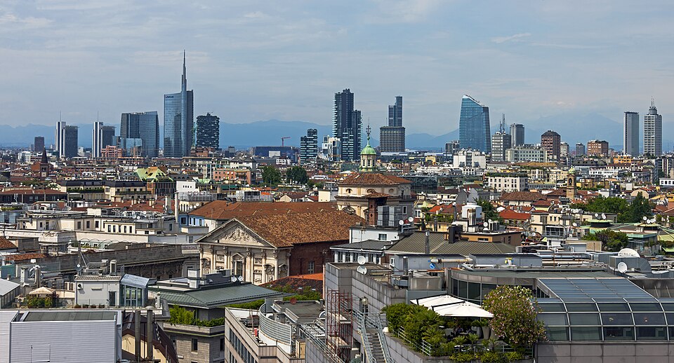

Milan is organised around a compact historic centre, with the Duomo, Galleria Vittorio Emanuele II and La Scala close enough to combine on foot. Brera lies immediately north, the Navigli canals sit to the southwest, and the modern Porta Nuova district rises around Garibaldi station. Longer journeys connect the centre with Santa Maria delle Grazie, San Siro and outer design districts.
實用資訊
實用資訊
- 使用語言
- 義大利文
- 國家實用導向;區域及少數語言亦可能使用
- 國際電話區碼
- +39
- 國際電話區碼;當地區域及行動電話前置碼仍適用
- 貨幣
- 歐元(EUR)
- 請使用當地官方貨幣;各處刷卡接受度不一
- 緊急電話
- 112
- 僅供緊急情況使用;旅客協助可能另有專線
- 插座類型
- C 型、F 型和 L 型 · 230 V
- 使用轉接器前,請確認充電器支援記錄的電壓
- 自來水
- 未記錄
- 未記錄經核實的全國旅客聲明
將此列表轉為行程規劃
設定您的天數、步調與實際想外出的時段。規劃工具會自動避開休館日、計算交通時間,並預留用餐空檔。
規劃造訪
- 建議停留天數
- Not recorded
- 交通方式
- Walk, metro, tram and bus
- 最佳時節
- 適合時節
- 有取捨但仍可行
- 艱困條件
必遊景點
按重要性排序——網站連結、頁面瀏覽量與文化遺產地位,而非編輯偏好。
Milan 中沒有任何項目符合所有篩選條件
此列表根據真實景點資料建置,因此空白結果表示該組合確實沒有符合項目——並非頁面載入失敗。放寬任一篩選條件,排名結果即會恢復。
資料來源: OpenStreetMap 貢獻者, Wikidata ·
城市格局概覽
Use the Duomo as the central reference point. The fashion quadrilateral and Brera are north of it, Castello Sforzesco and Parco Sempione are west, and the Navigli and Porta Ticinese districts are south and southwest. Milano Centrale is northeast of the old centre, while Porta Garibaldi serves the Porta Nuova business district. Grouping sights by these zones avoids repeated cross-city travel.
檢查2026-08-26
交通方式
Walk inside the historic centre and use ATM metro, tram and bus services for longer moves. Milan has five metro lines, while surface routes connect neighbourhoods beyond the rail corridors. Contactless bank cards and mobile devices can be used on ATM services, and the system calculates the applicable fare. Check the operator map before travelling to outer sites or changing fare zones.
檢查2026-08-26
常見問題
How many days should I spend in Milan?
A fixed stay length is not recorded. Build the visit around the historic centre, Brera and the castle, then add Navigli, Porta Nuova or an outer attraction as time allows.
Can I explore central Milan on foot?
Yes. The Duomo, Galleria Vittorio Emanuele II, La Scala, Brera and Castello Sforzesco form a practical walking core, although the metro is useful for crossing between wider districts.
What public transport serves Milan?
ATM operates the city's metro, tram, bus and trolleybus network. Use rail for cross-city movement and surface services where the metro does not directly reach the destination.
Can I pay contactless on Milan public transport?
Yes. ATM accepts supported contactless cards and mobile devices on its services and calculates the applicable fare, provided the same payment method is used throughout the journey.
Which Milan areas should be planned separately?
Treat Navigli, Porta Nuova, San Siro and other outer districts as separate clusters. They sit beyond the compact Duomo-Brera-castle core and usually require a dedicated transit leg.