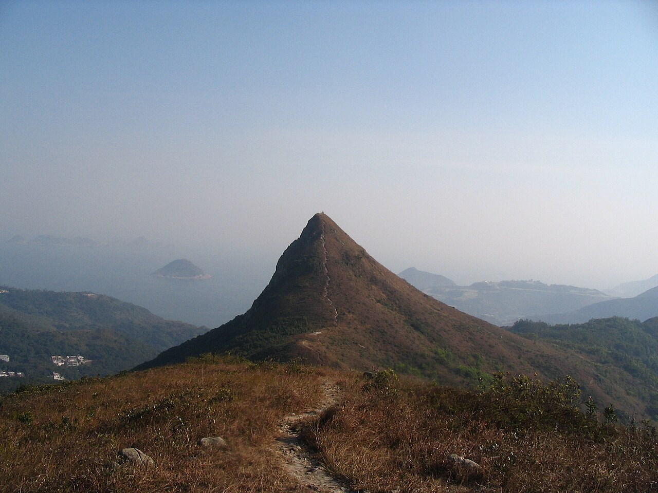
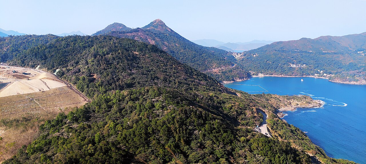
High Junk Peak, known locally as 釣魚翁 High Junk Peak, is a mountain in Hong Kong. It stands as one of the notable peaks in the Clear Water Bay area of the New Territories. The peak is part of Hong Kong's country park system and offers hiking opportunities. Its distinctive profile makes it recognizable from surrounding areas. The name reflects local maritime history, with junk references connecting to traditional Chinese sailing vessels that once populated regional waters. The peak represents a natural landmark within Hong Kong's varied topography of urban and rural landscapes.
The High Junk Peak trail provides natural terrain including exposed ridgelines and vegetation typical of Hong Kong's coastal hills. Hikers encounter subtropical flora and rocky outcrops along the route. The summit area offers views toward Clear Water Bay and surrounding waters. The landscape features grassland patches interspersed with shrubland. No built facilities such as shelters, viewing platforms, or visitor centers are documented at this location. The environment remains largely undeveloped, presenting a natural hiking experience without artificial attractions or maintained amenities beyond basic trail markers where present.
2026-08-28 kontrol edildi
Fotoğraf
· TLpedia at Chinese Wikipedia
·
Public domain
The duration of a High Junk Peak hike depends on chosen route, fitness level, and starting point. Common approaches connect from nearby villages or coastal roads. Most hikers allow several hours for a return trip including rest stops. The distance varies by trail selection, with some routes forming part of longer connecting paths through the country park network. Steep sections may slow progress. Visitors should consult current trail maps and assess personal capability before departure. Weather conditions significantly affect hiking time on exposed ridges.
High Junk Peak can be hiked year-round subject to weather conditions. Hong Kong's subtropical climate brings hot humid summers and milder winters. Typhoon season from approximately May to November requires particular caution. Summer heat demands early morning starts and adequate hydration. Winter offers cooler conditions generally preferred for strenuous activity. No staffed gates or controlled access points with published opening times have been documented. Daylight hours naturally constrain safe hiking periods. Visitors should check Hong Kong Observatory weather warnings before planning any mountain excursion. Check the operator's own site for the travel date before relying on a schedule or fare.
Access to High Junk Peak appears unrestricted with no entrance fee documented for the trail or summit area. As part of Hong Kong's country park lands, no ticketing infrastructure is evident at this location. No payment mechanisms, ticket booths, or permit requirements have been identified in available sources. Visitors should verify current regulations through official Hong Kong country park channels. Any future changes to access arrangements would be announced through the Agriculture, Fisheries and Conservation Department. Standard country park regulations regarding fire, litter, and wildlife protection apply. Check the operator's own site for the travel date before relying on a schedule or fare.
High Junk Peak is accessible via public transportation to surrounding areas with subsequent walking approach. The MTR system connects to nearby stations requiring bus or taxi transfer. Minibuses serve coastal roads in the Clear Water Bay vicinity. Specific route numbers and schedules require verification against current transport operator information. Private vehicles can reach parking areas near trailheads though spaces may be limited. Walking distances from bus stops to trail starts vary. Visitors should consult the Transport Department or individual operators for service status. Navigation apps using OpenStreetMap data may assist with final approach on foot.
High Junk Peak presents hiking hazards requiring caution. Exposed ridgelines offer minimal shelter during thunderstorms. Steep sections demand appropriate footwear with grip. Summer heat and humidity risk heat exhaustion without adequate water and rest. Limited mobile phone coverage may affect emergency communication. The trail lacks lighting for night hiking. Loose rocks and eroded surfaces occur naturally. Country park regulations prohibit fires and mandate litter removal. Wildlife encounters are possible though serious incidents are uncommon. Solo hiking on remote sections carries inherent risks. Informing others of planned route and expected return time represents prudent practice for all visitors.
High Junk Peak offers photographic subjects including coastal panoramas, rugged terrain, and atmospheric conditions. Clear days provide visibility toward surrounding islands and water. Early morning and late afternoon light enhances landscape texture. The exposed summit suits wide-angle compositions of the ridgeline. Weather transitions create dramatic cloud and mist opportunities. No restrictions on photography are documented though drone operation falls under Hong Kong civil aviation regulations requiring permits in many circumstances. Tripod use on narrow trail sections may obstruct other hikers. Sunrise and sunset positioning varies seasonally affecting optimal shooting locations along the route.
2026-08-28 kontrol edildi
Sık sorulan sorular
Is High Junk Peak suitable for beginners?
The difficulty level depends on route selection and individual fitness. Some sections involve steep terrain that may challenge inexperienced hikers. Proper footwear and basic preparation are essential.
Are there toilet facilities on the trail?
No toilet facilities are documented at High Junk Peak or along the immediate trail. Visitors should plan accordingly and follow country park guidelines for waste management.
Can I bring my dog to High Junk Peak?
Dog access regulations follow standard Hong Kong country park rules. Visitors should verify current leash requirements and any seasonal restrictions through official channels before bringing animals.
Is the trail clearly marked?
Trail marking presence and condition vary. Some sections may have basic markers while others rely on visible path wear. Carrying a map and navigation capability is advisable.
What should I do if the weather changes during my hike?
Seek lower ground immediately if thunderstorms approach. Exposed ridges present lightning danger. Carry rain protection and consider turning back if conditions deteriorate significantly.
Are there food or water vendors near the trail?
No vendors are documented at the trail itself. Nearby villages may have limited services. Visitors should carry sufficient supplies for the complete hike duration.
Kaynak:
OpenStreetMap katkıda bulunanları, Wikidata
·
Çerez tercihleri
İzin gereken bölgelerde, siz seçim yapmadan önce zorunlu olmayan hiçbir şey ayarlanmaz. Reddetmeniz durumunda reklamlar yine görünür ancak kişiselleştirilmemiş olur ve analitik tamamen kapatılır.





_07.jpg)
_23.jpg)
_24.jpg)
