


10 dk yürüyüş · 沙田區 Sha Tin District
牛押山 The Hunch Backs
- Mutlaka görülmeli
- Manzara noktası
Dil · 11 yayınlandı
Manzara noktası · 大埔區 Tai Po District, Hong Kong
馬鞍山 Ma On Shan

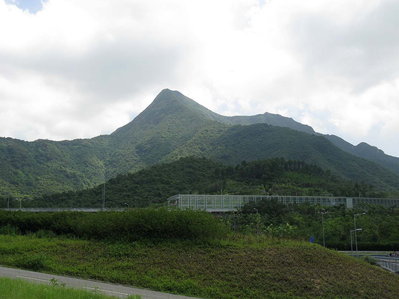
Ma On Shan is a mountain peak in the New Territories of Hong Kong, standing prominently on the eastern side of Tolo Harbour. Its name translates from Cantonese as Horse Saddle Mountain, describing its distinctive saddle-shaped ridge profile. The peak forms part of the Ma On Shan Country Park and is one of Hong Kong's most recognizable natural landmarks. It rises dramatically from the surrounding terrain and is visible from many parts of northeastern Hong Kong, including Sha Tin and Tai Po districts. The mountain holds significance for local hikers and nature enthusiasts.
2026-08-28 kontrol edildi
The Ma On Shan area contains rugged mountain terrain with steep trails, rocky outcrops, and natural vegetation typical of Hong Kong's subtropical environment. The summit area offers expansive views across Tolo Harbour, Plover Cove, and toward the Sai Kung peninsula. The Ma On Shan Country Park encompasses the mountain and surrounding slopes. Nearby, the Ma On Shan Promenade and Ma On Shan town centre provide urban amenities at the mountain's base. The area includes the Ma On Shan line of the MTR, connecting residential developments to broader Hong Kong.
2026-08-28 kontrol edildi

The duration of a hike to Ma On Shan's summit varies considerably based on chosen route, fitness level, and weather conditions. Multiple trail approaches exist, including from Ma On Shan village, Sai Kung, and connections to the MacLehose Trail. Ascents typically require several hours of sustained walking on steep, exposed terrain. Descent adds comparable time. The full traverse connecting to nearby peaks such as Sai Kung's Sharp Peak or the Hunch Backs extends the journey substantially. Visitors should plan conservatively and carry adequate supplies.
2026-08-28 kontrol edildi

Hong Kong's subtropical climate brings hot, humid summers and mild, dry winters to Ma On Shan. Summer hiking carries risks of heat exhaustion, dehydration, and sudden thunderstorms. Typhoon season from approximately May to November demands particular caution. Winter months generally offer more comfortable temperatures for strenuous ascent. Early morning starts help avoid peak heat. Fog and low cloud frequently obscure summit views. Visitors should verify current conditions through official Hong Kong Observatory forecasts and Agriculture, Fisheries and Conservation Department notices before departing. Check the operator's own site for the travel date before relying on a schedule or fare.
2026-08-28 kontrol edildi
Access to Ma On Shan and the surrounding country park is generally unrestricted and without entry fees for standard hiking activities. No ticketed attraction operates at the summit itself. The mountain forms part of Hong Kong's public country park system managed by government authorities. Any commercial operations, guided tours, or special activities would require separate arrangements. Visitors should consult official Agriculture, Fisheries and Conservation Department channels for any updates regarding access restrictions, permit requirements, or changes to public land management policies affecting the Ma On Shan area.
2026-08-28 kontrol edildi
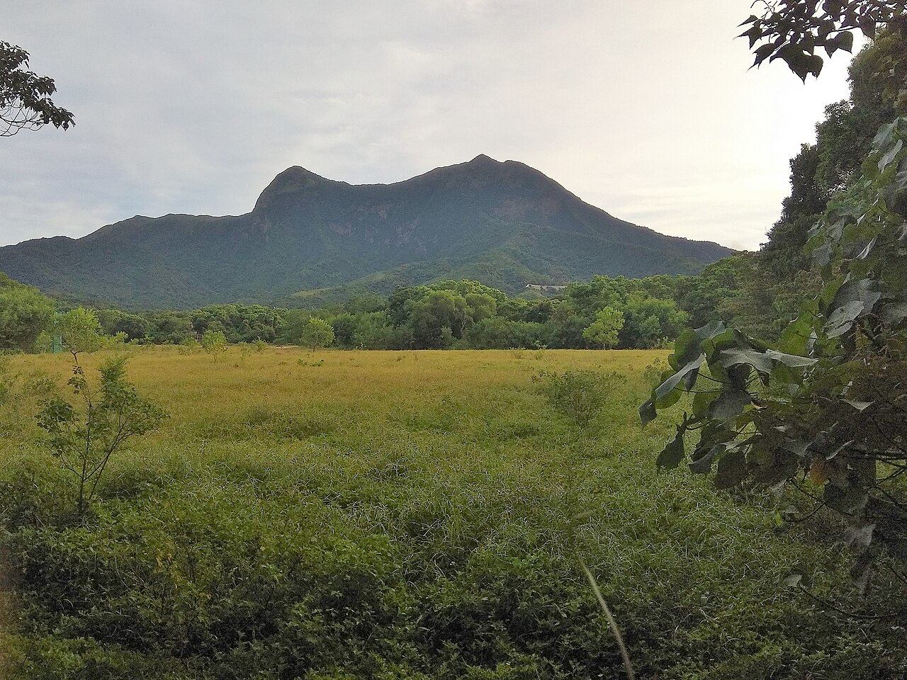
Ma On Shan is accessible via multiple transport options converging on the town of Ma On Shan at the mountain's base. The MTR Ma On Shan line serves the area with stations including Ma On Shan and Wu Kai Sha. Bus services connect from Sha Tin, Tai Po, and other New Territories locations. Private vehicles can reach parking areas near trailheads, though spaces are limited. Taxi and ride-hailing services operate in the district. Trailheads begin from various points including Ma On Shan village road and country park access points. Route planning should account for return journey logistics.
2026-08-28 kontrol edildi
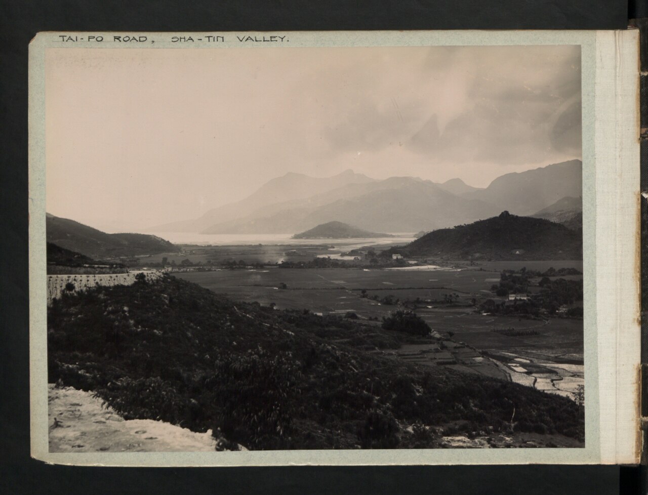
Ma On Shan's trails present genuine hiking hazards requiring preparation and caution. Steep, exposed rock sections demand sure footing and appropriate footwear. Summer heat and humidity create serious dehydration and heatstroke risks with limited shade on upper slopes. Sudden weather changes including fog can disorient hikers. Some trail sections feature significant exposure with drop-offs. Mobile phone coverage may be intermittent. Emergency services access is challenging in remote terrain. Solo hiking is inadvisable. Visitors should carry sufficient water, inform others of planned routes, and possess navigational capability beyond smartphone dependence. Country park regulations prohibit littering and fire lighting.
2026-08-28 kontrol edildi
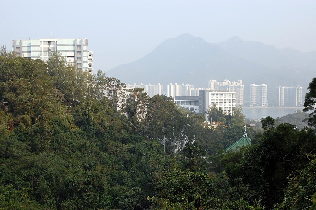
Ma On Shan offers dramatic photographic subjects including the distinctive summit ridge profile, panoramic harbour and coastline vistas, and atmospheric conditions of cloud and mist. Early morning and late afternoon light enhance terrain texture. The contrast between natural mountain scenery and distant urban development provides compositional interest. Weather conditions significantly impact visibility and safety for photography. Tripods require secure placement on uneven rock surfaces. Drone operation falls under Hong Kong Civil Aviation Department regulations with restricted zones applicable. Summit photography demands caution near exposed edges. Seasonal variations in vegetation density and atmospheric clarity affect optimal shooting conditions throughout the year.
2026-08-28 kontrol edildi
Not recorded. The terrain features steep, exposed sections requiring fitness and experience. Cautious visitor judgement suggests assessing personal capability against described trail difficulty.
Not recorded. Country parks typically have minimal infrastructure. Visitors should plan accordingly before ascending.
Not recorded. Hong Kong Observatory warnings should guide decisions. Exposed mountain terrain presents severe danger during severe weather.
Not recorded. Country park camping regulations apply. Official Agriculture, Fisheries and Conservation Department guidance should be consulted.
Not recorded. Commercial operators may offer services. Independent verification of any tour provider is advisable.
Hong Kong's universal emergency number is 999. Mobile coverage is intermittent on the mountain. Self-rescue capability remains essential.
Etkileşimli harita yükleniyor…
Etkileşimli harita yüklenemedi.


Son güncelleme:
Kaynak: OpenStreetMap katkıda bulunanları, Wikidata ·