.jpg)
.jpg)
_50D_(14437861742).jpg)
_(circle_of)_-_James,_5th_Earl_of_Linlithgow_and_4th_Earl_of_Callendar_-_203.32_-_Gladstone%27s_Land.jpg)


2 min walk
Museum on the Mound
- Must see
- Museum
Language · 1 published
Historic monument · Edinburgh
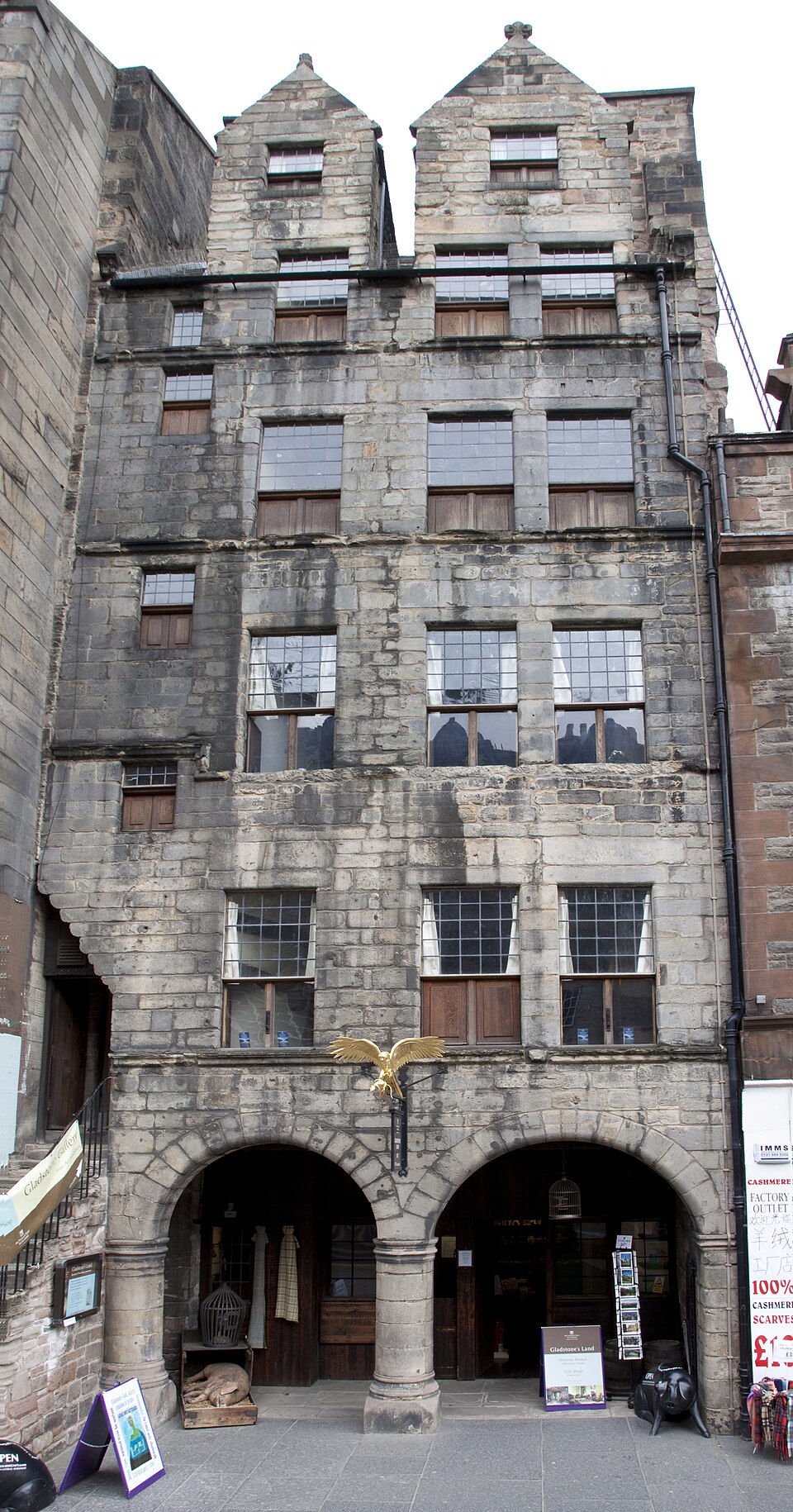
Gladstone's Land is a historic tenement building on Edinburgh's Royal Mile, preserved as a heritage property. The structure dates to the seventeenth century and represents the tall, narrow architecture typical of Edinburgh's Old Town before the New Town expansion. It bears the name of a long-ago proprietor rather than the Victorian prime minister. The building demonstrates how merchants and residents occupied vertical space in a congested medieval city, with different social levels stacked across multiple floors under a common roof.
Checked 2026-08-26
The interior contains period rooms furnished to suggest seventeenth-century domestic and commercial life. Visitors encounter recreated living spaces, painted ceilings, and architectural details that survived centuries of alteration. The upper floors originally housed wealthier occupants, while lower levels served trade purposes. Decorative painted beams and historic fixtures remain visible. The National Trust for Scotland operates the property, maintaining its presentation as an evocative snapshot of early modern Edinburgh society. Specific current room configurations and display items are Not recorded pending review.
Checked 2026-08-26
A complete visit typically requires between forty-five minutes and one hour, depending on personal pace and interest in historical detail. The compact vertical layout means visitors ascend and descend narrow staircases between floors, which naturally regulates flow and encourages deliberate observation. Those with strong interest in social history, architectural conservation, or painted interiors may wish to allocate additional time. The constrained spaces preclude rushing through large crowds, so timing visits away from peak periods improves the experience considerably. Gladstone's Land also earns time in a edinburgh itinerary because Exact production identity node/4618730691 is assigned through pois.city_place_id; stored production name and coordinates were copied without approximation. Its value becomes clearer when the stop is compared with the surrounding streets and the other ranked places nearby.
Checked 2026-08-26
Operator-confirmed hours are Not recorded pending review. Edinburgh's Royal Mile experiences substantial foot traffic throughout summer and during the Festival Fringe in August, when congestion peaks and spontaneous access becomes unpredictable. Winter months offer quieter conditions though daylight hours contract. Morning visits generally provide calmer conditions than afternoons when tour groups concentrate. Weather protection matters little since the entire visit occurs indoors, though queueing outside remains possible. Visitors should verify current operational status before travelling specifically for this property.
Checked 2026-08-26
Operator-confirmed prices are Not recorded pending review. As a National Trust for Scotland property, admission policies may differ for members and non-members. Some heritage properties in the trust's portfolio operate seasonal pricing or combined tickets with nearby sites. Visitors holding existing National Trust memberships should confirm reciprocal arrangements. Advance booking requirements, if any, remain unverified. Concession categories commonly applied at comparable Scottish heritage properties include seniors, students, and children, though specific eligibility and rates for Gladstone's Land require direct confirmation from the operator.
Checked 2026-08-26

Gladstone's Land occupies a prominent position on the Royal Mile between Edinburgh Castle and Holyrood Palace, making it inherently walkable within the Old Town core. The nearest railway station is Edinburgh Waverley, approximately ten minutes' walk downhill. No vehicle access exists on the pedestrianised thoroughfare itself. Multiple Lothian bus routes serve surrounding streets including North Bridge and South Bridge. Taxis and rideshares can approach nearby drop points. The cobbled, sloping terrain and stepped entrances present mobility challenges that visitors should assess against personal capabilities.
Checked 2026-08-26

The historic staircase is steep, narrow, and uneven, presenting significant difficulty for visitors with limited mobility, balance concerns, or pushchairs. Original floor levels and thresholds create trip hazards throughout. Ceiling heights vary and low beams occur in places. The building lacks modern climate control, so interior temperatures follow external conditions closely. Capacity restrictions may enforce waiting periods during busy periods. No lift access exists. Visitors should wear appropriate footwear for uneven surfaces and be prepared to navigate confined spaces without assistance mechanisms.
Checked 2026-08-26

Photography policies inside National Trust for Scotland properties typically restrict flash, tripods, and commercial usage, though specific rules for Gladstone's Land are Not recorded pending review. The painted ceilings and period rooms offer distinctive subjects for respectful documentation. Natural light entering through small historic windows creates atmospheric but technically challenging conditions. The confined spaces complicate composition and may obstruct other visitors. Drone usage would be inappropriate and legally restricted in this dense urban conservation area. Visitors should observe posted guidance or seek staff clarification upon arrival.
Checked 2026-08-26
No. The name derives from a later proprietor, not the nineteenth-century prime minister.
No. Access is via a historic narrow staircase with multiple floors.
The steep, narrow staircase and uneven floors present substantial barriers; visitor judgement is advised.
Walk-in policies are Not recorded pending review; verification with the operator is recommended.
The National Trust for Scotland operates Gladstone's Land as a heritage visitor property.
Seventeenth-century painted ceilings survive as significant architectural features, though conservation history is Not recorded pending review.
Loading the interactive map…
The interactive map could not be loaded.
Last updated:
Source: OpenStreetMap contributors, Wikidata ·