

.jpg)


2 dk yürüyüş
Vor Frue Kirke
- Mutlaka görülmeli
- Tarihi anıt
Dil · 11 yayınlandı
Tarihi anıt · Kopenhag
Gammeltorv is Copenhagen's oldest square, located in the Indre By district. Its name translates to Old Market, reflecting its historical function as a medieval marketplace. The square has served as a central public space since at least the 12th century, making it one of the most historically significant sites in the Danish capital. Today it functions as a pedestrian area with commercial activity, surrounded by buildings that reflect various architectural periods. The square maintains its role as a gathering place and transit point in Copenhagen's historic core.
2026-08-26 kontrol edildi
The square features the Caritas Well, a Renaissance-era fountain dating from 1608, which stands as its most prominent monument. The surrounding architecture includes structures from multiple centuries, representing the evolution of Copenhagen's urban fabric. Various shops, cafes, and commercial establishments occupy the ground floors of perimeter buildings. The open paved space accommodates pedestrian movement and occasional public events. No enclosed attractions or museums are situated within the square itself. The physical environment consists primarily of hard landscaping with limited vegetation.
2026-08-26 kontrol edildi

A visit to Gammeltorv typically requires 15 to 30 minutes for casual observation and photography. The square functions as a thoroughfare and brief stopping point rather than a destination requiring extended engagement. Visitors often incorporate it into walking tours of Copenhagen's historic center, allocating minimal dedicated time. Those interested in architectural detail or historical significance may extend their stay slightly. The duration depends largely on whether one pauses at adjacent commercial establishments. Integration with nearby Strøget pedestrian street and other central attractions is common.
2026-08-26 kontrol edildi
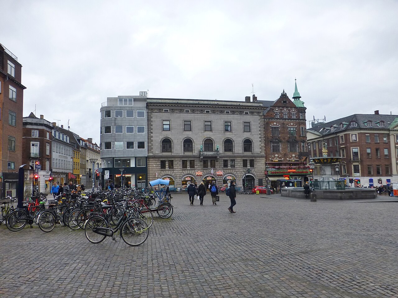
Gammeltorv is an open public square accessible at all hours throughout the year. Operator-confirmed hours for any specific facilities or events are Not recorded pending review. The square experiences typical patterns of urban activity, with busier periods during daytime shopping hours and reduced activity overnight. Seasonal variations in daylight and weather affect visitor experience, with summer offering extended evening light. No controlled access or ticketing periods apply to the square itself. Visitors should exercise standard urban awareness regarding personal safety during low-traffic hours.
2026-08-26 kontrol edildi
Access to Gammeltorv as a public square is free of charge. No admission mechanism exists for the open space. Operator-confirmed prices for any commercial establishments, events, or services within or adjacent to the square are Not recorded pending review. Individual businesses operate their own pricing structures. Visitors should not expect to encounter entry fees for the square itself. Payment would only apply to voluntary purchases from surrounding vendors or participation in ticketed events if any are scheduled. Gammeltorv also earns time in a copenhagen itinerary because Exact production identity is assigned through pois.city_place_id; the stored production name and coordinates were copied without approximation. Its value becomes clearer when the stop is compared with the surrounding streets and the other ranked places nearby.
2026-08-26 kontrol edildi
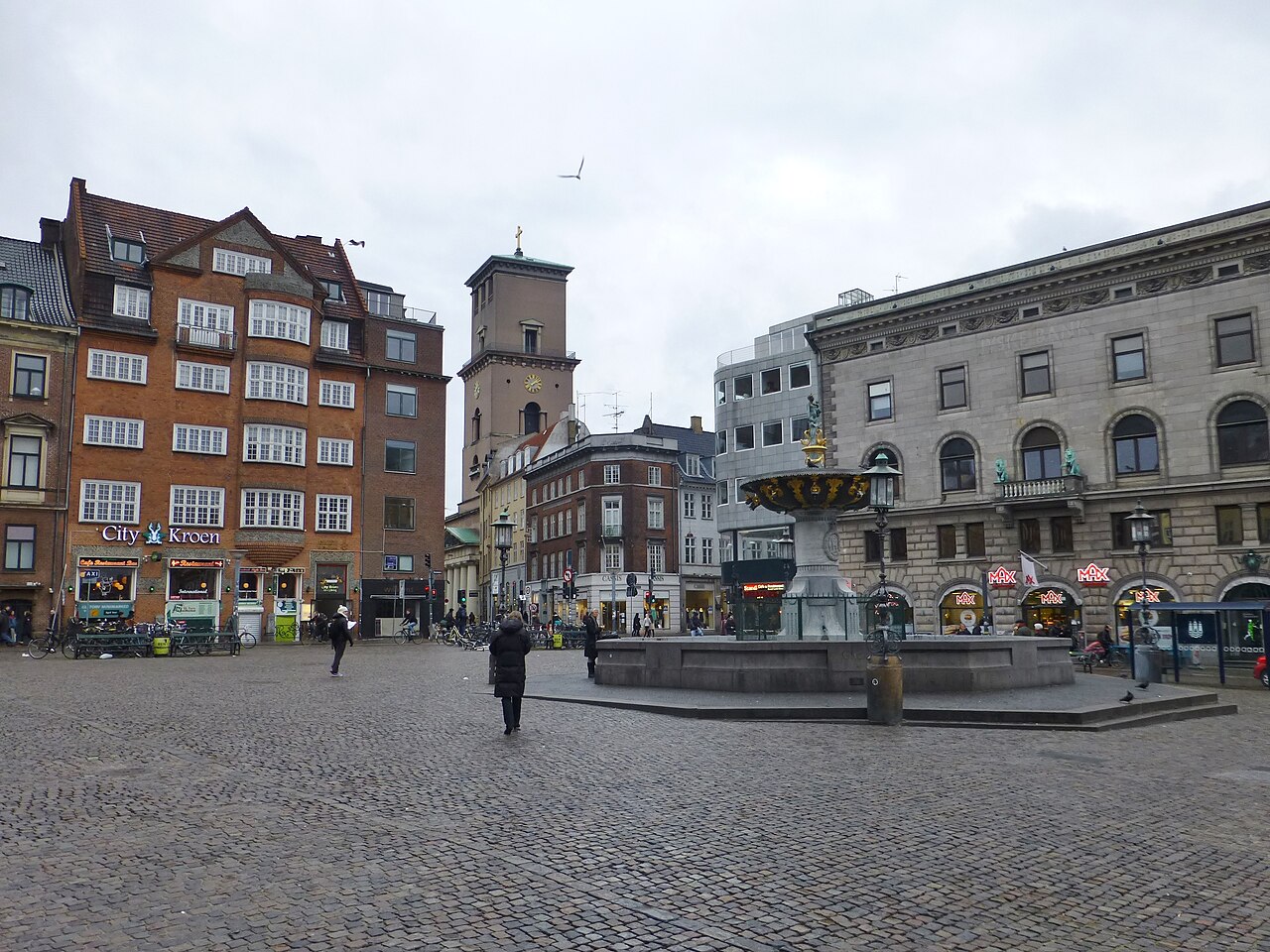
Gammeltorv occupies a central location in Copenhagen's pedestrian zone, approximately midway along Strøget, the city's primary walking street. Multiple bus routes serve stops within walking distance. The nearest metro station is Nørreport, requiring approximately 10 minutes on foot. Copenhagen Central Station is reachable within 15 to 20 minutes walking. Cycling infrastructure surrounds the area, though bicycle parking in the immediate square is restricted. The square's central position makes it accessible from most downtown accommodations on foot. Signage throughout the city center directs pedestrians toward this historic core.
2026-08-26 kontrol edildi
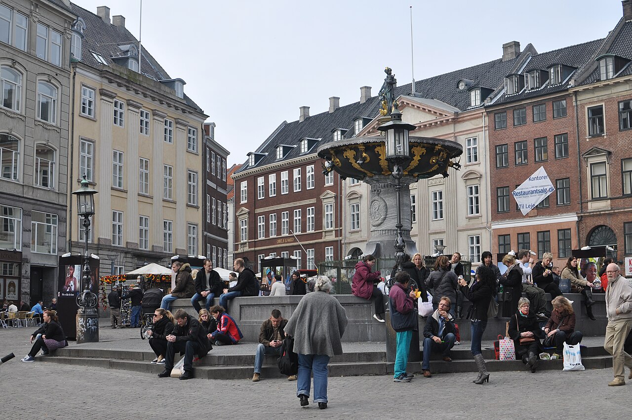
The square's function as a pedestrian thoroughfare creates consistent foot traffic requiring awareness of surrounding movement. Cobblestone and paving surfaces may become slippery in wet conditions. Cyclists occasionally traverse the square despite pedestrian priority. The Caritas Well and its basin present a physical obstacle requiring navigation. Adjacent vehicle streets create edge conditions where motorized traffic resumes. Visitors should maintain standard urban vigilance regarding personal belongings in crowded conditions. No extraordinary hazards are associated with the site, though typical city-center precautions apply regarding traffic, weather exposure, and crowd dynamics.
2026-08-26 kontrol edildi
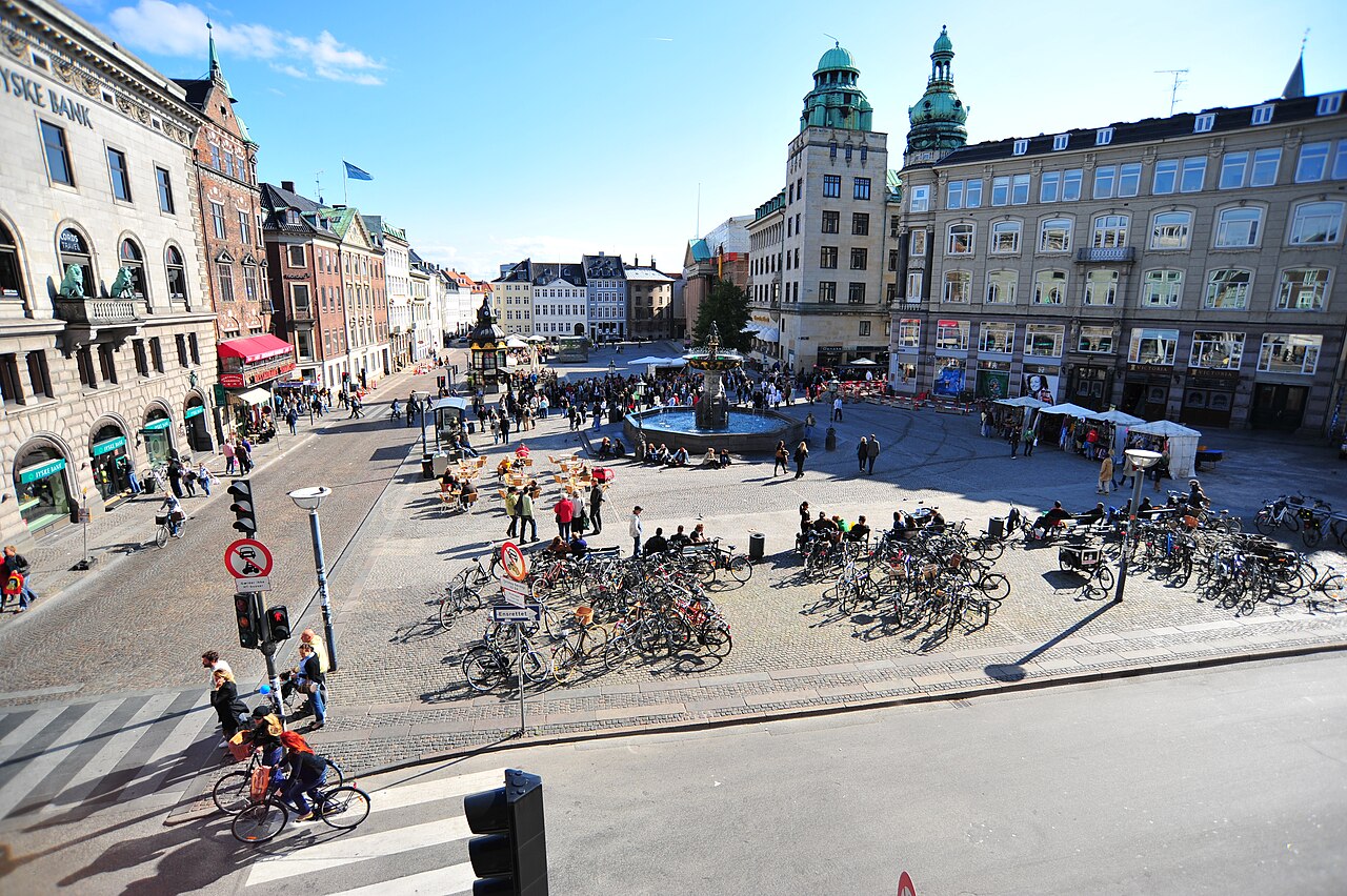
Photography of Gammeltorv and the Caritas Well is unrestricted in the public space. No commercial photography permits are required for personal or non-professional use. The fountain provides a central compositional element, best captured during daylight hours. Morning and late afternoon light offer favorable conditions for architectural photography of surrounding buildings. The open square allows multiple vantage points without obstruction. Tripod use may attract attention in the pedestrian flow but faces no formal prohibition. Evening photography benefits from building illumination, though the square itself has limited dedicated lighting features.
2026-08-26 kontrol edildi
Gammeltorv and Nytorv are adjacent but distinct squares. They function as a continuous public space divided by a narrow street. Gammeltorv is the older of the two, with Nytorv developing later.
The Caritas Well is a historical monument and decorative fountain. It does not function as a public drinking water source. Visitors should not attempt to consume water from this feature.
Public restroom facilities within the square itself are Not recorded. Visitors may need to utilize facilities in adjacent commercial establishments, subject to their individual policies.
Specific seasonal events and market schedules are Not recorded pending review. Visitors should consult current municipal or tourism authority announcements for event programming.
The paved surfaces of Gammeltorv present variable conditions. Some areas feature cobblestones or uneven paving that may challenge wheelchair users. Accessible routing through adjacent streets may be preferable.
Gammeltorv translates from Danish as Old Market or Old Square, reflecting its historical origins as Copenhagen's earliest marketplace and public gathering space.
Etkileşimli harita yükleniyor…
Etkileşimli harita yüklenemedi.
Son güncelleme:
Kaynak: OpenStreetMap katkıda bulunanları, Wikidata ·