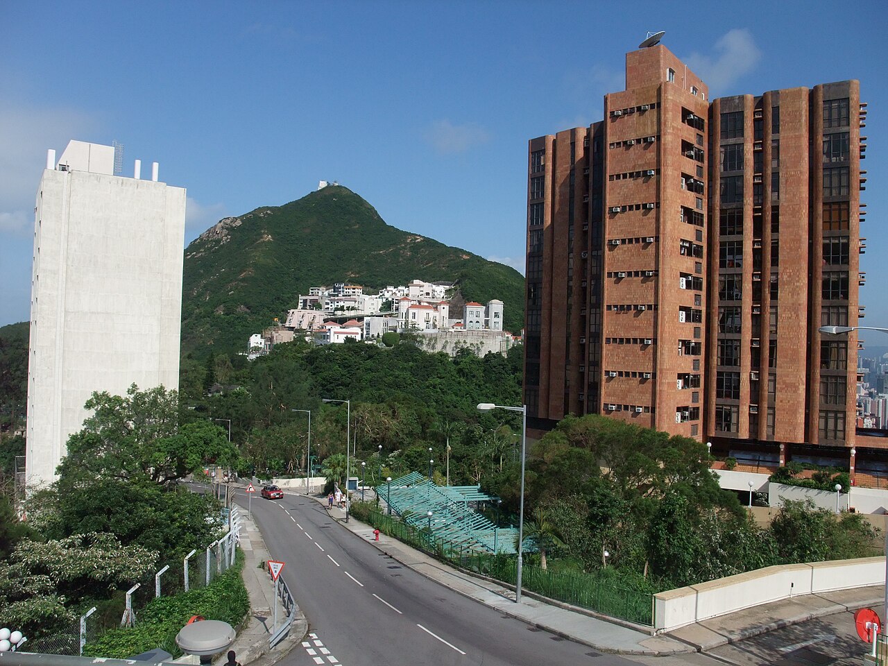
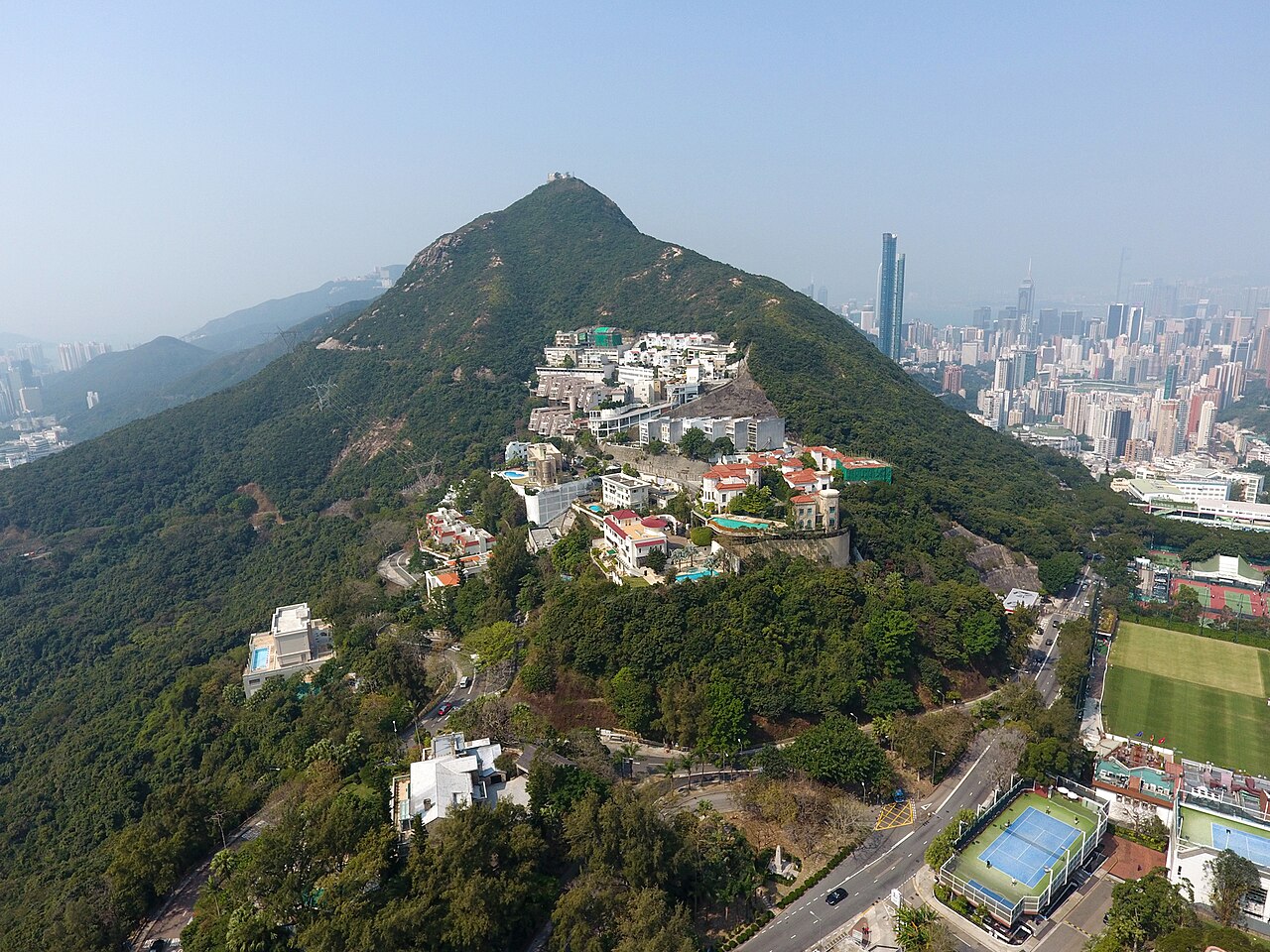
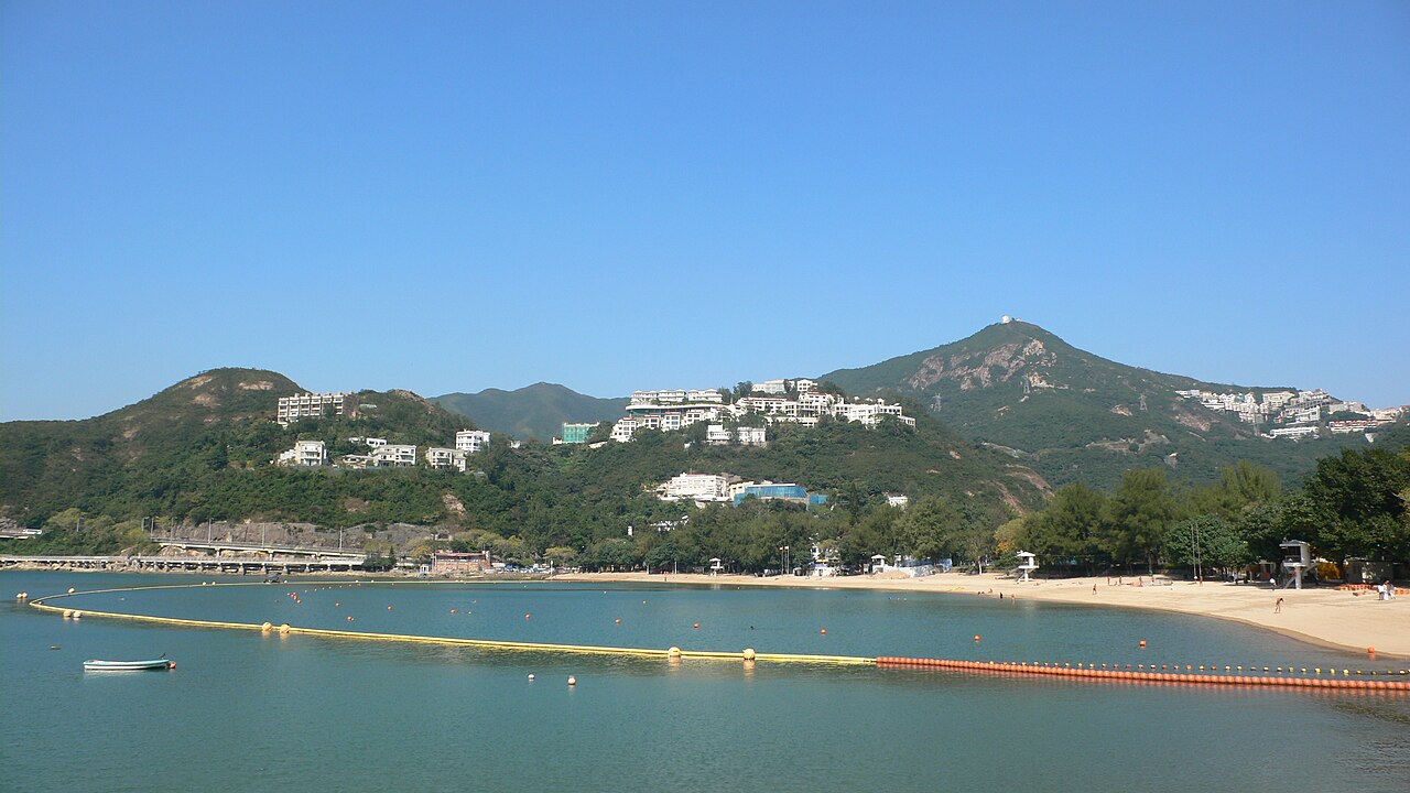
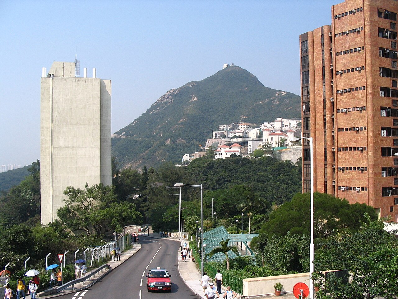
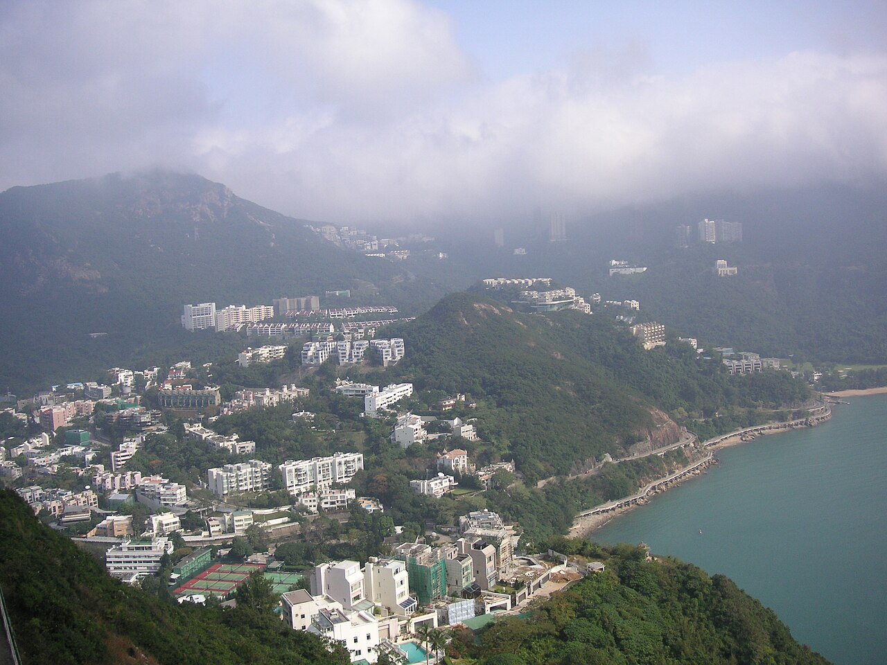
Mount Nicholson is a mountain located on Hong Kong Island, standing within the Wong Nai Chung Gap area. The peak rises in the southern central portion of the island, forming part of the island's mountainous interior. It is designated as a Site of Special Scientific Interest due to its ecological significance. The mountain is named after a British colonial figure. Its slopes contain important natural habitats that have been recognized for conservation value by Hong Kong authorities. Mount Nicholson also earns time in a hong kong itinerary because its setting and role differ from the surrounding ranked stops. Compare the place with the nearby streets before deciding how it fits the day.
The mountain contains natural woodland and shrubland habitats that support diverse flora and fauna. As a Site of Special Scientific Interest, it preserves vegetation communities of ecological importance. The surrounding area includes residential developments at lower elevations. The peak itself offers limited developed facilities, maintaining largely natural conditions. Visitors should expect undeveloped terrain with natural pathways rather than maintained trails or amenities. The ecological features that warranted its SSSI designation remain the primary contents of interest to those visiting the area.
The duration of a visit to Mount Nicholson depends entirely on individual objectives and chosen route. No standardized trail times are recorded. Visitors seeking to approach the summit area from nearby roads should anticipate steep terrain requiring significant physical effort. Those interested in ecological observation may spend extended periods examining the designated natural habitats. The absence of maintained visitor infrastructure means progress will be slower than on developed hiking routes elsewhere in Hong Kong. Adequate time should be allocated for safe navigation.
Operator-confirmed hours are Not recorded pending review. Mount Nicholson has no established opening or closing times as an undeveloped natural site. Visitors must exercise independent judgement regarding safe and appropriate timing. Hong Kong's subtropical climate brings hot humid summers with risk of typhoons between May and November. Winter months generally offer cooler more stable conditions for outdoor activity. Morning hours typically provide better visibility before afternoon haze develops. Seasonal variations in vegetation and wildlife activity may influence visitor experience throughout the year.
Operator-confirmed prices are Not recorded pending review. No admission fees are documented for accessing Mount Nicholson. The mountain is not operated as a commercial attraction with ticketed entry. Any costs associated with visiting would relate to transportation to the Wong Nai Chung Gap area and personal equipment requirements. Visitors should not expect facilities requiring payment. The absence of managed access points means no formal ticketing infrastructure exists. Individuals should verify current conditions independently before planning expenditure around this destination. A flexible visit keeps attention on what is distinctive at Mount Nicholson without treating one room, viewpoint or photograph as the whole experience. Conditions on arrival should decide the final pace.
Mount Nicholson is accessible from the Wong Nai Chung Gap area on Hong Kong Island. Public bus services operate along Wong Nai Chung Gap Road passing near the mountain's base. Visitors may alight at appropriate stops and proceed on foot toward the slopes. Private vehicles can reach the vicinity via the same road. The final approach to the summit area requires walking on steep undeveloped terrain. No dedicated parking or trailhead facilities are documented. Navigation requires careful attention to local conditions.
The steep terrain presents significant physical demands and potential slip hazards, particularly in wet conditions. As a Site of Special Scientific Interest, visitors must avoid damaging sensitive ecological features. No emergency services or rescue infrastructure is positioned on the mountain. Mobile telephone coverage may be unreliable in portions of the terrain. Hong Kong's tropical climate brings sudden weather changes including intense rainfall. Wildlife encounters are possible in the natural habitat. The absence of maintained trails increases navigation difficulty and disorientation risk. Solo visiting is inadvisable.
Photographic opportunities focus on natural landscape and vegetation subjects rather than panoramic urban views available from higher Hong Kong peaks. The ecological designation suggests macro and nature photography possibilities among the preserved habitats. Dense vegetation may limit sightlines in many areas. Lighting conditions vary significantly with weather and time of day. No designated viewpoints or photography platforms exist. Equipment protection from humidity and sudden rain is essential. Early morning generally offers optimal natural light before atmospheric haze develops. Respect for the scientific interest designation should guide all photography behavior.
2026-08-28 kontrol edildi
Sık sorulan sorular
Is there an entrance fee to visit Mount Nicholson?
No entrance fee is recorded. The mountain is not operated as a commercial attraction.
Are there maintained hiking trails to the summit?
No maintained trails are documented. The terrain is undeveloped and visitors must navigate natural conditions.
What public transport reaches Mount Nicholson?
Bus services operate along Wong Nai Chung Gap Road near the mountain's base.
Is Mount Nicholson suitable for beginner hikers?
The steep undeveloped terrain presents significant challenges that may exceed beginner capabilities.
Are there facilities like restrooms or drinking water on the mountain?
No facilities are documented. Visitors must be self-sufficient with adequate supplies.
Why is Mount Nicholson designated as a Site of Special Scientific Interest?
The designation recognizes its ecological significance, specifically its important natural habitats and diverse flora and fauna.
Kaynak:
OpenStreetMap katkıda bulunanları, Wikidata
·
Çerez tercihleri
İzin gereken bölgelerde, siz seçim yapmadan önce zorunlu olmayan hiçbir şey ayarlanmaz. Reddetmeniz durumunda reklamlar yine görünür ancak kişiselleştirilmemiş olur ve analitik tamamen kapatılır.