
6 dk yürüyüş · Alsergrund
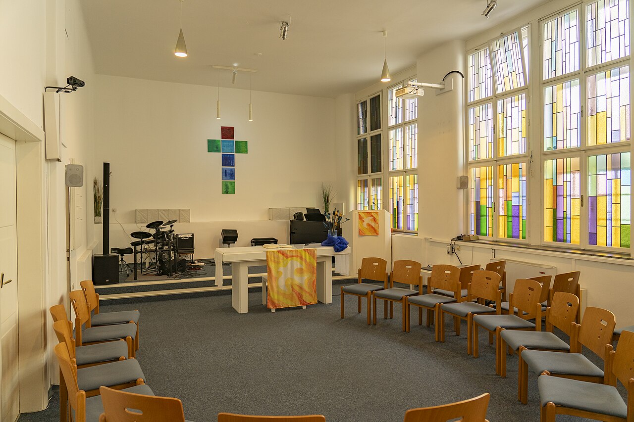
Evang. Messiaskapelle
- Yüksek
- İbadet yeri
Dil · 11 yayınlandı
Tarihi anıt · Brigittenau, Vienna
| Pazartesi | 00:00 – 23:59 |
|---|---|
| Salı | 00:00 – 23:59 |
| Çarşamba | 00:00 – 23:59 |
| Perşembe | 00:00 – 23:59 |
| Cuma | 00:00 – 23:59 |
| Cumartesi | 00:00 – 23:59 |
| Pazar | 00:00 – 23:59 |
OpenStreetMap açılış saatlerinden 2026-08-23 tarihinde ayrıştırıldı.
OpenStreetMap erişim etiketlerinden okunur; listede olmayan için kayıtlı etiket yoktur.
Planlayıcıda grup türünü aile seçtiğinizde gün penceresi tek kişilik bir günün yaklaşık dörtte üçüne iner.
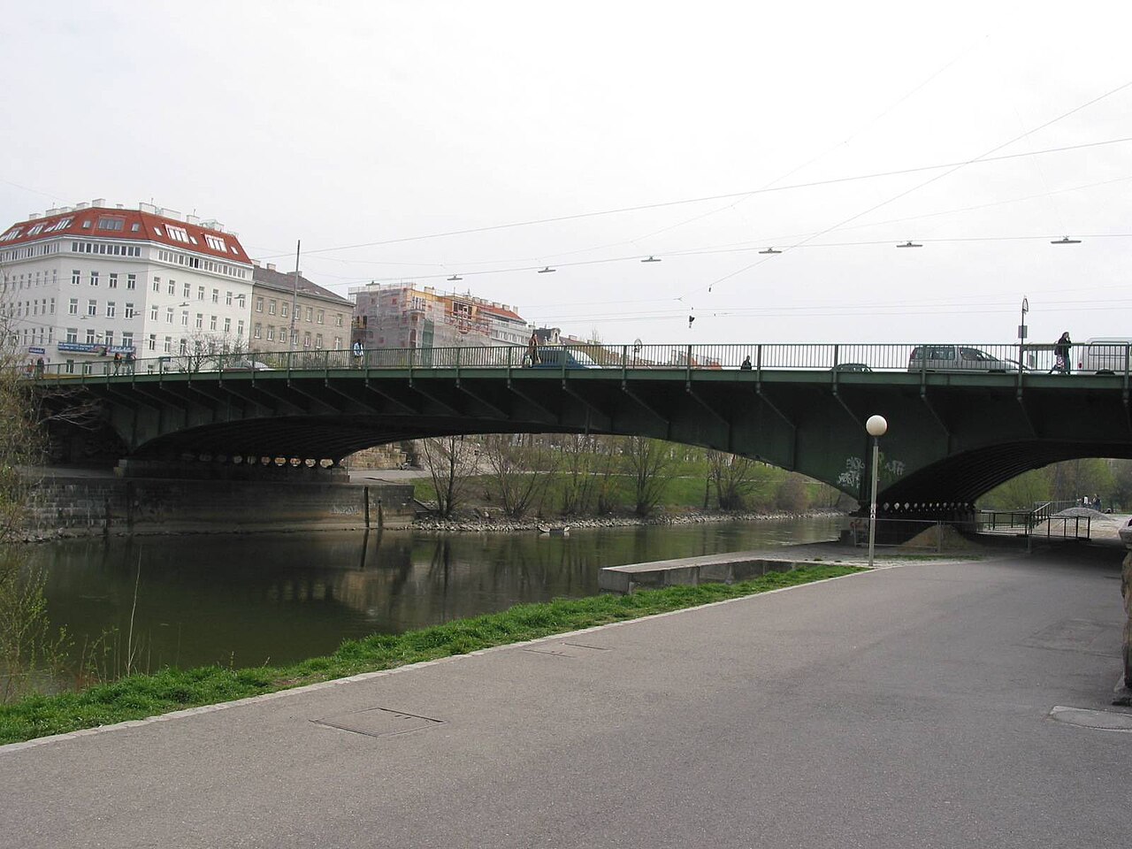
Friedensbrücke is a bridge spanning the Danube Canal in Vienna, Austria. Its name translates to Peace Bridge, reflecting its commemorative significance. The structure serves as a vital transportation link connecting different districts of the Austrian capital. As part of Vienna's urban infrastructure, it facilitates both pedestrian and vehicular movement across this important waterway. The bridge represents one of numerous crossings that integrate the city's historic and modern areas. Visitors encounter it as a functional element of Vienna's riverine landscape rather than a standalone monument. Its presence contributes to the networked character of Danube Canal navigation.
2026-08-26 kontrol edildi
Friedensbrücke contains no interior spaces accessible to visitors. The bridge consists of standard structural elements including roadway surfaces, pedestrian walkways, and supporting architecture. Any decorative or commemorative features present on the bridge are visible from public thoroughfares. The crossing offers views of the Danube Canal and surrounding Viennese architecture. Users traverse the bridge in open-air conditions without enclosed chambers, exhibitions, or visitor facilities. The experience is defined by passage rather than exploration. Structural details may be observed during crossing, though no dedicated viewing platforms or interpretive installations are documented. The bridge functions purely as transit infrastructure.
2026-08-26 kontrol edildi
A complete crossing of Friedensbrücke requires minimal time, typically measured in minutes rather than hours. The duration depends on individual pace, whether walking, cycling, or driving. Pedestrians might spend several minutes appreciating canal views or photographing surroundings. The bridge itself does not demand extended visitation as it lacks attractions requiring lingering examination. Most users incorporate it into larger itineraries exploring Vienna's canal districts or traveling between destinations. No queues, entry procedures, or timed experiences affect duration. Visitors should allocate time contextually within broader Danube Canal or district exploration rather than scheduling dedicated bridge visits.
2026-08-26 kontrol edildi
Friedensbrücke operates as public infrastructure accessible at all hours without restriction. Operator-confirmed hours are Not recorded pending review. The bridge serves transportation needs continuously, though individual preferences for lighting, traffic density, and atmospheric conditions may influence visit timing. Dawn and dusk offer particular qualities for canal photography. Night crossings benefit from urban illumination. Seasonal considerations include weather protection and crowd patterns in surrounding areas. No ticketing or controlled access governs entry timing. Visitors should exercise standard urban awareness regardless of hour. Special events or maintenance activities could cause temporary disruption, though such occurrences are not documented in available sources.
2026-08-26 kontrol edildi
No admission fee applies to Friedensbrücke. Operator-confirmed prices are Not recorded pending review. The bridge functions as free public infrastructure without ticketing mechanisms, turnstiles, or payment requirements. Pedestrians, cyclists, and vehicles cross without charge. No special access passes, guided tour fees, or donation requests are documented. Visitors should remain alert to standard urban parking charges if arriving by private vehicle in surrounding districts. Public transportation costs to reach bridge vicinity follow Vienna's standard transit fare structure. The bridge itself imposes no financial barrier to crossing or viewing. Budget planning for this site requires no allocation beyond transportation to the general area.
2026-08-26 kontrol edildi
Friedensbrücke is situated along Vienna's Danube Canal, accessible via the city's integrated public transportation network. The U-Bahn metro system serves nearby stations, with walking connections to the bridge. Multiple tram and bus routes operate in surrounding districts. Cyclists may utilize Vienna's extensive bike path network along the canal. Pedestrians approach from either bank via established riverside walkways. Drivers should note that bridge access is primarily for through traffic rather than destination parking. Exact route planning requires current map consultation. The bridge connects areas with distinct characters, allowing visitors to incorporate crossing into varied itinerary structures exploring different Viennese districts.
2026-08-26 kontrol edildi
Visitors should exercise standard urban bridge awareness when using Friedensbrücke. Traffic includes vehicles, cyclists, and pedestrians sharing limited space. Cyclist lanes may be present; pedestrians should remain attentive to bicycle movement. Weather conditions affect surface traction, particularly during precipitation or freezing temperatures. The open structure offers no shelter from elements. Personal belongings require normal vigilance appropriate to any European capital. Canal waters present inherent hazards; barriers should be respected. Night use benefits from awareness of surroundings and travel companions. No exceptional risks are documented, though standard city precautions apply. Construction or maintenance may cause temporary pathway modifications without advance notification in available sources.
2026-08-26 kontrol edildi
Friedensbrücke offers photographic opportunities of the Danube Canal and Viennese urban landscape. The bridge structure itself may serve as framing element or subject. Lighting conditions vary dramatically across day and seasons, affecting image character. Morning and evening provide directional illumination on water surfaces. Night photography captures artificial lighting reflections. No restrictions on photography are documented, though tripod use in traffic pathways requires courtesy and safety awareness. Drone operation falls under Austrian aviation regulations unrelated to bridge-specific rules. The canal's linear geometry creates compositional possibilities. Surrounding architecture provides contextual depth. Weather and seasonal vegetation alter visual character significantly.
2026-08-26 kontrol edildi
Friedensbrücke functions primarily as transportation infrastructure rather than a designated tourist destination. Visitors may appreciate it contextually within Danube Canal exploration.
The name Peace Bridge suggests commemorative intent, though specific historical events or dedication circumstances are Not recorded in available sources.
No guided tours are documented. The bridge is used independently as part of broader Vienna exploration without structured interpretation.
Standard bridge engineering suggests ramped or graded access possibilities, though specific accessibility confirmations are Not recorded pending review.
Urban bridge infrastructure typically includes lighting for safety and navigation, though specific illumination characteristics are Not recorded in available sources.
No commercial establishments are located on the bridge itself. Dining options exist in surrounding districts accessible by foot from either terminus.
Etkileşimli harita yükleniyor…
Etkileşimli harita yüklenemedi.

Son güncelleme:
Kaynak: OpenStreetMap katkıda bulunanları, Wikidata ·