
01
20 min
Katarina Elevator
- Must see
- Viewpoint
Language · 1 published
City guide · Sweden
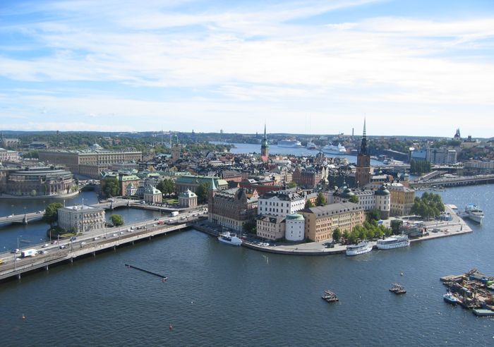
Stockholm spreads across islands joined by bridges, ferries and rail, but its central visitor districts form a manageable chain. Gamla Stan, Norrmalm, Djurgården, Östermalm and Södermalm each reward a separate walking block. Public transport closes the gaps, while boats are part of the useful network rather than only sightseeing. Plan by island and district so repeated water crossings do not consume the day.
Ranked by importance — sitelinks, pageviews and heritage status, not editor preference.
25 places match
Category
Typical visit duration
Interests
Source: OpenStreetMap contributors, Wikidata ·
Gamla Stan is the historic hinge between the northern and southern halves of central Stockholm. Norrmalm, the main commercial and transport centre, lies immediately north; Östermalm and museum-rich Djurgården continue east. Södermalm rises south of the old town, while Kungsholmen and Vasastan extend west and northwest. The official visitor guide identifies seven central districts with distinct characters. Combine adjacent districts on foot, and treat the archipelago or distant suburbs as separate outings.
Checked 2026-08-26
Use the SL network of metro, commuter rail, tram, bus and selected local boats for moves between districts. The centre is compact enough for substantial walking, but water and rail lines determine the quickest route more than straight-line distance. Use one valid SL ticket product consistently and check the official journey planner before island connections. Djurgården can be reached by tram or ferry, while outer archipelago travel requires separate route planning.
Checked 2026-08-26
Three to four days suit a first visit. Use the first days for Gamla Stan, Norrmalm, Djurgården and Södermalm, then reserve additional time for a longer island or archipelago route.
May through September gives the most useful daylight for walking between districts and using boat connections. Winter can still work for museums and indoor culture, but outdoor sightseeing time is much shorter.
Yes, within one district and between several central islands. Bridges, hills and water make some apparently short cross-city routes slower, so use public transport when changing from one side of the centre to another.
Yes. Selected local boat services form part of the wider public transport network. Check the SL journey planner and ticket conditions for the specific route rather than assuming every sightseeing or archipelago boat is included.
Gamla Stan and Norrmalm combine naturally, while Östermalm and Djurgården make another coherent block. Södermalm deserves its own walking route, especially when viewpoints and evening stops are included.
Set your days, your pace and the hours you actually want to be out. The planner works around closing days and travel time, and leaves room to eat.