Guia da cidade · United Kingdom
Glasgow
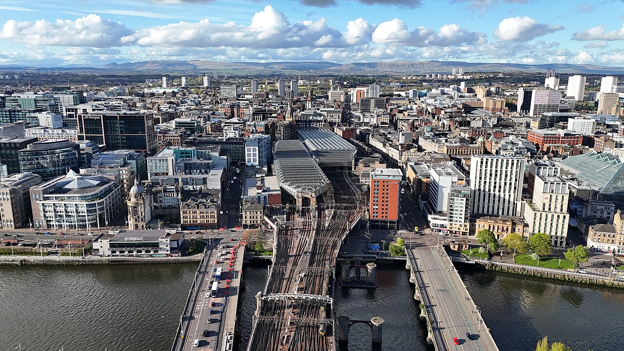

Glasgow is a compact central city with major visitor districts stretching west along the River Clyde and university corridor. The city centre and Merchant City are walkable, while the West End, Riverside Museum and Southside are better reached by subway, train or bus. Two main railway stations serve different directions. Plan the central core and West End as separate blocks rather than walking every transfer.
Informações práticas
Informações práticas
Transforme esta lista em um plano
Defina seus dias, seu ritmo e os horários em que realmente quer sair. O planejador considera dias de fechamento e tempo de deslocamento, e reserva tempo para refeições.
Planejando uma visita
- Estadia sugerida
- 2-3 days
- Como se locomover
- Walking, Subway, train and bus
- Melhor época
- Boa época
- Viável com ressalvas
- Condições difíceis
Principais atrações
Ordenado por importância — links do site, visualizações de página e status de patrimônio, não preferência do editor.
Filtrar a lista
0 locais correspondem
0 locais correspondem
Categoria
Duração típica da visita
Nada em Glasgow corresponde a todos esses filtros
A lista é construída a partir de dados reais de lugares, então um resultado vazio significa que a combinação realmente não tem correspondência — não que a página falhou. Flexibilize um filtro e a classificação retorna.
Fonte: Colaboradores do OpenStreetMap, Wikidata ·
Como a cidade está organizada
The city centre is a regular street grid between Glasgow Central and Queen Street stations, with Merchant City immediately east. The River Clyde forms the southern edge of the core and leads west toward the SEC and Riverside Museum. The West End clusters around the University of Glasgow, Kelvingrove and Byres Road. South of the river, Pollok Country Park and the Burrell Collection form another distinct outing. The compact Subway loop links the centre, West End and parts of the Southside.
Verificado em 2026-08-26
Locomoção
Walk through the city centre and Merchant City, then use the Subway, suburban trains or buses for the West End and Southside. Visit Glasgow identifies the Subway as a simple link among the centre, West End and south of the river, while rail reaches a much wider Greater Glasgow area. Central and Queen Street stations are separate but close enough to connect on foot. Check the operator journey planner before combining rail and Subway legs.
Verificado em 2026-08-26
Perguntas comuns
How many days does Glasgow need?
Two to three days cover the principal districts. Use one day for the city centre and Merchant City, another for the West End, and add a third for the Southside or Clyde waterfront.
When is the best time to visit Glasgow?
May through September provides longer daylight for architecture, parks and river routes. Rain is possible in every season, so museums work well as flexible anchors rather than fixed weather bets.
Is Glasgow easy to explore on foot?
The city centre and Merchant City are easy to walk. The West End, Southside and farther Clyde attractions are better linked by Subway, train or bus.
What does the Glasgow Subway connect?
The circular Subway links the city centre with the West End and parts of the Southside. It is useful for district-to-district travel but does not replace suburban rail or buses for every attraction.
Which station should visitors use in Glasgow?
Glasgow Central mainly serves routes south and west, while Queen Street mainly serves routes north and east. They are separate stations, so confirm the departure point before planning a connection.