Local de natureza · Cairo
Wadi Degla
محمية وادي دجلة
Fotografia

Horário de funcionamento
| Segunda-feira | 07:00 – 18:00 |
|---|---|
| Terça-feira | 07:00 – 18:00 |
| Quarta-feira | 07:00 – 18:00 |
| Quinta-feira | 07:00 – 18:00 |
| Sexta-feira | 07:00 – 18:00 |
| Sábado | 07:00 – 18:00 |
| Domingo | 07:00 – 18:00 |
Analisado a partir do horário de funcionamento do OpenStreetMap em 2026-08-26.
- Hoje
- Aberto hoje, 07:00 – 18:00
- Duração da visita
- 1 hora
- Acessibilidade
- Não registrado
- Preço
- Não registrado
- Posição
- Imperdível
- Classificação
- Classificação 54 de 1,322
Sobre Wadi Degla
Wadi Degla Protected Area is a desert wadi situated at Cairo's southeastern edge, forming a natural corridor through rocky terrain. The protected status preserves this arid landscape from urban encroachment. As the nearest significant protected hiking area to Cairo's urban core, it offers accessible wilderness experience for residents and visitors seeking respite from the dense metropolitan environment. The wadi system represents a typical Eastern Desert drainage pattern, shaped by seasonal water flow through sedimentary rock formations over geological timescales.
Verificado em 2026-08-26
O que há dentro
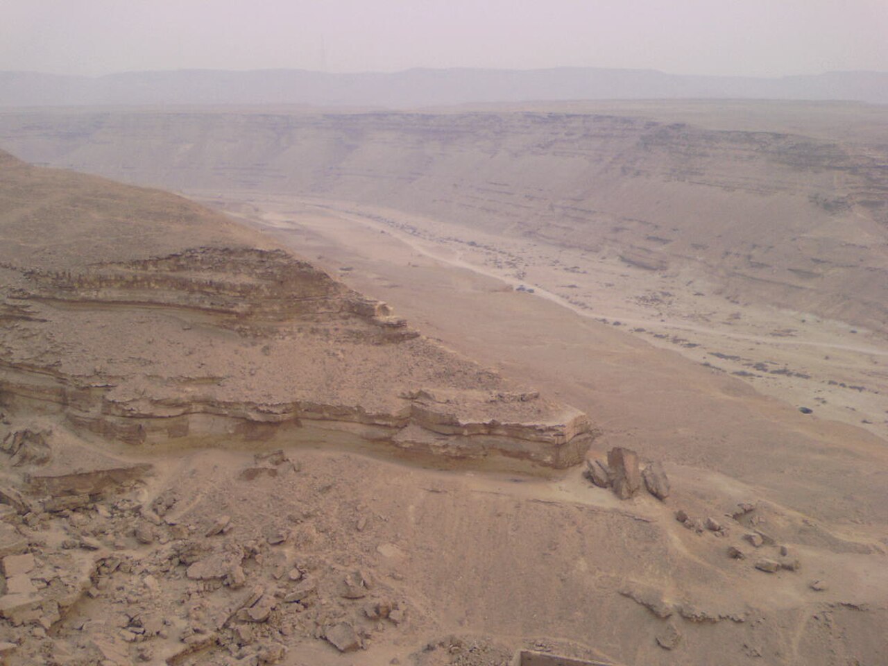
The protected area contains a dry riverbed valley flanked by limestone and sedimentary rock cliffs. Sparse desert vegetation adapted to arid conditions occupies the wadi floor and cliff faces. The terrain supports typical desert fauna including reptiles, small mammals, and bird species. Rock formations display erosion patterns from occasional flash floods. Fossil deposits may be present in the sedimentary strata. The landscape offers unobstructed views across desert plains toward the Eastern Desert mountain ranges. No permanent water sources, built structures, or visitor facilities are recorded within the protected boundaries.
Verificado em 2026-08-26


Quanto tempo dedicar
A typical visit spans two to four hours for hiking the main wadi corridor. Extended exploration of side tributaries and elevated viewpoints may extend duration to a full day. The depth of engagement depends on individual fitness levels, heat tolerance, and photographic interests. Visitors should carry sufficient water supplies proportional to time spent. Return trips from central Cairo including transport and activity generally require half a day minimum. Overnight camping is not documented as an established practice. Self-sufficiency in planning is essential given the undeveloped nature of the site.
Verificado em 2026-08-26


Temporada e multidões
The optimal visiting period falls during cooler months from late autumn through early spring, when daytime temperatures permit sustained physical activity. Summer months bring extreme heat dangerous for exposed hiking. Early morning departures mitigate thermal stress regardless of season. Operator-confirmed hours are Not recorded pending review. Visitors must independently verify current access conditions before travel. Seasonal flash flood risk following rare rainfall events presents a serious hazard. Sandstorms may occur during spring months. Clear skies predominate in winter, offering the most reliable conditions for desert exploration and navigation.
Verificado em 2026-08-26
Ingressos
Entry requirements and fee structures for protected areas in Egypt vary by administrative designation and are subject to change. Operator-confirmed prices are Not recorded pending review. Visitors should anticipate potential entrance fees collected at access points or permit requirements for foreign nationals. Payment methods may be restricted to cash in Egyptian pounds. Annual or multi-site passes for Egypt's protected areas may offer alternatives for repeated visits. Independent verification through official channels is essential before arrival. No advance booking infrastructure is documented. Carry identification documents as regulatory inspections may occur.
Verificado em 2026-08-26


Chegando lá
The protected area lies approximately fifteen to twenty kilometers southeast of central Cairo, accessible via the Autostrad road toward Maadi and beyond. Private vehicle or hired taxi represents the most reliable transport method. Public bus routes may serve nearby districts with remaining distance on foot. Ride-hailing applications operate with variable availability in peripheral zones. Road conditions on final approaches may deteriorate. Navigation requires attention as signage is minimal. Return transport should be arranged in advance due to limited spontaneous pickup options. Travel time from downtown Cairo typically exceeds forty minutes depending on traffic congestion patterns.
Verificado em 2026-08-26


O que observar
Desert hiking hazards include dehydration, heat exhaustion, and disorientation from featureless terrain. Carry abundant water beyond apparent requirements. Mobile telephone coverage may be intermittent or absent. Inform contacts of intended route and return time. Loose rock on slopes presents fall risk. Wildlife encounters require respectful distance, particularly with snakes active in warmer periods. No rescue services or emergency facilities operate within the protected area. Solo hiking is inadvisable. Weather changes can be rapid and severe. Proper footwear, sun protection, and navigation equipment are essential. Leave no trace of visitation to preserve ecological integrity.
Verificado em 2026-08-26


Fotografia
The wadi offers strong photographic potential through geological textures, dramatic shadows, and expansive desert vistas. Golden hour lighting enhances cliff formations during early morning and late afternoon. Midday sun produces harsh contrasts challenging exposure balance. Wide-angle lenses capture the scale of wadi walls; telephoto lenses isolate rock detail patterns. Minimal light pollution may permit astrophotography on clear nights, though overnight stays require independent security assessment. Dust exposure risks camera equipment. Tripods assist in low-light conditions. Human subjects provide scale reference against landscape immensity. Respect any restrictions on commercial filming activities.
Verificado em 2026-08-26
Perguntas comuns
Is Wadi Degla suitable for beginner hikers for Wadi Degla Protected Area in Cairo?
Beginners may attempt the main wadi floor with adequate preparation, though desert conditions demand self-sufficiency. Navigation is straightforward along the primary corridor, but heat exposure and uneven terrain require caution. Companion hikers with experience are recommended.
Are there guides available at the site for Wadi Degla Protected Area in Cairo?
No formal guide services are recorded at Wadi Degla. Visitors must be prepared for independent exploration. Local knowledge may be available through community contacts in nearby settlements, though reliability varies.
Can I bring children to Wadi Degla for Wadi Degla Protected Area in Cairo?
Children may visit with close supervision, considering heat exposure, rough terrain, and absence of emergency services. Shorter durations and generous water supplies are essential. Infant and toddler visits are inadvisable.
Is camping permitted overnight for Wadi Degla Protected Area in Cairo?
Established camping regulations are not documented. Overnight stays in undeveloped desert areas carry security considerations beyond daytime visits. Visitors should seek current official guidance before planning extended stays.
What should I wear for a visit for Wadi Degla Protected Area in Cairo?
Long lightweight clothing protects from sun exposure and abrasive rock contact. Sturdy closed footwear with ankle support is essential. Head covering reduces heat stress. Avoid dark colors that absorb solar radiation.
Are restroom facilities available for Wadi Degla Protected Area in Cairo?
No facilities of any kind are recorded within the protected area. Visitors must plan accordingly and carry out all waste. Nearest services likely exist in surrounding urban districts at considerable distance.
Onde está
A carregar o mapa interativo…
Não foi possível carregar o mapa interativo.
Perto
Encaixe isso em um plano
Links externos
Última atualização:
Fonte: Colaboradores do OpenStreetMap, Wikidata ·