Monumento histórico · Seul
Some Sevit
세빛섬
Fotografia

.jpg)
- Hoje
- Horário não registado
- Duração da visita
- 45 min
- Acessibilidade
- Não registrado
- Preço
- Não registrado
- Posição
- Imperdível
- Classificação
- Classificação 57 de 9,921
Sobre Some Sevit
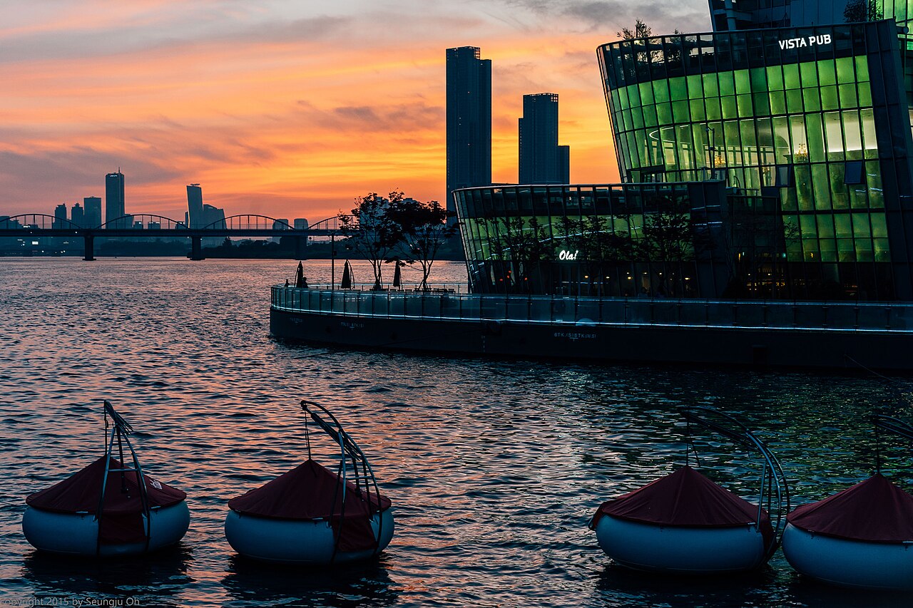
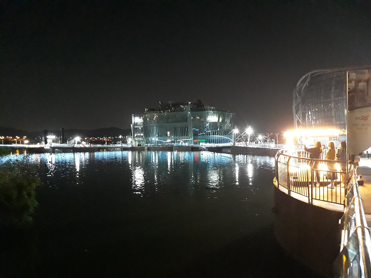
Some Sevit, known locally as 세빛섬, comprises three artificial islands situated on the Han River in Seoul, South Korea. The complex was developed as a distinctive riverside landmark and cultural venue. The three islands are named Gavit, Chavit, and Solvit, collectively forming a recognizable feature of Seoul's contemporary urban landscape. The structures serve multiple functions including exhibition spaces, performance venues, and recreational areas. Their illuminated appearance at night has become a notable element of Seoul's riverside scenery. The islands represent a significant example of modern Korean architectural intervention in natural waterways.
Verificado em 2026-08-26
O que há dentro
The three islands contain varied facilities distributed across their structures. Gavit functions as a convention and exhibition center with halls suitable for events and gatherings. Chavit contains cultural facilities and spaces for performances or displays. Solvit serves as an additional venue with complementary functions. The islands feature outdoor terraces and observation areas providing river views. Restaurants and cafes operate within the complex, offering dining options with waterfront outlooks. The architectural design incorporates modern materials and forms. Specific current tenants, exact capacity figures, and detailed amenity listings are Not recorded. Visitors should verify operational status of individual facilities before planning specific activities.
Verificado em 2026-08-26
.jpeg)
Quanto tempo dedicar
The duration of a visit to Some Sevit varies considerably based on individual interests and purposes. A brief external viewing from the riverside paths or bridges may require thirty minutes or less. Those entering the facilities for dining, events, or cultural activities should allocate corresponding time. Evening visits to observe the illuminated structures demand additional time for optimal viewing conditions. Visitors attending scheduled performances or exhibitions must factor event durations into their planning. The complex does not appear designed as a full-day destination in itself, but rather as a component of broader Han River exploration. Combination with nearby riverside attractions extends typical visits substantially.
Verificado em 2026-08-26


Temporada e multidões
Some Sevit presents different atmospheric qualities across daily and seasonal cycles. Evening hours offer the illuminated appearance that constitutes much of its visual recognition. Daylight hours permit clearer appreciation of architectural forms and river surroundings. Seasonal weather variations affect outdoor comfort on terraces and connecting walkways. The Han River area experiences distinct seasonal conditions including humid summers and cold winters. Operator-confirmed hours are Not recorded pending review. Visitors should independently verify current access times and any seasonal operational adjustments. Special events or private bookings may restrict public access on particular dates. Advance confirmation of intended visit timing remains prudent given potential scheduling variations.
Verificado em 2026-08-26
Ingressos
Access arrangements for Some Sevit depend on specific activities and areas sought. General external access to the riverside surroundings and bridge viewpoints requires no admission. Entry to island facilities may involve fees for particular exhibitions, performances, or events. Dining establishments operate on standard commercial terms. Operator-confirmed prices are Not recorded pending review. Visitors should not assume free access to all areas and should verify current cost structures before visiting. Event-specific ticketing typically operates through standard Korean booking platforms or direct venue channels. Group arrangements may follow separate protocols. Payment methods accepted should be confirmed in advance, particularly for international visitors unfamiliar with local transaction systems.
Verificado em 2026-08-26

Chegando lá
Some Sevit occupies a position on the Han River accessible via multiple transportation modes. The Banpo Bridge, which carries both vehicles and pedestrians, provides direct proximity. Nearby subway stations on Seoul Metro lines require walking connections of varying distances. Bus services operate along adjacent roadways with stops in reasonable proximity. The riverside cycling and walking paths connect to broader Han River trail networks. Taxi and ride-hailing services serve the area with designated drop-off points. Specific route numbers, station names, and walking durations are Not recorded. Visitors should consult current Seoul transit applications or official tourism resources for precise directions from their departure points, as infrastructure modifications may affect access.
Verificado em 2026-08-26

.jpg)
O que observar
Visitors to Some Sevit should exercise standard urban waterway precautions. The artificial island edges and connecting structures may present slip hazards, particularly in wet conditions. Evening illumination viewing requires attention to pedestrian traffic on surrounding bridges and paths. Weather conditions including river winds affect outdoor comfort and safety. The area experiences visitor concentration during peak evening hours and special events. Facility operational changes or temporary closures may occur without extensive advance notification. Food and beverage prices within venue establishments may exceed neighborhood averages. Language barriers may affect service interactions for non-Korean speakers. Emergency procedures and facility security arrangements should be noted upon entry to specific buildings.
Verificado em 2026-08-26

.jpg)
Fotografia
Some Sevit offers substantial photographic interest, particularly the illuminated night appearance of the three islands. The Banpo Bridge and adjacent riverside paths provide external vantage points. Bridge structures themselves may offer framing opportunities. The Rainbow Fountain feature on Banpo Bridge, when operational, creates additional visual elements though synchronization with Some Sevit illumination is Not recorded. Interior photography may face restrictions within specific venues or during ticketed events. Tripod use in public areas may require consideration of pedestrian traffic flow. Drone operation would fall under Korean aviation regulations and local restrictions. Optimal lighting conditions for exterior photography occur during twilight transitions when artificial illumination complements remaining natural light.
Verificado em 2026-08-26
Perguntas comuns
Is Some Sevit open every day for Some Sevit in Seoul?
Operator-confirmed hours are Not recorded pending review. Visitors should verify current schedules before visiting.
How much does it cost to enter Some Sevit for Some Sevit in Seoul?
Operator-confirmed prices are Not recorded pending review. External viewing from riverside areas requires no admission; facility access may involve variable costs.
What is the best way to photograph the illuminated islands for Some Sevit in Seoul?
Evening twilight from Banpo Bridge or adjacent riverside paths offers favorable vantage points. Specific timing for full illumination activation is Not recorded.
Are there restaurants at Some Sevit for Some Sevit in Seoul?
Dining establishments operate within the complex. Current operational status, cuisines, and price ranges are Not recorded pending review.
Can I walk between the three islands for Some Sevit in Seoul?
The islands form a connected complex. Specific internal circulation arrangements and any access restrictions are Not recorded pending review.
Is Some Sevit accessible for visitors with mobility limitations for Some Sevit in Seoul?
Specific accessibility features, elevator availability, and barrier-free route information are Not recorded pending review. Visitors with particular needs should verify facilities in advance.
Onde está
A carregar o mapa interativo…
Não foi possível carregar o mapa interativo.
Perto
Encaixe isso em um plano
Links externos
Última atualização:
Fonte: Colaboradores do OpenStreetMap, Wikidata ·