展望スポット · リオデジャネイロ
Sugarloaf Mountain
Pão de Açúcar
写真

- 今日
- 営業時間の記録なし
- 訪問期間
- 20分
- アクセシビリティ
- 未登録
- 価格
- 未登録
- 評価
- 必見 · 遺産
- ランク
- 5,359 の 42 をランク付け
Sugarloaf Mountainについて
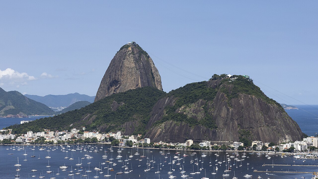
Sugarloaf Mountain, locally known as Pão de Açúcar, is a prominent peak situated on a peninsula at the mouth of Guanabara Bay in Rio de Janeiro, Brazil. The mountain rises dramatically from the water and is recognized globally as an iconic symbol of the city. Its distinctive rounded shape resulted from granite composition weathered over geological time. The site functions primarily as a tourist attraction offering panoramic observation points. Two cable car stages connect the base at Praia Vermelha to Morro da Urca and then to the summit. The location provides extensive views of surrounding beaches, the bay, and the Atlantic Ocean.
2026-08-26 を確認しました
中には何が入っているのか
The summit area contains observation platforms and limited commercial facilities including a food court and souvenir retail. Visitors will find open viewing terraces without enclosed exhibition spaces. The Morro da Urca intermediate station offers additional lookout areas and dining options. There are no museums, historical buildings, or curated collections on either peak. The experience centers entirely on landscape observation and photography. Restroom facilities are available at both stations. The cable car system itself represents the principal engineered feature, with enclosed cabins accommodating multiple passengers. Nighttime operations permit evening visits with illuminated city views, though specific schedules are operator-dependent.
2026-08-26 を確認しました
見学時間の目安
A complete visit typically requires two to three hours including both cable car journeys and time at observation points. The cable car ride between stations lasts approximately three minutes each direction, with the full ascent divided into two segments. Visitors often spend forty to sixty minutes at the main summit. Additional time at Morro da Urca may extend the total duration. Queuing periods vary substantially based on arrival time and seasonal demand. Sunset visits attract larger crowds and longer waits. Photography enthusiasts should allocate extra time for changing light conditions. No guided tours or structured programs are mandatory components of the standard visit.
2026-08-26 を確認しました
季節と混雑状況
Clear atmospheric conditions significantly enhance visibility from the summit, making weather forecasting a practical consideration for timing visits. Morning hours often provide more stable conditions before afternoon cloud buildup common to coastal Rio de Janeiro. Sunset periods remain popular despite increased congestion. Visitors should verify current operating schedules through official channels before planning. Seasonal variations in rainfall affect experience quality, with drier months generally preferable. The attraction operates during daytime and evening periods, though exact timing requires confirmation. Holiday periods and weekends typically experience heavier visitor volume that may diminish the observational experience. Check the operator's own site for the travel date before relying on a schedule or fare.
2026-08-26 を確認しました
チケット
Access requires purchase of cable car tickets covering both stages of ascent. Pricing structures may vary for different visitor categories including residents, tourists, and specific age groups. Payment methods and advance booking availability should be confirmed through official sources. Some package combinations with other Rio attractions may exist seasonally. Ticket validity is typically restricted to the date of purchase. Group rates and special access arrangements may be available but require direct inquiry. Visitors should be prepared for potential price adjustments and verify current rates before arrival. Discount documentation requirements vary by category and jurisdiction of origin. Check the operator's own site for the travel date before relying on a schedule or fare.
2026-08-26 を確認しました
行き方
The base station at Praia Vermelha in the Urca neighborhood serves as the access point. Public bus routes connect from various parts of Rio de Janeiro to the surrounding area. Taxi and rideshare services provide direct access. The location sits near the Botafogo beach district with relatively straightforward approach from the city's southern zone. No private vehicle parking at the immediate station entrance is reliably described in available sources. Walking from nearby neighborhoods is feasible for those accommodated in adjacent districts. The airport connection requires transit through the city center. Visitors should anticipate urban traffic conditions affecting journey duration, particularly during peak periods and major events.
2026-08-26 を確認しました
気をつけるべきこと
Strong sun exposure at open observation areas necessitates protective measures including sunscreen and head covering. Sudden weather changes can rapidly obscure views; summit conditions may differ substantially from base conditions. Crowded cabins and platforms create personal space constraints during peak visitation. Valuables require attention in congested queuing areas. The cable car system suspends operations during electrical storms for safety protocols. Physical accessibility limitations exist for wheelchair users and those with mobility restrictions; specific accommodation details require operator confirmation. No strenuous hiking is required for standard access, though some uneven surfaces exist at summit platforms. Children require supervision near open terrace edges.
2026-08-26 を確認しました
写真
The summit offers extensive photographic opportunities encompassing cityscape, seascape, and mountain perspectives including distant Corcovado and Christ the Redeemer. Early morning and late afternoon provide favorable directional lighting. Night photography captures illuminated urban patterns. Tripod use may face practical limitations from crowd density and platform space constraints. Weather haze significantly degrades long-distance image clarity. The cable car windows permit sequence photography during ascent though reflections and motion present technical challenges. No photography restrictions are documented for standard visitor equipment. Commercial or drone photography likely requires advance authorization. Best results correlate with atmospheric transparency, requiring patience for optimal conditions rather than fixed scheduling.
2026-08-26 を確認しました
よくある質問
Is Sugarloaf Mountain accessible by hiking instead of cable car for Sugarloaf Mountain in Rio De Janeiro?
Not recorded. Some trails in the Urca area are referenced in broader sources, but verified trail access to the summit without cable car use is not confirmed in the supplied context.
Are there restaurants at the summit for Sugarloaf Mountain in Rio De Janeiro?
Food service facilities exist at both Morro da Urca and the main summit, though specific operating hours, menus, and price ranges are not recorded in available sources.
Can tickets be purchased in advance online for Sugarloaf Mountain in Rio De Janeiro?
Advance purchase systems may exist but are not confirmed in the supplied context. Visitors should verify current booking options through official operator channels.
Is the attraction suitable for visitors with fear of heights for Sugarloaf Mountain in Rio De Janeiro?
The cable car journey and open summit platforms involve significant elevation exposure. Individual tolerance varies considerably. Enclosed cabin design may mitigate but not eliminate height-related discomfort.
What happens if weather conditions deteriorate during a visit for Sugarloaf Mountain in Rio De Janeiro?
Cable car operations suspend during electrical storms. Fog or rain may obscure views without necessarily halting transport. No specific refund or rebooking policies are recorded in available sources.
Are there restroom facilities at both stations for Sugarloaf Mountain in Rio De Janeiro?
Restroom facilities are indicated at both Morro da Urca and the main summit station, though specific accessibility features, cleanliness standards, and maintenance schedules are not recorded.
どこにありますか
インタラクティブマップを読み込んでいます…
インタラクティブマップを読み込めませんでした。
近くの
計画に組み込む
外部リンク
最終更新日:
情報源: OpenStreetMap コントリビューター, Wikidata ·