Monumento storico · Paris 1er Arrondissement, Paris
Pont Neuf
Fotografia

Orari di apertura
| Lunedì | 00:00 – 23:59 |
|---|---|
| Martedì | 00:00 – 23:59 |
| Mercoledì | 00:00 – 23:59 |
| Giovedì | 00:00 – 23:59 |
| Venerdì | 00:00 – 23:59 |
| Sabato | 00:00 – 23:59 |
| Domenica | 00:00 – 23:59 |
Analizzato dagli orari di apertura di OpenStreetMap il 2026-08-24.
Accesso e strutture
- Accesso senza gradini · Non disponibile
Leggi dai tag di accesso di OpenStreetMap; tutto ciò che non è elencato non ha alcun tag registrato.
Imposta il tipo di gruppo su Famiglia nel pianificatore e la finestra giornaliera si contrae a circa tre quarti di una giornata da solista.
- Oggi
- Aperto oggi, 00:00 – 23:59
- Durata della visita
- 20 min
- Accessibilità
- Accesso con gradini
- Prezzo
- Ingresso gratuito
- Posizione
- Da non perdere · Sito del patrimonio
- Rango
- Classifica 37 di 7,605
Informazioni su Pont Neuf
The Pont Neuf is the New Bridge and it is the oldest standing bridge in Paris, which has been the joke about it for four hundred years.
Henry III ordered it in 1578. The wars of religion stopped the work, it resumed in 1599, opened to traffic in 1604 and was completed in 1607 under Henry IV.
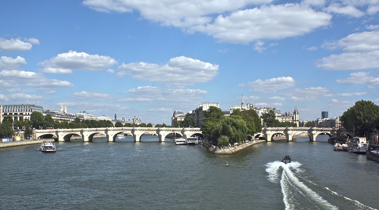
It is 232 m long and 22 m wide, in stone, on twelve arches — seven spans on the Right Bank side and five on the Left — crossing both channels of the Seine over the western tip of the Île de la Cité.
It was restored for its four-hundredth anniversary, the work completing in 2007.
Controllato 2026-08-23 · Fonte
Cosa c'è dentro
381 stone faces, a king on a horse, and the reason the bridge mattered.
The mascarons — 381 carved masks along the cornices, attributed to the Renaissance sculptor Germain Pilon — are the detail nobody notices while crossing and the best thing on the structure.
The equestrian statue of Henry IV stands where the bridge crosses the island. The original of 1614 was destroyed in the Revolution and the present one was put up in 1818.
What made the bridge revolutionary was what it lacked: it was the first stone bridge in Paris with no houses built along it, and the first with raised pavements protecting pedestrians from the traffic. Paris had never had a place to stand over the river before.
Controllato 2026-08-23 · Fonte


Quanto tempo dedicare
Twenty minutes to cross it properly, an hour if you go down to the point.
The Square du Vert-Galant, at the downstream tip of the island below the bridge, is reached by a stair beside the statue and is a triangle of grass and trees at water level. It is the best picnic ground in central Paris and the least advertised.
The bridge itself is a walk, and it connects the Louvre side to Saint-Germain in ten minutes.
Christo and Jeanne-Claude wrapped the whole bridge in fabric in 1985, which is worth knowing while standing on it.
Controllato 2026-08-23 · Fonte


Stagione e folla
Sunset, from the middle of the western span, looking downstream.
The bridge faces the widest stretch of the Seine in central Paris and the sun sets down the river. It is the reason people sit on the semicircular bays over the piers.
The Square du Vert-Galant below closes at dusk and floods in high water — it is the first place in Paris to go under and is closed for weeks in a wet winter.
It is a public bridge and never shut.
Controllato 2026-08-23 · Fonte
Biglietti
Free. It is a road bridge and a public square, not a monument with a door.
The Square du Vert-Galant below is a public garden and free, closing at dusk.
River boats depart from the quay beside it, each operator setting its own fare at the pontoon.
Controllato 2026-08-23

Come arrivare
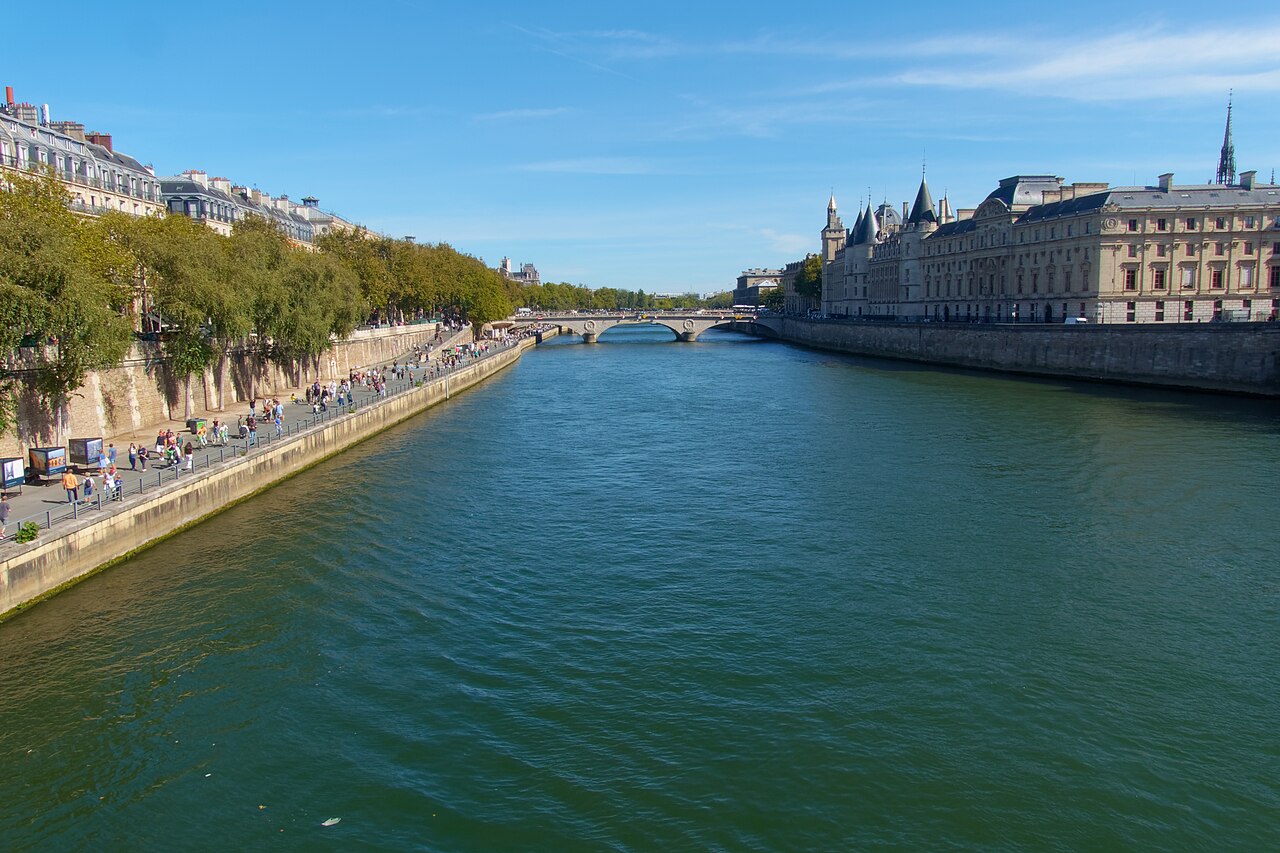
Between the 1st and the 6th arrondissements, across the western end of the Île de la Cité.
Pont Neuf on Métro line 7 is at the Right Bank end, beside the Samaritaine. Cité on line 4 is on the island and Odéon on lines 4 and 10 is five minutes from the Left Bank end.
The Métro runs 16 lines across 321 stations, with stations 548 m apart on average — a two-stop journey is usually faster walked.
Controllato 2026-08-23 · Fonte

.jpg)
A cosa prestare attenzione
It carries traffic. The Pont Neuf is a working road with buses on it, and the pavements — the innovation of 1607 — are narrow by modern standards.
The Square du Vert-Galant floods. In high water the stair is chained shut, sometimes for weeks.
Love-locks were cut off the Paris bridges after the Pont des Arts parapet collapsed under their weight; attaching one here is both prohibited and pointless.
The bays over the piers are where the buskers and the petition operations work in summer.
There is no shade on the bridge and no drinking water on it.
Controllato 2026-08-23 · Fonte


Fotografia
The bridge photographs best from another bridge. The Pont des Arts upstream gives the full 232 m with the island behind it, and the Passerelle des Arts side gives the sunset alignment down the river.
From the Square du Vert-Galant at water level the arches read as a colonnade, which is the picture the roadway cannot take.
The mascarons need a short telephoto and raking side light; at midday they flatten into the stone and disappear.
The statue of Henry IV faces west and is backlit all morning.
Controllato 2026-08-23
Domande comuni
Why is the oldest bridge called the New Bridge?
Because it was new in 1607. Henry III ordered it in 1578 and it was completed under Henry IV; everything older has since been replaced.
How big is it?
232 m long and 22 m wide, on twelve stone arches — seven spans on the Right Bank side and five on the Left.
What made it different?
It was the first stone bridge in Paris with no houses on it and the first with raised pavements, so it was the first place Parisians could stand and look at their river.
What are the carved faces?
381 mascarons along the cornices, attributed to the Renaissance sculptor Germain Pilon.
Who is the statue?
Henry IV, on horseback. The original of 1614 was destroyed in the Revolution and the present statue dates from 1818.
What is the garden below?
The Square du Vert-Galant, on the downstream tip of the island, reached by a stair beside the statue. It closes at dusk and floods in high water.
Dov'è
Caricamento della mappa interattiva…
Impossibile caricare la mappa interattiva.
Nelle vicinanze
Inseriscilo in un piano
Collegamenti esterni
Ultimo aggiornamento:
Fonte: Contributori di OpenStreetMap, Wikidata ·