Belvedere · Döbling, Vienna
Leopoldsberg
Fotografia

_-_Leopoldsberg_(3).JPG)
- Oggi
- Orari non registrati
- Durata della visita
- 45 min
- Accessibilità
- Non registrato
- Prezzo
- Non registrato
- Posizione
- Da non perdere
- Rango
- Classifica 77 di 5,640
Informazioni su Leopoldsberg
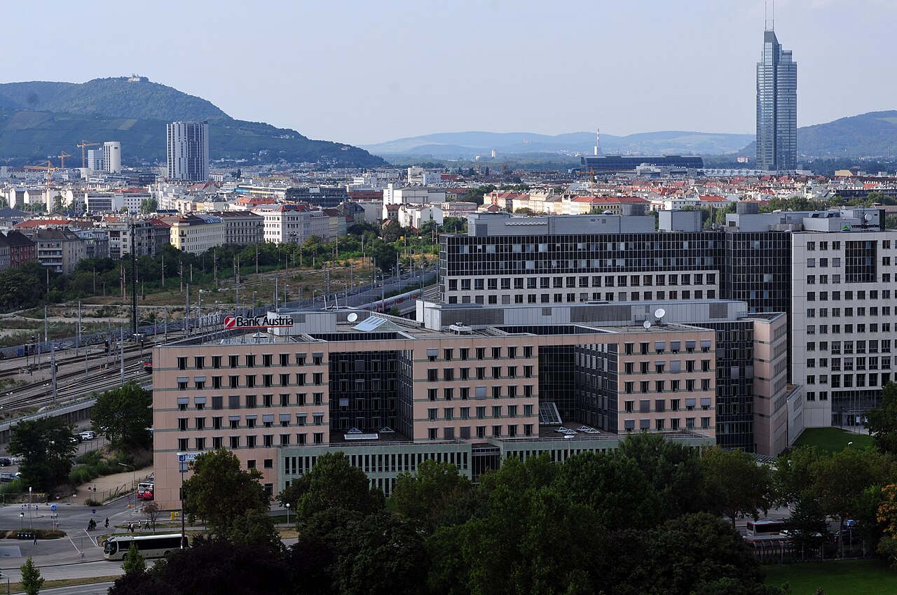
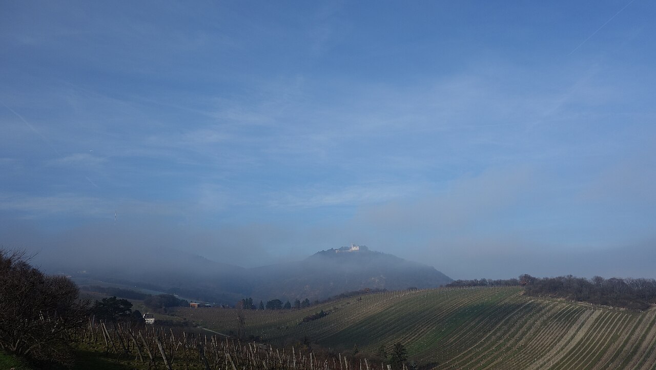
Leopoldsberg is a 425-metre hill at the northern edge of the Vienna Woods, overlooking the point where the Danube leaves the city, and one of two viewpoint hills — with its taller neighbour Kahlenberg — that form Vienna's best-known skyline lookout.
A Babenberg-era fortress stood on the summit from the twelfth century until Ottoman forces destroyed it during the sieges of 1529 and again in 1683; the present church, Leopoldskirche, was built on the ruins in the early eighteenth century and gives the hill its current landmark.
The hill is named for Saint Leopold III, Margrave of Austria, whose Babenberg dynasty held the original castle.
It is also remembered as the point from which the relief forces under the Polish-led coalition gathered before the decisive battle that ended the 1683 Ottoman siege of Vienna, which gives the hill a place in Austrian and Polish historical memory well beyond its role as a viewpoint.
Controllato 2026-08-24 · Fonte
Cosa c'è dentro
Leopoldskirche, a Baroque parish church, occupies the summit where the medieval castle once stood; its terrace outside the church is the hill's main draw, an open viewpoint over the Danube's bend, the vineyards below and the city skyline.
A restaurant and guesthouse (Gasthaus) sit beside the church and serve the terrace crowd, and a car park and bus turnaround occupy the flat summit area. Scattered stonework near the church is what remains of the Babenberg fortress walls.
Below the summit, vineyards run down the hill's southern slopes toward Nussdorf and Grinzing, part of the same wine-growing belt that gives those villages their Heurigen taverns — a combination of hilltop view and valley wine tavern that draws walkers to link the two in a single outing.
Controllato 2026-08-24 · Fonte

Quanto tempo dedicare
Thirty to forty-five minutes covers the church, the terrace view and a walk around the summit; a visitor arriving by the hiking trail from Kahlenberg or Nussdorf should add the walking time itself, which runs forty-five minutes to an hour each way depending on the route.
Controllato 2026-08-24 · Fonte


Stagione e folla
Clear late-afternoon light gives the longest, sharpest view over the Danube and the city, and autumn mornings often carry mist in the valley below that clears within the hour.
Weekends bring day-trippers and cyclists in fair weather, since the hill is a popular finishing point for a Vienna Woods ride or walk; a weekday visit is quieter.
Winter can bring snow and ice on the summit road and the connecting trails, which slows both the bus service and any walking route considerably, and the terrace view is at its clearest on the cold, dry days that often follow a winter front.
Controllato 2026-08-24 · Fonte
Biglietti
The summit, the terrace and the outside of the church are free and open at all times; the church itself keeps its own opening hours for visitors and no ticket is needed to enter.
The restaurant and guesthouse beside the church charge only for what is ordered, the same as any restaurant, rather than for entry to the summit itself.
Controllato 2026-08-24 · Fonte


Come arrivare
Bus 38A runs from Heiligenstadt station, on the U4 line, up to the Leopoldsberg summit and is the direct public-transport route.
On foot, marked trails climb from Nussdorf and from Kahlenberg, which the same bus route also serves; drivers reach the summit car park by the same road the bus uses.
Cyclists commonly combine the climb with the Vienna Woods route up from the Danube towpath, since the road up from Nussdorf is part of a well-known local training climb.
Controllato 2026-08-24 · Fonte


A cosa prestare attenzione
The terrace has no continuous railing along its full length, so supervision matters with children close to the drop.
The summit road can be narrow and busy with cyclists on weekends; walkers on the connecting trail from Kahlenberg should expect some steep, uneven sections rather than a paved path throughout.
The church keeps its own service and visiting hours separate from the open terrace, so it is not always possible to step inside; the exterior and the summit grounds remain accessible regardless.
The bus can run to a reduced weekend or seasonal timetable outside the main tourist months, so anyone relying on public transport rather than a car should check the current schedule before heading up in the off-season.
Controllato 2026-08-24 · Fonte

Fotografia
The terrace faces roughly southeast over the Danube's bend, so morning and late-afternoon sun both work well for the view; shooting toward the city skyline at dusk, once lights come on below, is the hill's best-known shot.
The church's Baroque façade and the fragments of the Babenberg wall make a foreground for wider landscape shots from the summit.
Controllato 2026-08-24 · Fonte
Domande comuni
How high is Leopoldsberg and what is the view?
425 metres, with a terrace looking out over the Danube's bend, the vineyards below and the Vienna skyline.
Is there an entry fee?
No. The summit, terrace and church exterior are open and free at all times; the church itself has its own visiting hours.
What stood here before the church?
A Babenberg-era fortress, destroyed by Ottoman forces during the sieges of Vienna in 1529 and 1683; scattered wall fragments near the church survive from it.
How do I get to Leopoldsberg without a car?
Bus 38A runs from Heiligenstadt station on the U4 line directly to the summit.
Can Leopoldsberg and Kahlenberg be visited together?
Yes; they are connected by a marked trail of roughly forty-five minutes to an hour on foot, and the same bus route serves both.
Is Leopoldsberg suitable for children?
The summit is easy walking, but the terrace lacks a continuous railing along its full length, so children need supervision near the edge.
Dov'è
Caricamento della mappa interattiva…
Impossibile caricare la mappa interattiva.
Nelle vicinanze
Inseriscilo in un piano
Collegamenti esterni
Ultimo aggiornamento:
Fonte: Contributori di OpenStreetMap, Wikidata ·