Monument historique · Cusco
Willkapampa
Photographie


- Aujourd'hui
- Horaires non renseignés
- Durée de la visite
- 45 min
- Accessibilité
- Non renseigné
- Prix
- Non renseigné
- Classement
- Incontournable · Site patrimonial
- Rang
- Rang 45 sur 2,497
À propos de Willkapampa
Vilcabamba, known locally as Willkapampa, is an archaeological site in the Cusco region of Peru. It served as the final refuge and capital of the Inca state after the Spanish conquest of Cusco in 1533. The site represents the last stronghold of Inca resistance against Spanish colonial forces. Located in a remote cloud forest environment, it remained largely forgotten by the outside world until its rediscovery in the twentieth century. The name Willkapampa derives from Quechua, reflecting its sacred significance in indigenous Andean cosmology.
Vérifié le 2026-08-28
Qu'y a-t-il à l'intérieur
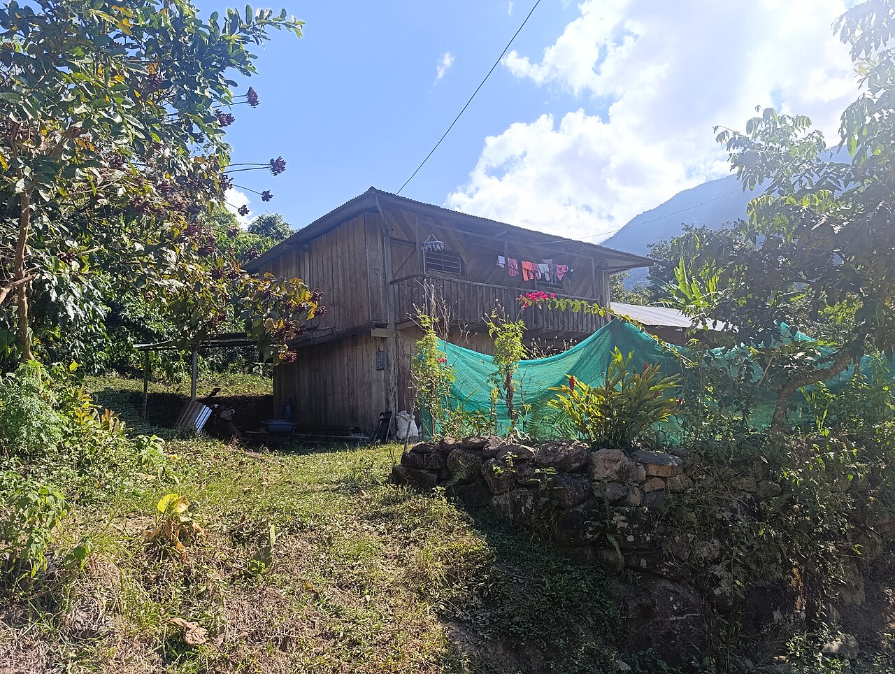
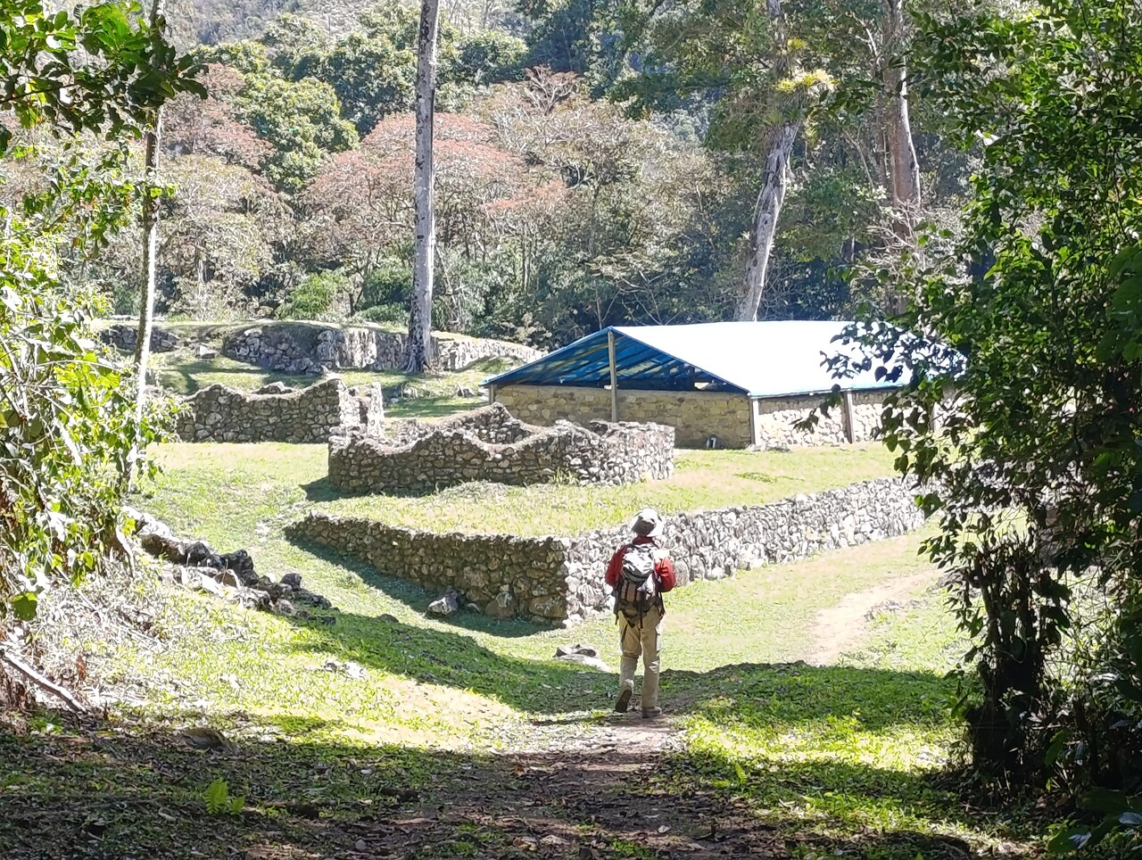
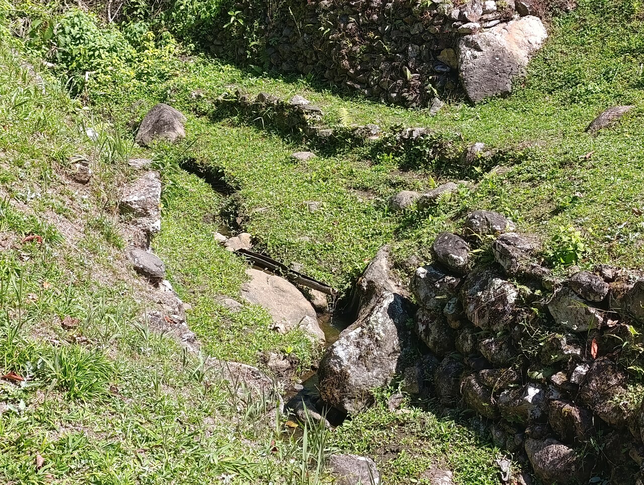
The site encompasses extensive stone terraces, building foundations, and ceremonial platforms distributed across a mountainous landscape. Archaeological investigations have revealed residential compounds, agricultural systems, and possible religious structures. The cloud forest setting has contributed to significant vegetation overgrowth, with many structures partially reclaimed by tropical vegetation. Notable features include water management channels and retaining walls demonstrating Inca engineering capabilities. The remote location has helped preserve certain architectural elements, though detailed survey data remains incomplete. Ongoing research continues to document the full extent of surviving remains.
Vérifié le 2026-08-28
.jpg)
Combien de temps passer
Visitor time requirements vary substantially based on individual interests and physical preparedness. The remote location necessitates multi-day trekking approaches for most visitors, typically extending overall commitment to several days. Actual on-site exploration duration depends on weather conditions, trail status, and personal pacing. The terrain presents significant elevation changes and potentially muddy conditions during rainy periods. Visitors should allocate sufficient time for safe transit to and from the location without rushing. Self-assessment of fitness and experience with backcountry conditions should inform planning decisions. Vilcabamba is best treated as a distinct stop rather than a generic example of its category. Focus on the setting, surviving features and visitor route visible on arrival.
Vérifié le 2026-08-28

.jpg)
Saison et foule
Seasonal considerations for this cloud forest location include pronounced wet and dry patterns affecting trail accessibility and site conditions. The dry season generally offers more favorable trekking conditions with reduced precipitation, though specific months require verification against current climate data. Fog and mist occur year-round given the elevation and vegetation cover. Operator-confirmed hours are Not recorded pending review. Visitors should consult established trekking operators and regional tourism authorities for current accessibility status before committing to travel dates, as conditions can change rapidly.
Vérifié le 2026-08-28
Billets
Formal entry requirements and fee structures for Vilcabamba remain insufficiently documented in available sources. The site's remote status and limited infrastructure suggest that standardized ticketing systems may not operate as at more accessible archaeological sites. Operator-confirmed prices are Not recorded pending review. Visitors should verify current regulations with SERNANP, regional tourism offices, or established trekking agencies serving the area. Potential costs may include guide services, pack animals, camping permits, and logistical support rather than simple site admission. Advance financial planning should accommodate uncertainty in fee structures.
Vérifié le 2026-08-28
.jpg)
Y arriver
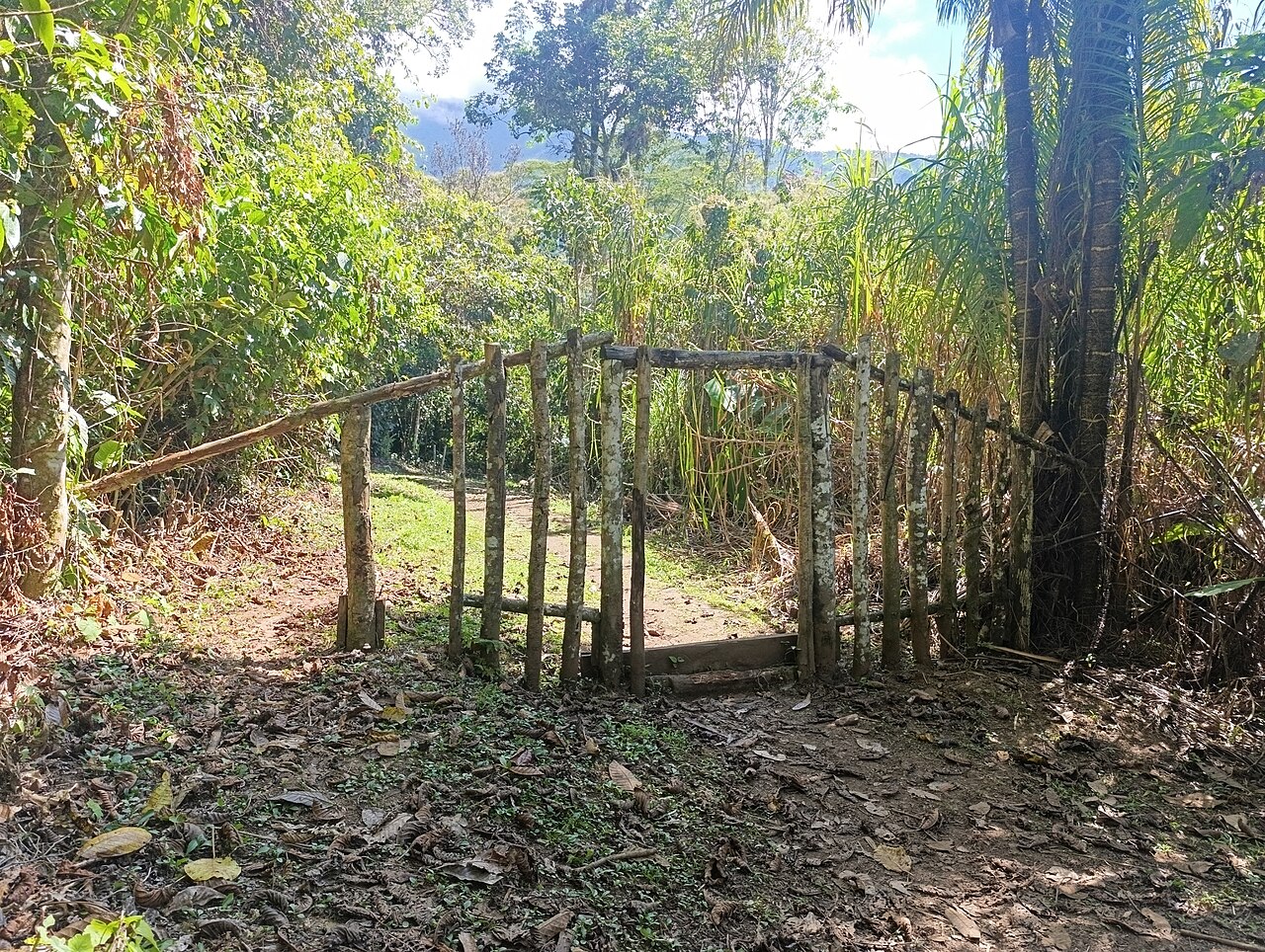
Access to Vilcabamba requires extended trekking through difficult mountainous terrain. Common approaches originate from settlements in the Cusco region, with routes passing through cloud forest and high-elevation zones. No road access reaches the immediate site area. Established trekking itineraries typically span multiple days with camping requirements. Trail conditions vary seasonally and may involve river crossings, steep ascents, and potentially hazardous segments. Engaging experienced local guides is strongly advisable for route-finding and safety. Self-sufficient backcountry skills are essential given the isolation and limited rescue accessibility.
Vérifié le 2026-08-28
.jpg)
À quoi faut-il faire attention
Multiple hazards warrant careful attention at this remote location. Tropical diseases including leishmaniasis and other vector-borne illnesses present genuine risks in cloud forest environments. Unpredictable weather can generate dangerous conditions with limited warning. Trail erosion, stream crossings, and slippery surfaces contribute to injury potential. Wildlife encounters require appropriate precautions and food storage practices. The extreme isolation means medical evacuation would be significantly delayed. Altitude effects may compound physical demands. Adequate insurance coverage, first-aid supplies, and emergency communication plans are essential preparations that visitors should not neglect.
Vérifié le 2026-08-28
.jpg)
Photographie
Photography rules and restrictions are Not recorded pending review. The cloud forest environment presents distinctive photographic challenges including persistent moisture, variable lighting conditions, and dense vegetation. Equipment protection from humidity and precipitation requires careful planning. The atmospheric conditions can create dramatic visual effects but also limit visibility of architectural features. Early morning periods may offer clearer conditions before cloud formation intensifies. Visitors should prioritize documentary photography that supports site preservation awareness while respecting any regulations that local authorities may enforce. Drone usage would require explicit permission verification.
Vérifié le 2026-08-28
Questions courantes
Is Vilcabamba the same as Machu Picchu for Vilcabamba in Cusco?
No. Vilcabamba and Machu Picchu are separate archaeological sites with distinct historical roles. Vilcabamba served as the final Inca capital after the Spanish conquest, while Machu Picchu was constructed earlier and abandoned before sustained European contact.
Can I visit Vilcabamba independently without a guide for Vilcabamba in Cusco?
Independent visitation is strongly discouraged due to remote location, challenging terrain, and genuine safety risks. The area lacks infrastructure for self-rescue. Experienced local guides provide essential route knowledge and emergency support capabilities.
What physical fitness level is required for Vilcabamba in Cusco?
Multi-day trekking through mountainous cloud forest demands substantial cardiovascular fitness, balance, and endurance. Prior experience with loaded backpacking and comfort with basic wilderness camping are highly advisable preparations.
Are there facilities at the site for Vilcabamba in Cusco?
No developed facilities exist at Vilkapampa. Visitors must be fully self-sufficient for camping, sanitation, water treatment, and waste management throughout their visit.
What is the best source for current access information for Vilcabamba in Cusco?
Regional tourism authorities in Cusco, SERNANP offices, and established trekking operators with proven Vilcabamba experience represent the most reliable channels for current conditions and regulatory requirements.
Has the full extent of the site been archaeologically documented for Vilcabamba in Cusco?
Comprehensive documentation remains incomplete. Vegetation cover and remote location have limited archaeological survey scope. Research continues to refine understanding of the site's full spatial extent and structural details.
Où c'est
Chargement de la carte interactive…
La carte interactive n'a pas pu être chargée.
À proximité
Insérez-le dans un plan
Liens externes
Dernière mise à jour:
Source: Contributeurs OpenStreetMap, Wikidata ·