
.jpg)
.jpg)
.jpg)


9 min walk
Hudson Yards
- High
- Market
Language · 1 published
Nature site · New York
The High Line
| Monday | 07:00 – 19:00 |
|---|---|
| Tuesday | 07:00 – 19:00 |
| Wednesday | 07:00 – 19:00 |
| Thursday | 07:00 – 19:00 |
| Friday | 07:00 – 19:00 |
| Saturday | 07:00 – 19:00 |
| Sunday | 07:00 – 19:00 |
Parsed from OpenStreetMap opening hours on 2026-08-26.
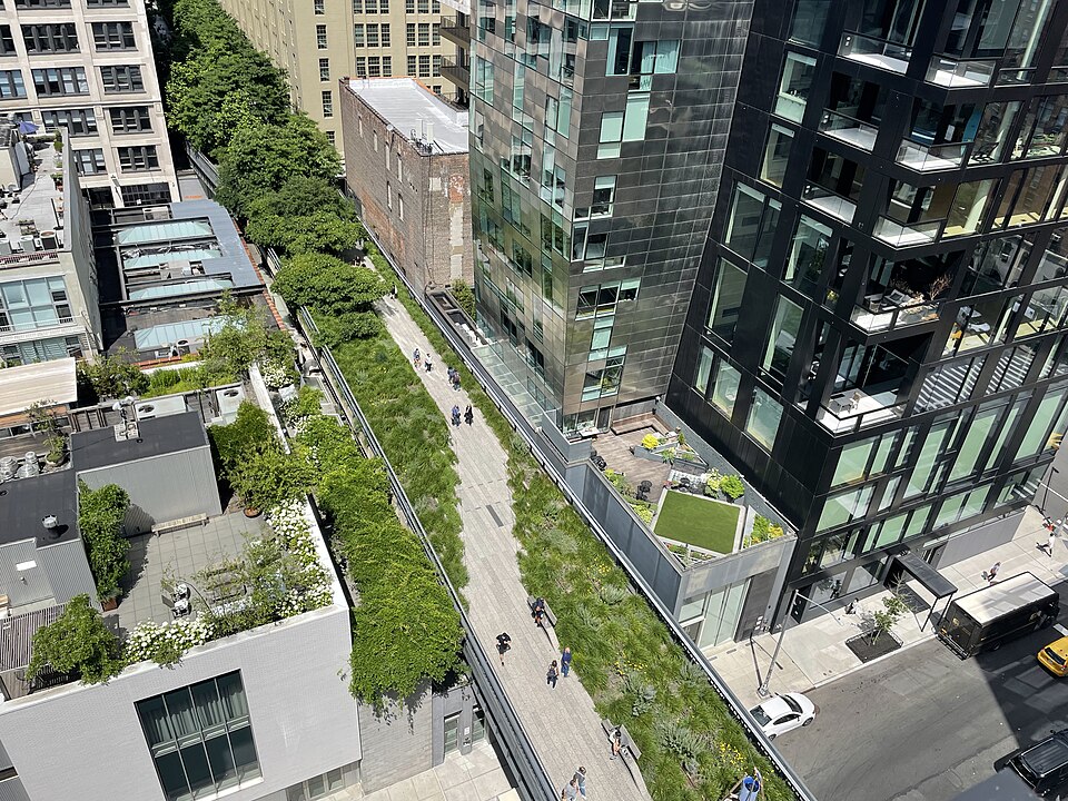
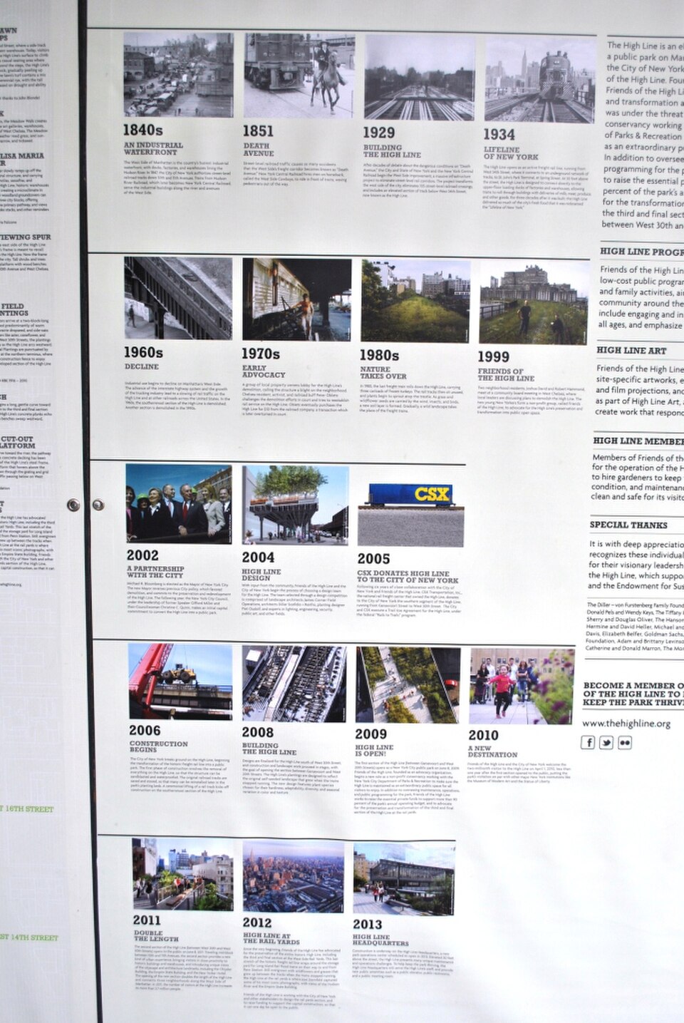
The High Line is a public park built on a historic freight rail line elevated above the streets on Manhattan's West Side. It runs from Gansevoort Street in the Meatpacking District to West 34th Street, between 10th and 12th Avenues. The park was transformed from a disused industrial structure into green space through community advocacy and adaptive reuse. It serves as both recreational corridor and linear gallery for art installations, offering visitors a distinctive vantage point over the Hudson River and surrounding cityscape.
Checked 2026-08-26
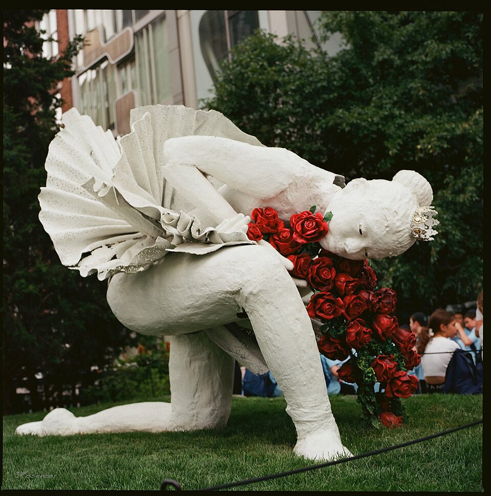
The park features planted gardens with species selected for resilience and seasonal variation. Art installations rotate throughout the year. Seating areas of various designs appear at intervals. Food vendors operate at select access points. The pathway passes through architectural surroundings including new and historic buildings. Water features appear in certain sections. Viewing platforms offer perspectives toward the Hudson River. The design preserves original rail tracks in places as historical reference. Performance spaces host occasional programming. The environment blends cultivated landscape with industrial heritage elements.
Checked 2026-08-26

The full length of The High Line extends approximately 1.45 miles. Walking the entire route without stopping typically requires between twenty and thirty minutes at moderate pace. Most visitors spend between one and two hours accounting for photography, rest stops, and observation. The elevated pathway contains no shortcuts or transit connections midway; entry and exit occur at designated access points. Wheelchair accessibility is maintained throughout. The linear nature means visitors must plan their route according to energy and time constraints. High Line also earns time in a new york itinerary because Exact unique production name match within the declared city scope. Its value becomes clearer when the stop is compared with the surrounding streets and the other ranked places nearby.
Checked 2026-08-26

The High Line operates as public space with seasonal hour variations. Operator-confirmed hours are Not recorded pending review. Weather conditions significantly affect experience due to exposed elevation. Summer brings full foliage but crowds and heat exposure. Winter offers reduced vegetation but clearer sightlines through surrounding architecture. Spring and autumn provide moderate temperatures with distinct horticultural displays. Evening visits present different atmospheric qualities with city lighting. Visitors should consult official channels before travel for current operational status and any scheduled maintenance closures.
Checked 2026-08-26
The High Line operates as free public park without admission charge. Operator-confirmed prices are Not recorded pending review for any special programming or ticketed events. No advance booking is required for general access. Donation stations appear at entrances for voluntary contributions supporting maintenance and programming. Some associated events or tours may require separate arrangements. Visitors should verify current policies through official channels before arrival, as operational models may evolve. Commercial photography permits may involve separate procedures not covered by general access.
Checked 2026-08-26
Multiple subway lines serve the surrounding area with stations at varying walking distances. The 14th Street corridor provides dense transit connections near the southern entrance. Bus routes operate on adjacent avenues. Street parking is extremely limited in surrounding neighborhoods. Taxi and rideshare services can access nearby streets but cannot reach the elevated structure directly. The path connects at various points to street level via stairs and elevators. Visitors with mobility considerations should identify appropriate access points in advance. Cycling is not permitted on the structure itself.
Checked 2026-08-26
The elevated structure lacks protective shelter from weather exposure. Crowding occurs predictably during peak tourism periods and pleasant weather. Narrow pathway sections create bottlenecks. No water fountains or restrooms exist along the full length; facilities appear only at certain access points. Sun exposure is substantial due to limited shade in portions. The surrounding neighborhood experiences heavy vehicle and pedestrian traffic at street level. Visitors should maintain awareness of personal belongings in crowded conditions. Emergency exits are marked but infrequent. The structure closes during severe weather for safety.
Checked 2026-08-26
The elevated perspective offers distinctive architectural and river views. Morning and late afternoon provide favorable directional light on the Hudson River side. Overcast conditions reduce harsh shadows in narrow sections. Tripods and commercial equipment may require permits. The surrounding building glass creates reflection opportunities and challenges. Crowded conditions frequently obstruct clear compositions. The planted areas provide foreground interest against urban backgrounds. Night photography captures city illumination but requires stability due to low light. The linear progression means viewpoints cannot be revisited without walking the full distance again.
Checked 2026-08-26
Elevator access is available at designated entry points. The pathway surface is maintained for wheeled circulation. Visitors should consult official maps to identify appropriate access locations.
Outside food is permitted. Food vendors operate at select locations. Visitors are expected to dispose of waste properly. Alcoholic beverages from outside are not permitted.
Dogs are permitted but must remain leashed. Owners are responsible for cleanup. Crowded conditions may create stress for some animals.
Closure occurs during severe weather conditions for safety. Operational decisions are made based on specific circumstances. Visitors should check official announcements during inclement weather.
Art programming rotates throughout the year. Current information is available through official park channels. Physical signage may identify nearby works.
Multiple access points allow exit at various locations. Visitors are not required to walk the full length. Planning route direction in advance is advisable.
Loading the interactive map…
The interactive map could not be loaded.
Last updated:
Source: OpenStreetMap contributors, Wikidata ·