
1 dk yürüyüş
Kawarau Bridge Bungy
- Mutlaka görülmeli
- Tarihi anıt
Dil · 11 yayınlandı
Tarihi anıt · Queenstown
Kawarau Bridge
The Kawarau Gorge Suspension Bridge, locally known as Kawarau Bridge, is a historic suspension bridge spanning the Kawarau River in the Otago region near Queenstown, New Zealand. The bridge was completed in 1880 and served as a vital transport link during the Central Otago gold rush era. It now functions primarily as a tourist attraction and adventure sports site. The structure holds particular significance as the birthplace of commercial bungy jumping, with AJ Hackett establishing operations here in 1988. The bridge is listed as a heritage structure and remains an iconic landmark of New Zealand's adventure tourism industry.
2026-08-28 kontrol edildi
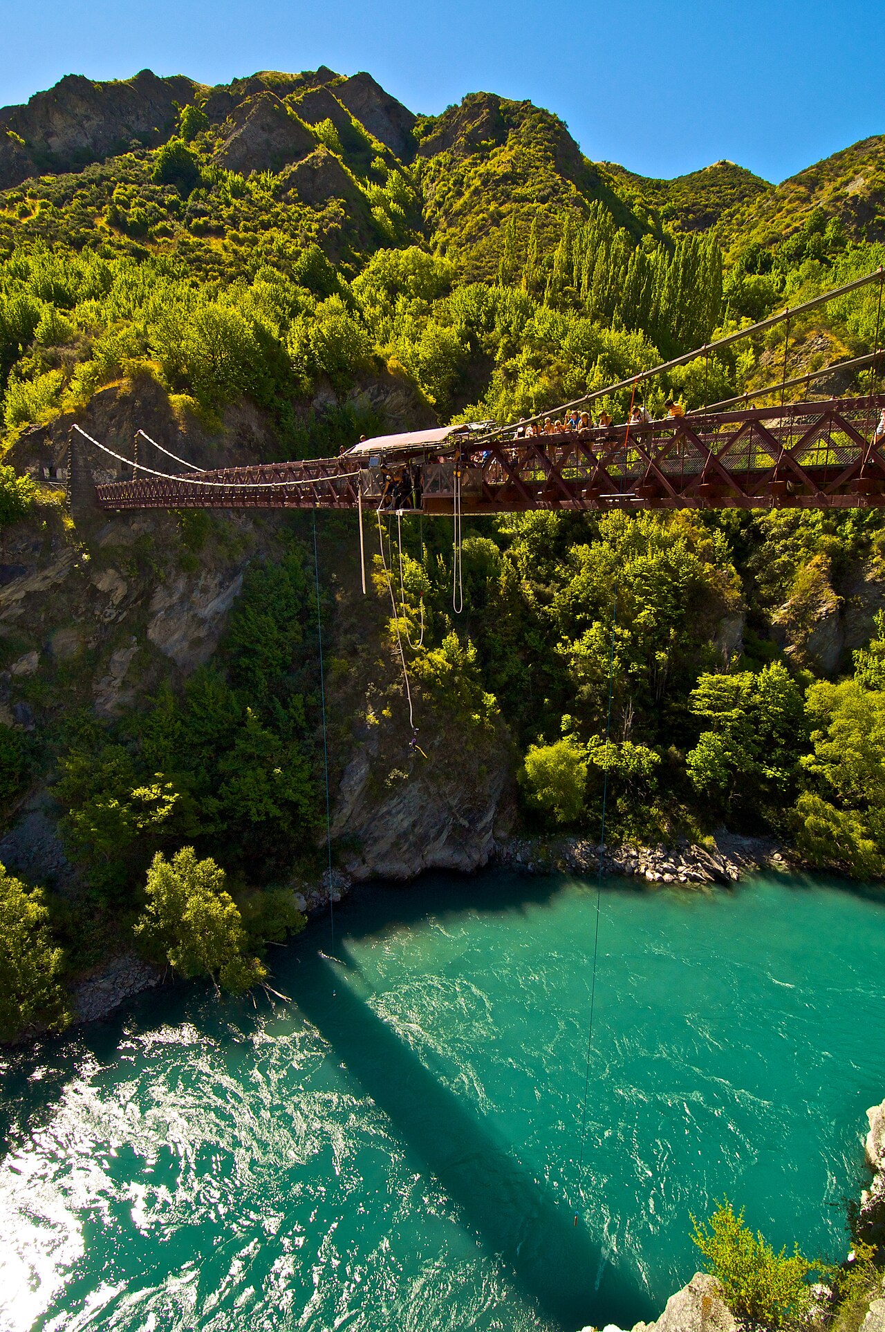
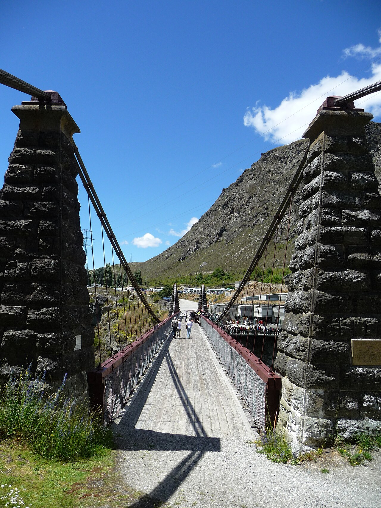
The bridge itself is the central feature, constructed from timber and iron with characteristic suspension design. Visitors can walk across the bridge deck to observe the river gorge below. The site includes viewing platforms and areas where spectators can watch bungy jumpers leap from the bridge. The surrounding Kawarau Gorge presents dramatic schist rock formations and the turquoise waters of the Kawarau River. There are no enclosed buildings or museums on the bridge itself. The experience centres on the structure, the landscape, and the adventure activities operated from the site. Natural features dominate the immediate environment.
2026-08-28 kontrol edildi
A casual visit to observe the bridge and surroundings typically requires 30 to 60 minutes, depending on interest in watching activities and photography. Those participating in bungy jumping should allow additional time for registration, safety briefings, and queueing, which may extend the total visit to two to three hours. The walking crossing of the bridge takes only a few minutes each way. Visitors combining this stop with other attractions along the Gibbston Valley wine region or en route to Cromwell often allocate half a day for the broader area. No guided tours of the structure itself are offered.
2026-08-28 kontrol edildi
The bridge site is outdoors and exposed to weather conditions year-round. Queenstown experiences distinct seasons, with summer months (December to February) offering generally warmer and more settled conditions. Winter (June to August) can bring cold temperatures and occasional snow to surrounding hills. The gorge location may experience wind at any time. Visitors should consult current local forecasts before travelling, as conditions affect both comfort and the operation of adventure activities. The site receives substantial visitor numbers during peak tourist seasons, particularly when international travel is unrestricted. Check the operator's own site for the travel date before relying on a schedule or fare.
2026-08-28 kontrol edildi
Access to walk across the bridge and observe from viewing areas is understood to be free of charge, though this should be verified on arrival. Bungy jumping and any other commercial activities operated from the site require separate payment to the adventure operator. No pricing information from official sources has been supplied for this draft. Visitors should check directly with operators for current activity costs, any package options, and booking requirements. Payment methods and cancellation policies would be determined by individual activity providers rather than any central ticketing system. Check the operator's own site for the travel date before relying on a schedule or fare.
2026-08-28 kontrol edildi
The bridge is located approximately 23 kilometres from central Queenstown along State Highway 6, in the direction of Cromwell. Private vehicle is the most common access method, with parking available at the site. The route passes through the scenic Gibbston Valley. No public transport specifics are recorded pending review. Cycling is possible via the Queenstown Trail network, which includes sections through this area. The highway location makes the bridge accessible as a stop en route to other Central Otago destinations. Road conditions should be checked in winter when ice or snow may affect higher elevation sections nearby.
2026-08-28 kontrol edildi
The bridge deck has open sides with railings; visitors should exercise caution, particularly when leaning to view the river below or when the deck is crowded. Bungy jumpers are attached to cords and supervised, but spectators should remain in designated areas. Weather can change rapidly in the gorge, with wind gusts possible. The river below is fast-flowing and cold; no swimming access is available or advisable from the bridge. Sun exposure is high in summer with limited shade on the structure. Appropriate footwear is recommended for the metal deck surface, which may become slippery when wet.
2026-08-28 kontrol edildi
Photography rules are Not recorded pending review. The bridge and gorge offer obvious scenic opportunities, including the structure against the river backdrop and jumpers in action. Spectators may capture images of participants with their consent. Commercial or drone photography would require separate permission from site operators and compliance with New Zealand aviation regulations. The best natural light for landscape photography typically occurs in morning or late afternoon, though the gorge orientation creates variable shadow conditions. Tripod use on the deck may impede pedestrian traffic and should be exercised with consideration for other visitors. No indoor or restricted photography areas are present.
2026-08-28 kontrol edildi
Yes. Kawarau Bridge is the local name for the structure officially known as the Kawarau Gorge Suspension Bridge.
Yes. Pedestrian access to cross the bridge is understood to be available to all visitors, though conditions should be confirmed on arrival.
The bridge is approximately 23 kilometres from central Queenstown along State Highway 6.
No.
Check the operator's own site for the travel date before relying on a schedule or fare.
Public transport specifics are Not recorded pending review. Private vehicle and cycling via the Queenstown Trail are known access options.
Etkileşimli harita yükleniyor…
Etkileşimli harita yüklenemedi.


Son güncelleme:
Kaynak: OpenStreetMap katkıda bulunanları, Wikidata ·