
.jpg)
62 dk yürüyüş
Señor de Caña
- Dikkate değer
- İbadet yeri
Dil · 11 yayınlandı
Manzara noktası · Cusco
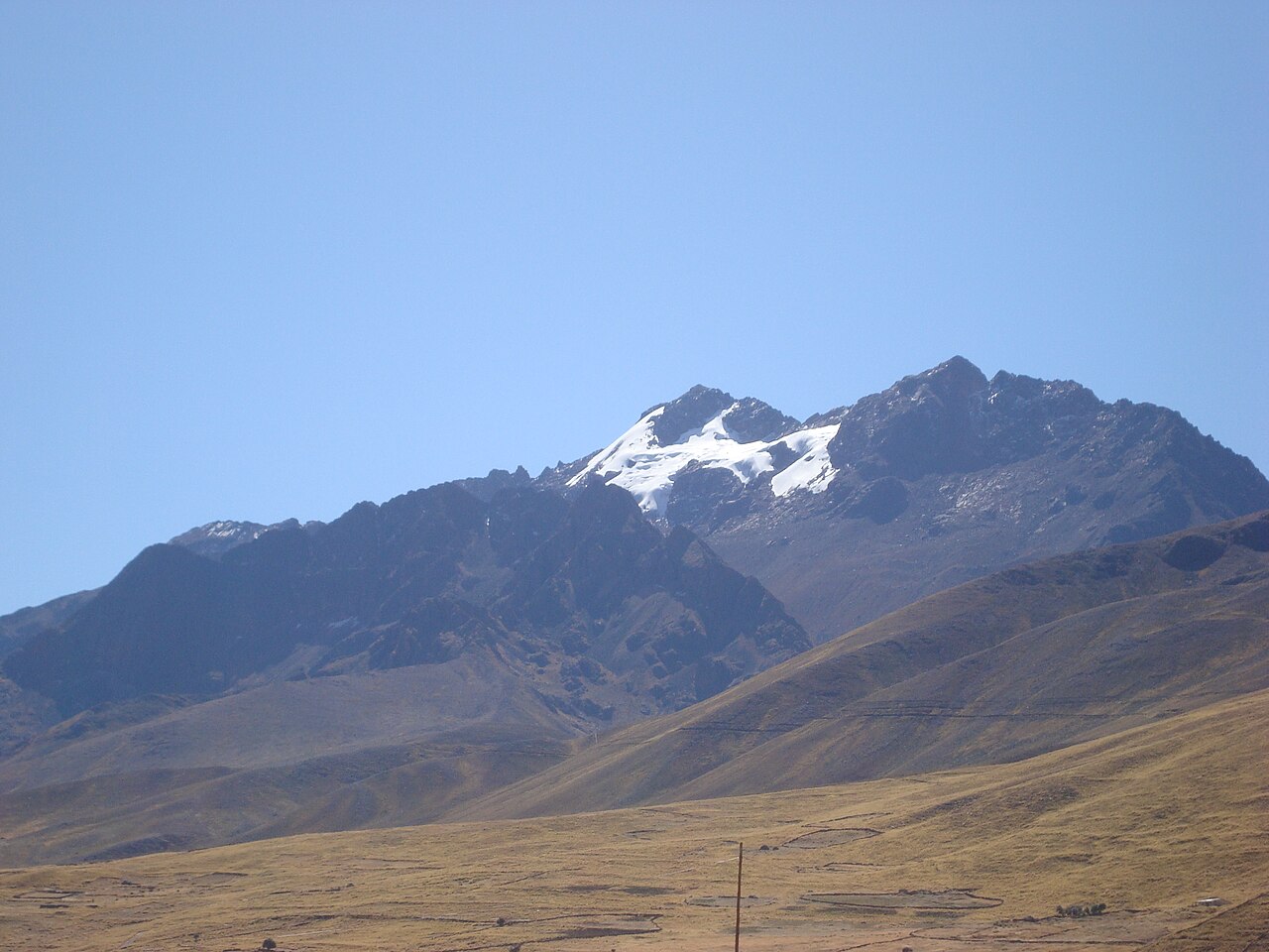
Nevado Chimbolla, also known as Chimboya, is a mountain peak situated near Cusco in the Peruvian Andes. The summit forms part of the dramatic high-altitude landscape that characterises the region surrounding the historic Inca capital. As a glacial mountain, it contributes to the sacred geography that has shaped Andean culture for millennia. The peak is visible from various points along trekking routes through the Ausangate region. Its local name reflects indigenous Quechua linguistic heritage. The mountain holds significance within the broader context of Andean spiritual geography, where peaks are traditionally revered as apus, or mountain deities.
2026-08-28 kontrol edildi
The mountain itself is a natural formation without constructed visitor facilities. Approaching the peak reveals glacial ice fields, rocky moraine terrain, and high-altitude tundra ecosystems. The surrounding area contains scattered glacial lakes and streams fed by meltwater. No visitor centre, shelter, or marked trails to the summit are documented. The terrain requires technical mountaineering equipment and experience for any ascent attempt. Local herders may pasture alpacas and llamas in adjacent valleys. The interior of the mountain massif consists of granite and metamorphic rock formations typical of the eastern Cordillera Vilcanota range.
2026-08-28 kontrol edildi
No standardised visitor duration is established for Nevado Chimbolla. The mountain is not a designated tourist site with managed access points. Any approach would require multi-day trekking through remote terrain, with exact timing dependent on route selection, weather conditions, and individual acclimatisation. Ausangate circuit treks in the broader region typically extend four to six days. Day trips from Cusco to viewpoints where the peak may be visible involve twelve to sixteen hours of total travel. Independent mountaineering expeditions would require additional preparation time.
2026-08-28 kontrol edildi
The dry season from May to September generally offers more stable conditions for Andean trekking, though weather at altitude remains unpredictable year-round. Rainy season months from November to March frequently bring snow and hazardous conditions. Operator-confirmed hours are Not recorded pending review. No official opening or closing times apply to this natural feature. Trekking agencies in Cusco may offer seasonal programmes with varying schedules. Visitors should consult current local conditions before planning any approach. Acclimatisation in Cusco for several days is essential before attempting significant altitude gain in this region.
2026-08-28 kontrol edildi
No formal admission system exists for Nevado Chimbolla as an unmanaged natural feature. Operator-confirmed prices are Not recorded pending review. The Ausangate region requires payment of community trekking fees to local authorities, though specific amounts and collection points are not documented in supplied sources. Guided expedition costs vary by provider and inclusions. Independent travellers may encounter informal requests for passage payments from community landholders. No concession pricing or advance booking mechanisms are established. Visitors should carry sufficient cash in Peruvian soles for any encountered fees, as electronic payment is unavailable in remote areas.
2026-08-28 kontrol edildi
The peak lies approximately one hundred kilometres southeast of Cusco in the Canchis Province. No public transport reaches the immediate area. Road access terminates at trailheads serving the broader Ausangate region, requiring four-wheel-drive vehicles on unpaved routes. Common departure points include the town of Upis or Tinqui, reached by bus or organised transport from Cusco. From trailheads, extended trekking on foot or horseback is necessary. No railway connection exists. Weather frequently interrupts road conditions. Self-driving without local knowledge is inadvisable due to unmarked routes and potential vehicle damage on rough tracks.
2026-08-28 kontrol edildi
Altitude sickness poses serious risk above four thousand metres; symptoms include headache, nausea, and respiratory distress. Weather changes rapidly with lethal potential for unprepared visitors. Glacial terrain contains hidden crevasses requiring rope travel and technical skills. Stream crossings may become impassable during precipitation. Limited rescue infrastructure exists; emergency evacuation would be prolonged and expensive. Water requires purification. Solar exposure intensifies at altitude. No mobile telephone coverage extends throughout the region. Solo travel is strongly discouraged. Informal mining activity may occur in adjacent areas. Respect community land rights and request permission before crossing private holdings.
2026-08-28 kontrol edildi
Photography rules are Not recorded pending review. No operator source supplies specific restrictions. The mountain and surrounding landscape offer extensive photographic subjects including glacial formations, high-altitude flora, and pastoral scenes with traditional herding. Morning light typically provides clearest atmospheric conditions. Drone operation would require compliance with Peruvian aviation regulations and local community consent, neither of which is documented here. Tripod use on unstable terrain demands caution. Battery performance degrades in cold conditions; spare power sources are essential. Respect privacy when photographing local residents; explicit permission should be obtained. Commercial photography may require additional permits not specified in available sources.
2026-08-28 kontrol edildi
Yes. The peak is referred to by both names, with Nevado Chimbolla representing the local designation and Chimboya appearing in some external references.
No documented non-technical route exists. The glacial terrain demands mountaineering experience, proper equipment, and crevasse rescue skills. Beginners should not attempt ascent.
While not legally mandated for all approaches, guides are strongly recommended due to remote location, unmarked terrain, and significant objective hazards. Many trekkers employ local services.
Vicunas, Andean foxes, and various high-altitude bird species including condors inhabit the region. Specific wildlife sightings cannot be guaranteed.
No established lodging exists at the mountain itself. Trekkers typically camp or use basic community shelters on multi-day routes. Cusco offers comprehensive accommodation.
Cold-weather layering, waterproof protection, sun protection, water purification, and emergency shelter are essential. Specific packing lists should be confirmed with experienced operators.
Etkileşimli harita yükleniyor…
Etkileşimli harita yüklenemedi.
Son güncelleme:
Kaynak: OpenStreetMap katkıda bulunanları, Wikidata ·