4 dk yürüyüş
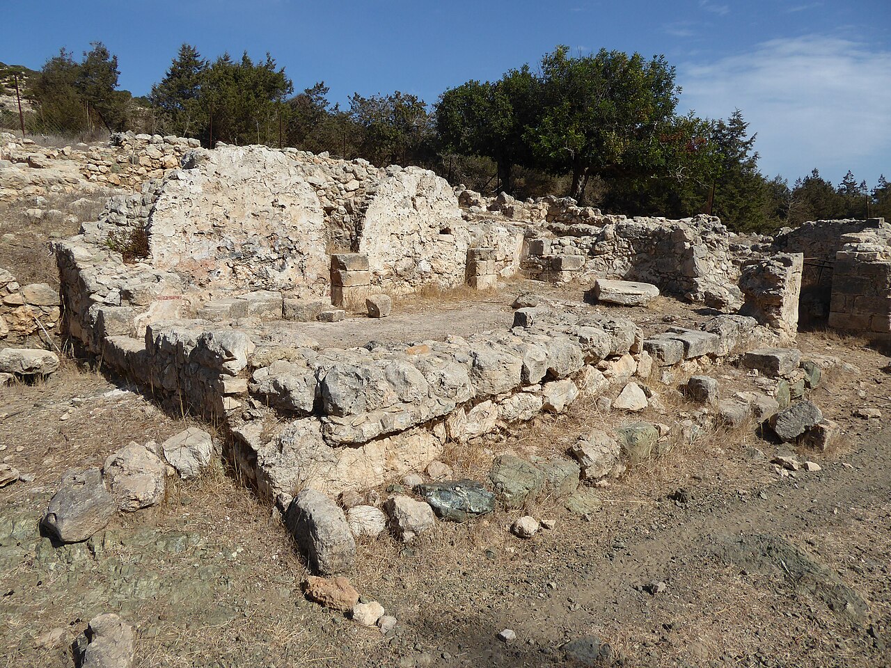
Byzantine monastery
- Yüksek
- Tarihi anıt
Dil · 11 yayınlandı
Manzara noktası · Wadi Musa
Mount Hor, known locally as Jabal al-Nabi Harun, is a mountain located within or immediately adjacent to the Petra archaeological park in southern Jordan. The name associates the site with the biblical figure Aaron, brother of Moses, and the mountain holds religious significance for multiple traditions. It rises prominently above the surrounding landscape and forms part of the visitor locality around the ancient Nabataean city of Petra. The peak is visible from various points within the archaeological zone and serves as a notable landmark in the region's topography.
2026-08-26 kontrol edildi
The mountain itself is a natural geological formation with no permanent structures recorded in available sources. The summit area contains a shrine traditionally identified as the burial place of Aaron, which represents the primary point of visitor interest. The terrain consists of rugged desert mountainscape typical of the Petra region, with rocky slopes and limited vegetation. No comprehensive inventory of archaeological features, inscriptions, or secondary structures has been documented in the provided source material. Visitors should expect an undeveloped natural environment with minimal facilities.
2026-08-26 kontrol edildi
The duration of a visit to Mount Hor depends entirely on individual approach and physical capability. The mountain requires a substantial hike from the main Petra visitor areas, involving significant elevation gain across demanding desert terrain. Experienced hikers in good condition should anticipate several hours for a round trip, though no standardized trail times are recorded. Factors including heat, trail conditions, and time spent at the summit will affect total duration. Visitors should plan conservatively and carry adequate water supplies for extended exertion in arid conditions.
2026-08-26 kontrol edildi
Operator-confirmed hours are Not recorded pending review. The Petra archaeological park has established operating schedules, but specific access arrangements for Mount Hor are not documented in available sources. Seasonal considerations strongly affect visit feasibility. Summer months bring extreme temperatures that make hiking dangerous during midday hours. Spring and autumn offer more moderate conditions for strenuous outdoor activity. Winter visits may encounter cold temperatures and occasional precipitation. Early morning departures are advisable regardless of season to maximize available daylight and minimize heat exposure during the ascent.
2026-08-26 kontrol edildi
Operator-confirmed prices are Not recorded pending review. Mount Hor's access arrangements within the broader Petra park system are not specified in available sources. The main Petra archaeological park requires entrance fees, but whether supplementary charges apply for Mount Hor specifically remains undocumented. Visitors should verify current fee structures at official park entry points or through recognized tourism authorities before planning. No advance booking procedures or special permit requirements are mentioned in the provided source material, though this does not preclude their existence. Mount Hor also earns time in a petra itinerary because Mount Hor is a named mountain within the Petra archaeological park or immediate visitor locality; no production match exists. Its value becomes clearer when the stop is compared with the surrounding streets and the other ranked places nearby.
2026-08-26 kontrol edildi
Mount Hor is reached from within the Petra visitor locality, with the trailhead accessible from the main archaeological park area. The route requires proceeding on foot or by animal transport through the ancient city and continuing beyond the developed tourist zones. No motorized access to the mountain base is indicated. The path involves substantial distance and elevation change from the visitor center. Local guides familiar with the terrain are recommended given the remote character of the route and absence of marked trail infrastructure in source descriptions.
2026-08-26 kontrol edildi
Desert hiking hazards require serious preparation. Dehydration and heat-related illness present primary risks, particularly given the exposed terrain and limited shade. The rocky, uneven path demands sturdy footwear and careful foot placement. Remote location means rescue assistance may be delayed; self-sufficiency is essential. No water sources are documented along the route. Weather conditions can change rapidly. Wildlife encounters, while not specifically recorded, remain possible in this natural environment. Mobile phone coverage cannot be assumed. Visitors should inform others of their intended route and expected return time before departing.
2026-08-26 kontrol edildi
The mountain offers elevated perspectives over the Petra region's dramatic landscape, with potential for wide-angle scenic photography encompassing desert terrain and distant formations. The summit shrine provides cultural subject matter requiring respectful approach. Lighting conditions favor early morning and late afternoon for landscape work, with harsh midday sun typical of desert environments. The physical exertion of the ascent may limit equipment carrying capacity; photographers should prioritize essential gear. No restrictions on photography are documented, though sensitivity regarding the religious site should guide behavior. Tripod use on uneven summit terrain requires stability assessment.
2026-08-26 kontrol edildi
The local name Jabal al-Nabi Harun translates as Mountain of the Prophet Aaron, and a shrine on the summit is traditionally associated with Aaron's burial place. The precise historical verification of this identification is not addressed in available sources.
The mountain's location within or immediately adjacent to the Petra archaeological park suggests main access routes pass through the park. Whether alternative access exists is not recorded in available sources.
No formal requirement is documented, but the remote, undeveloped nature of the terrain and absence of marked trails in source descriptions strongly recommend engaging local guidance for safety.
Essential items include substantially more water than anticipated, sun protection, sturdy hiking footwear, snacks, and basic first aid supplies. Self-sufficiency is necessary given the remote location.
The hike involves significant distance, elevation gain, and demanding desert terrain across rocky, uneven surfaces. Physical fitness and hiking experience are advisable.
No facilities are recorded in available sources. Visitors should expect completely undeveloped natural terrain with no water, shelter, restrooms, or services of any kind.
Etkileşimli harita yükleniyor…
Etkileşimli harita yüklenemedi.

Son güncelleme:
Kaynak: OpenStreetMap katkıda bulunanları ·