


7 dk yürüyüş
S/S Sankt Erik
- Mutlaka görülmeli · Miras alanı
- Tarihi anıt
Dil · 11 yayınlandı
Tarihi anıt · Stockholm

Kastellet is a small citadel located on Kastellholmen, an islet in central Stockholm, Sweden. The structure was built in the mid-17th century during the reign of King Charles X Gustav, forming part of Stockholm's defensive system. The star-shaped fortification sits on a hilltop position overlooking Saltsjön, the inlet to the Baltic Sea. The Swedish Navy has maintained a long association with this site. The current building dates from a later reconstruction period. Kastellet is visible from many vantage points around Stockholm's harbor area and serves as a recognizable landmark in the city's maritime landscape. The site holds historical military significance for Sweden's capital.
2026-08-28 kontrol edildi · Kaynak
The citadel contains a central building with a distinctive tower and flagstaff. The structure features the characteristic geometry of bastion fort design. The interior spaces are not regularly open for public tours. The Swedish Navy's presence means portions remain under military administration. The surrounding grounds include earthwork fortifications and sloping defensive walls. A flag is raised on the tower when the country is at peace, following a tradition of national significance. The islet itself contains limited developed area beyond the fortification. Visitors can observe the exterior architecture from the grounds. The building's red facade with white trim is visually distinctive against the harbor setting.
2026-08-28 kontrol edildi · Kaynak
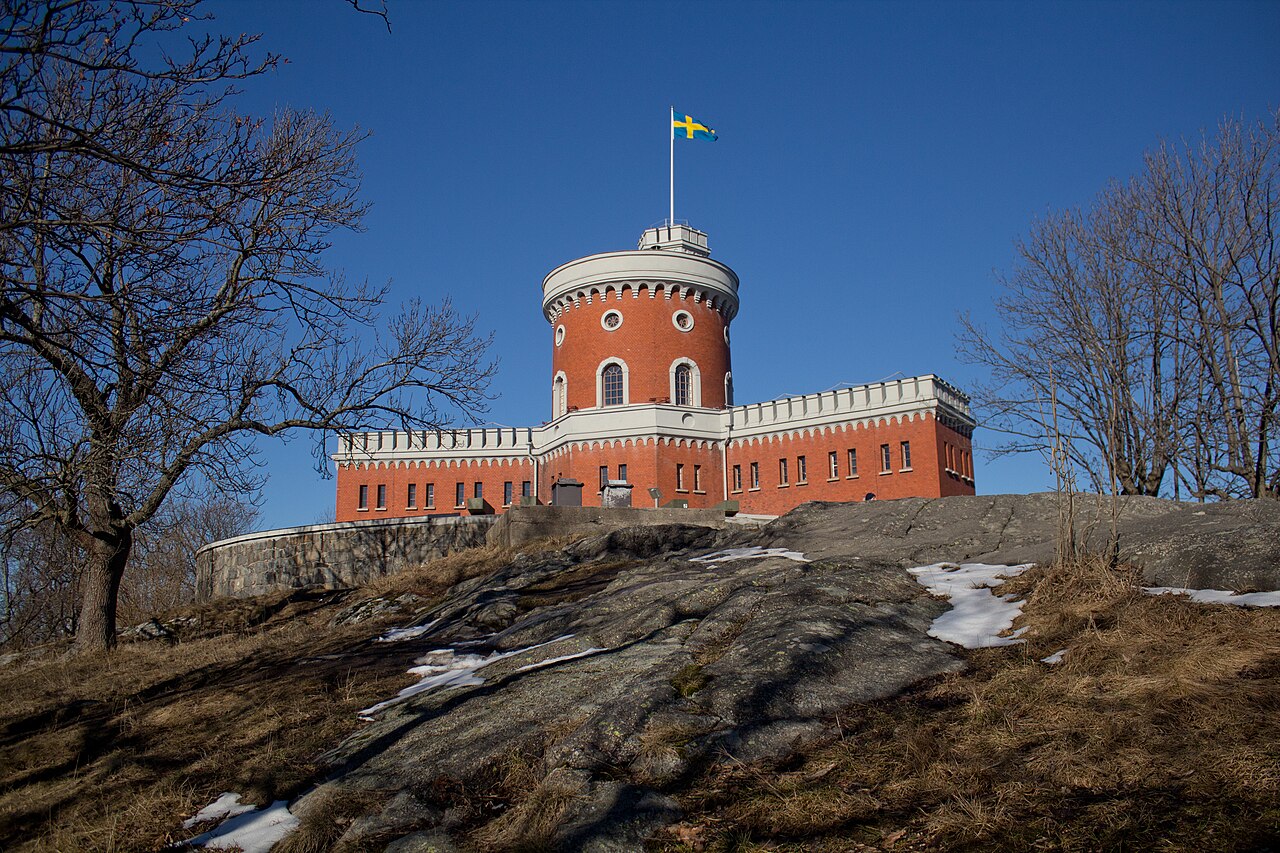
A visit to Kastellet typically involves exterior viewing rather than interior exploration. Most visitors spend approximately 30 minutes to one hour walking the accessible grounds and observing the citadel from various angles. The compact size of the islet limits the duration of exploration. Those interested in military architecture or Stockholm's fortification history may allocate additional time for detailed observation of the bastion design and harbor views. Combined visits with nearby attractions on Skeppsholmen, connected by bridge, can extend the overall excursion. The site suits brief stops during harbor walks rather than dedicated full-day visits. Photography and scenic appreciation constitute primary activities.
2026-08-28 kontrol edildi · Kaynak

Operator-confirmed seasonal hours, specific opening dates, and annual closure periods are Not recorded. The exterior grounds are generally observable during daylight hours, though weather conditions affect accessibility and visibility. Stockholm's maritime climate brings cold winters with potential ice and snow, while summers offer extended daylight. The flag-raising tradition is visible when operational, though specific schedules are Not recorded. Visitors should consult current local information before planning. The harbor setting means wind exposure can affect comfort. No official events calendar or seasonal programming details are available in the provided sources. Advance verification of any access changes is recommended.
2026-08-28 kontrol edildi · Kaynak
Operator-confirmed admission prices, payment methods, and ticketing procedures are Not recorded. The site's military administration suggests access policies may differ from standard tourist attractions. No advance booking requirements, guided tour fees, or combined ticket options are documented in the provided sources. Visitors should not assume free or paid entry without current verification. Group visit arrangements and any special access permissions are Not recorded. The lack of published operational details indicates direct inquiry with relevant authorities may be necessary. No discount categories, membership benefits, or promotional pricing structures are established in the available information.
2026-08-28 kontrol edildi · Kaynak
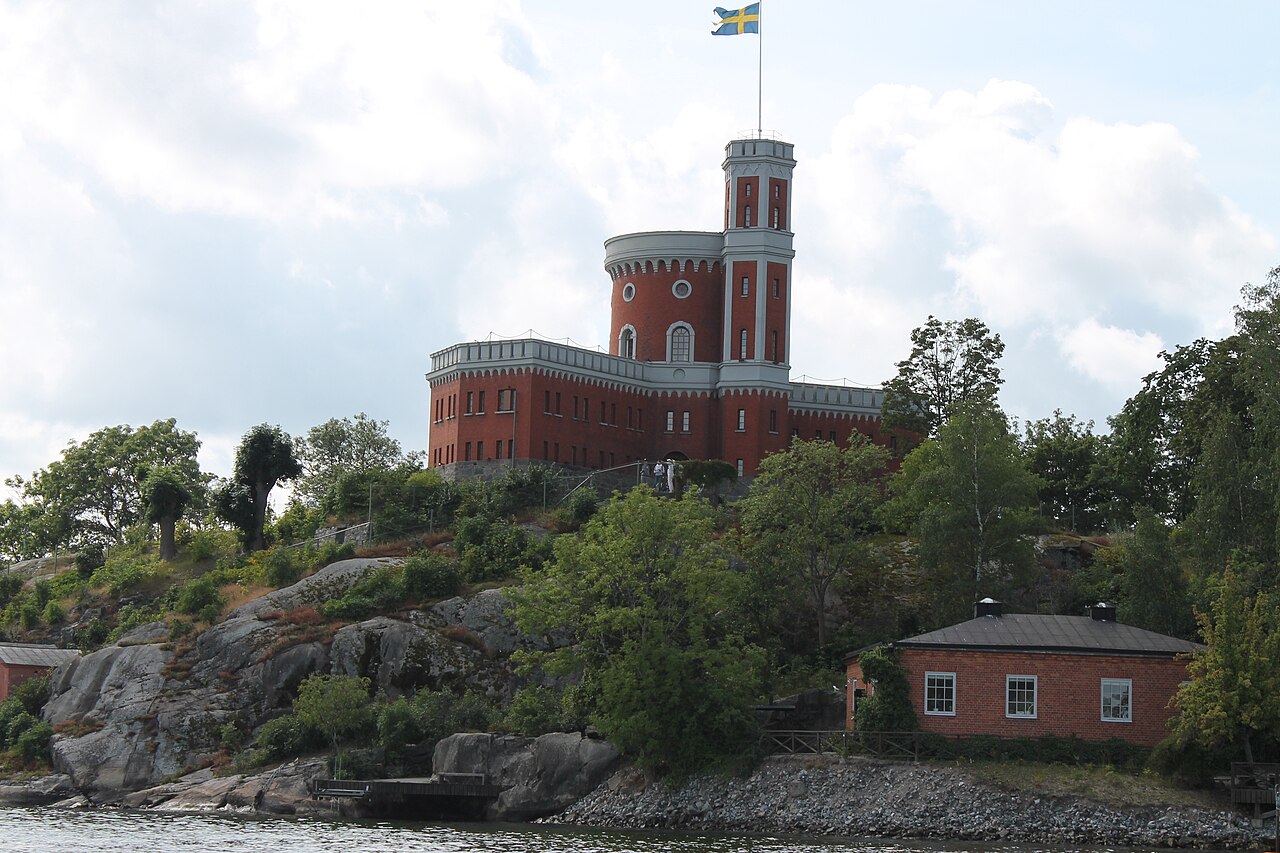
Kastellet occupies Kastellholmen, accessible from Skeppsholmen via the Kastellholmsbron bridge. Skeppsholmen connects to Stockholm's Blasieholmen peninsula, reachable on foot from the city center. Public transportation serves the general area, though specific routes, stops, and schedules are Not recorded. Walking from Gamla Stan or Östermalm provides harbor-side approaches. The site lacks dedicated parking information. Water-based approaches offer views of the citadel from tour boats and harbor traffic. Bicycle access to Skeppsholmen is possible. Winter ice conditions may affect pedestrian access. Visitors should consult current Stockholm transport resources for precise directions and any service modifications.
2026-08-28 kontrol edildi · Kaynak

The military association means restricted zones may exist without clear demarcation in available sources. Steep terrain and uneven surfaces around the fortification require appropriate footwear. Harbor winds create exposure risks regardless of season. The limited islet size offers minimal shelter during weather changes. No specific safety warnings, emergency procedures, or hazard notifications are documented. Visitors should respect any boundary indicators encountered. The absence of detailed facility information means self-sufficiency is advisable. Water edges present standard precautions. No recorded incidents or particular risk factors are established in the provided sources. General urban vigilance applies as in any Stockholm location.
2026-08-28 kontrol edildi · Kaynak
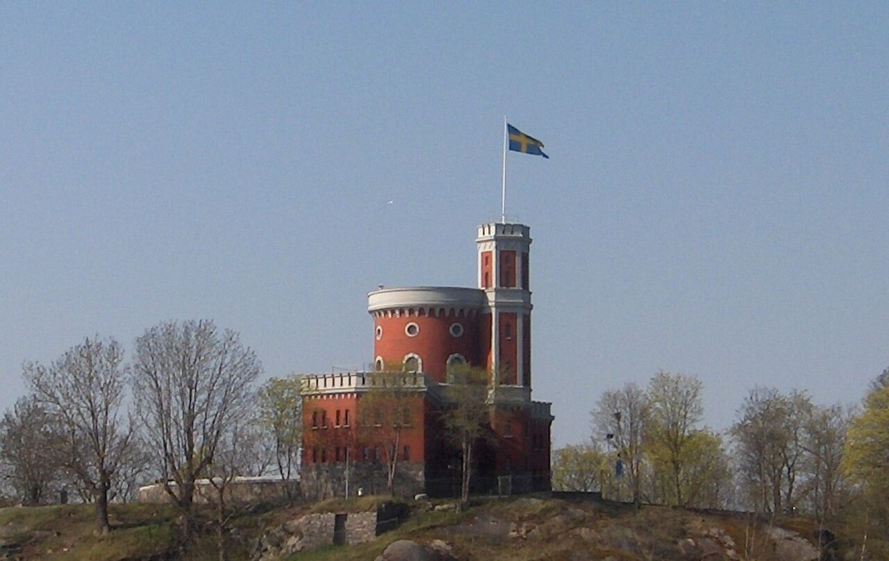
The citadel's harbor position and distinctive architecture offer photographic subjects. Exterior views from multiple angles are possible from the grounds and surrounding areas. The red building against water and sky provides color contrast. The flagstaff and tower create vertical elements for composition. Wide-angle lenses accommodate the compact site. Harbor traffic and distant city views add contextual depth. No photography restrictions are documented, though military sensitivity may apply to certain perspectives. Lighting varies significantly with season and time of day given Stockholm's latitude. Dawn and dusk positions create different atmospheric conditions. Tripod use policies are Not recorded. The bridge approach offers transitional framing opportunities.
2026-08-28 kontrol edildi · Kaynak
Not recorded. The citadel's military administration suggests interior access may be restricted or unavailable. Visitors should verify current access policies with relevant authorities.
The flag on Kastellet's tower is raised when Sweden is at peace, representing a long-standing national tradition. Specific historical origins and protocol details are Not recorded.
Not recorded. The small islet size and military character suggest limited visitor amenities. Self-sufficiency is advisable when visiting.
Physical access depends on weather and ice conditions. Operator-confirmed seasonal operations are Not recorded. Visitors should check current local conditions and any access restrictions.
Not recorded. The fortification's historic construction on sloping terrain presents probable physical challenges. Specific accessibility accommodations are Not recorded.
Kastellet formed part of Stockholm's 17th-century defensive system. Specific operational relationships with other fortifications and comprehensive historical context are Not recorded.
Etkileşimli harita yükleniyor…
Etkileşimli harita yüklenemedi.
Son güncelleme:
Kaynak: OpenStreetMap katkıda bulunanları, Wikidata ·