

15 dk yürüyüş
Cape Point
- Mutlaka görülmeli
- Manzara noktası
Dil · 11 yayınlandı
Tarihi anıt · Cape Town
Cape of Good Hope
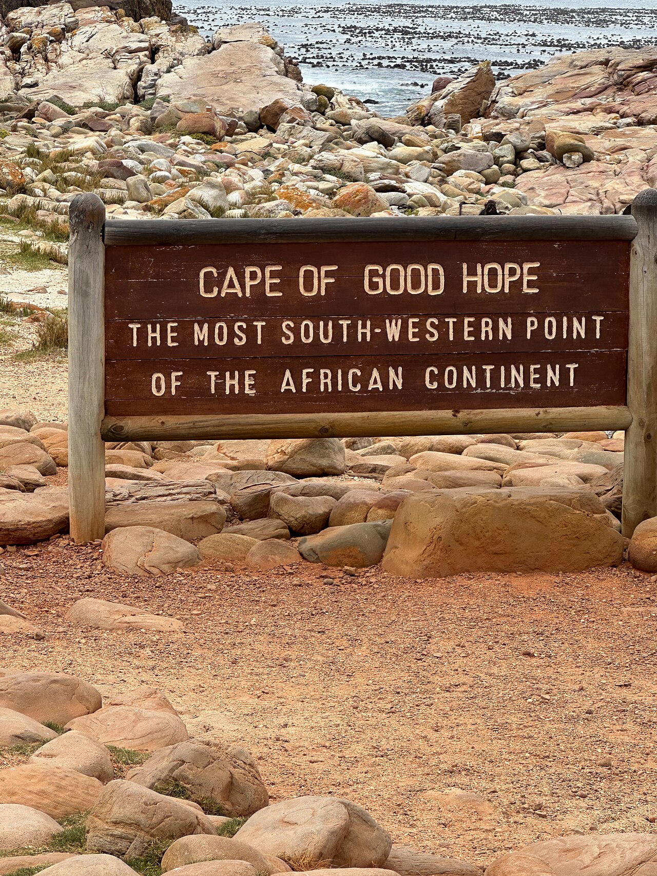
The Cape of Good Hope is a rocky headland on the Atlantic coast of the Cape Peninsula in South Africa. It lies within Table Mountain National Park. Historically significant as a major milestone on sea routes from Europe to the East, it was long misunderstood as Africa's southernmost point. The cape is marked by a navigational beacon and surrounded by dramatic cliffs and ocean views. Its name reflects the optimism of Portuguese explorers who rounded it seeking passage to Asia.
2026-08-28 kontrol edildi
The immediate area features a lighthouse-style beacon, viewpoints, and walking trails along the rugged coastline. The broader Table Mountain National Park encompasses fynbos vegetation, wildlife including baboons, ostriches, and antelope, and additional scenic drives. Dias Beach lies nearby below steep cliffs. The park infrastructure includes parking areas, information boards, and restrooms at main sites. The landscape is characterized by sandstone formations, wild seas, and endemic plant species adapted to the harsh coastal environment. Cape of Good Hope also earns time in a cape town itinerary because its setting and role differ from the surrounding ranked stops. Compare the place with the nearby streets before deciding how it fits the day.
2026-08-28 kontrol edildi
Visitors typically spend two to four hours at the Cape of Good Hope, depending on walking preferences and photography stops. A brief visit to the main viewpoint and beacon requires under an hour. Those undertaking coastal hikes or exploring multiple park areas may dedicate a full day. The driving route from Cape Town itself constitutes a substantial portion of total trip duration. Weather conditions can influence how long visitors comfortably remain exposed on the headland. A flexible visit keeps attention on what is distinctive at Cape of Good Hope without treating one room, viewpoint or photograph as the whole experience. Conditions on arrival should decide the final pace.
2026-08-28 kontrol edildi
The Cape of Good Hope can be visited year-round, though weather varies significantly. Summer months from December to February generally offer warmer temperatures and clearer skies. Winter brings more frequent storms and strong winds. Morning visits often provide calmer conditions before afternoon wind increases. Visitors should verify current access times with official Table Mountain National Park sources before traveling, as seasonal adjustments or conservation measures may affect availability without advance public notice. Check the operator's own site for the travel date before relying on a schedule or fare.
2026-08-28 kontrol edildi
Entry to the Cape of Good Hope requires payment of Table Mountain National Park conservation fees. Pricing structures typically differentiate between South African residents and international visitors, with possible variations for vehicle entry versus individual passengers. Payment is generally required at park entrance gates. Visitors should consult the official South African National Parks website or contact park authorities directly for current fee schedules, accepted payment methods, and any applicable discount categories before departure. Check the operator's own site for the travel date before relying on a schedule or fare.
2026-08-28 kontrol edildi
The Cape of Good Hope is approximately sixty kilometers south of central Cape Town, accessible via the scenic Chapman's Peak Drive or alternative inland routes through Kommetjie. Private vehicle represents the most common access method, with rental cars widely available in Cape Town. Organized tour operators offer day trips combining multiple peninsula attractions. No public transportation reaches the cape directly. Roads are paved but narrow and winding in sections. Drivers should anticipate travel time of ninety minutes to two hours each way depending on route and stops.
2026-08-28 kontrol edildi
Baboons in the area are habituated to humans and can become aggressive when food is present. Visitors must secure all food items, keep vehicle windows closed, and maintain distance. Sudden weather changes bring strong winds, fog, and cold conditions even in summer; layered clothing is essential. Cliff edges lack barriers in many locations. Wave action at beaches is dangerous for swimming. Sun exposure is intense due to reflective surfaces and limited shade at main viewpoints. Inform someone of travel plans when hiking remote trails.
2026-08-28 kontrol edildi
The beacon and surrounding cliffs offer classic compositions, though midday sun can be harsh. Early morning and late afternoon provide softer directional light on the headland. Wide-angle lenses accommodate the expansive seascape. Polarizing filters reduce glare on water and enhance sky saturation. The elevated position above Dias Beach creates dramatic downward perspectives. Wind stability challenges tripod use; weighted support is advisable. Wildlife encounters require telephoto lenses for safe distances. Cloud formations and breaking waves add dynamic elements. Fog can obscure views entirely, creating atmospheric alternatives or disappointment.
2026-08-28 kontrol edildi
No. Cape Agulhas, approximately 150 kilometers southeast, marks Africa's southernmost point where Atlantic and Indian Oceans officially meet.
Swimming is inadvisable due to cold water, strong currents, and dangerous wave action. Dias Beach below the cliffs is not patrolled and presents significant hazards.
Not recorded. The Two Oceans Restaurant operates elsewhere in the park near Cape Point. Visitors should carry water and snacks.
The main viewpoint and beacon area have paved paths with moderate gradients. Some surrounding trails and beach access involve steps or uneven terrain.
No. Standard vehicles navigate all paved roads to the cape. Chapman's Peak Drive has toll requirements and vehicle restrictions during adverse conditions.
African penguins are not present at this location. Boulders Beach near Simon's Town, approximately forty kilometers north, hosts a notable penguin colony.
Etkileşimli harita yükleniyor…
Etkileşimli harita yüklenemedi.


Son güncelleme:
Kaynak: OpenStreetMap katkıda bulunanları, Wikidata ·