Museu · 葵青區 Kwai Tsing District, Hong Kong
Lantau Link Visitors Centre and Viewing Platform
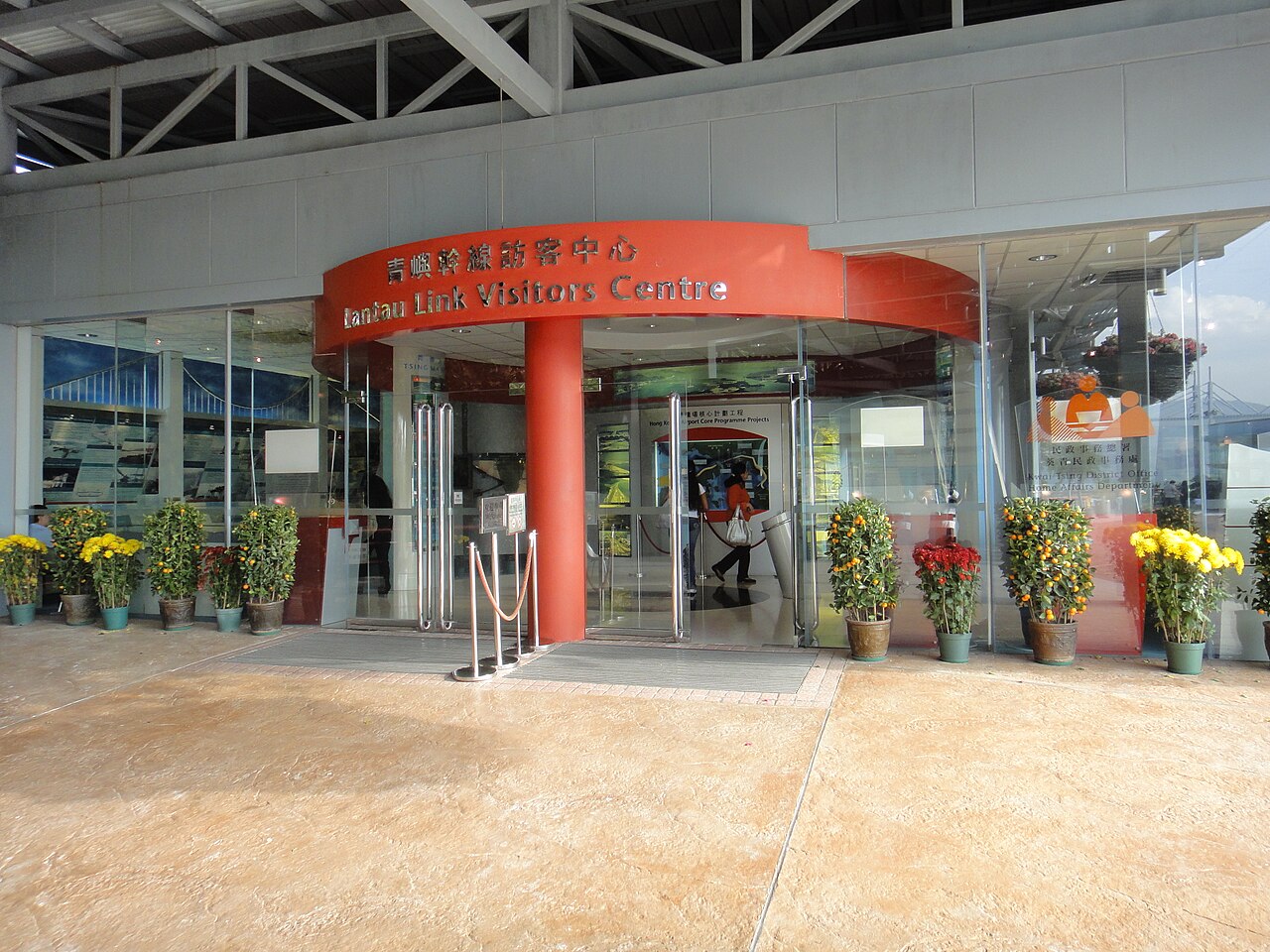
青嶼幹線訪客中心 Lantau Link Visitors Centre
Fotografia

Acesso e instalações
- Banheiros · Disponível
Leia as tags de acesso do OpenStreetMap; qualquer coisa não listada não tem tag registrada.
Defina o tipo de grupo como família no planejador e os contratos da janela diária para cerca de três quartos de um dia individual.
- Hoje
- Horário não registado
- Duração da visita
- 1 h 30 min
- Acessibilidade
- Não registrado
- Preço
- Não registrado
- Posição
- Imperdível
- Classificação
- Classificação 341 de 6,345
Sobre Lantau Link Visitors Centre and Viewing Platform
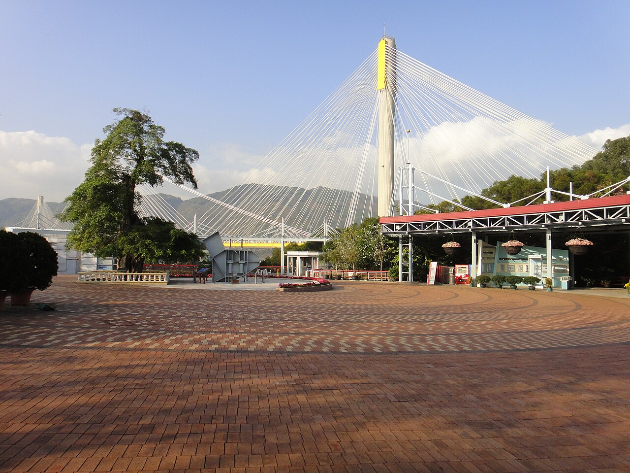
The Lantau Link Visitors Centre and Viewing Platform is an observation facility associated with the Lantau Link, the major road infrastructure connecting Hong Kong's urban core to Lantau Island. The centre offers visitors elevated perspectives of the Tsing Ma Bridge, Kap Shui Mun Bridge, and Ting Kau Bridge. These structures form critical components of the transport corridor linking the airport and Tung Chung New Town to the rest of Hong Kong. The viewing platform provides a designated vantage point for appreciating the engineering scale of this strategic infrastructure.
Verificado em 2026-08-26
O que há dentro
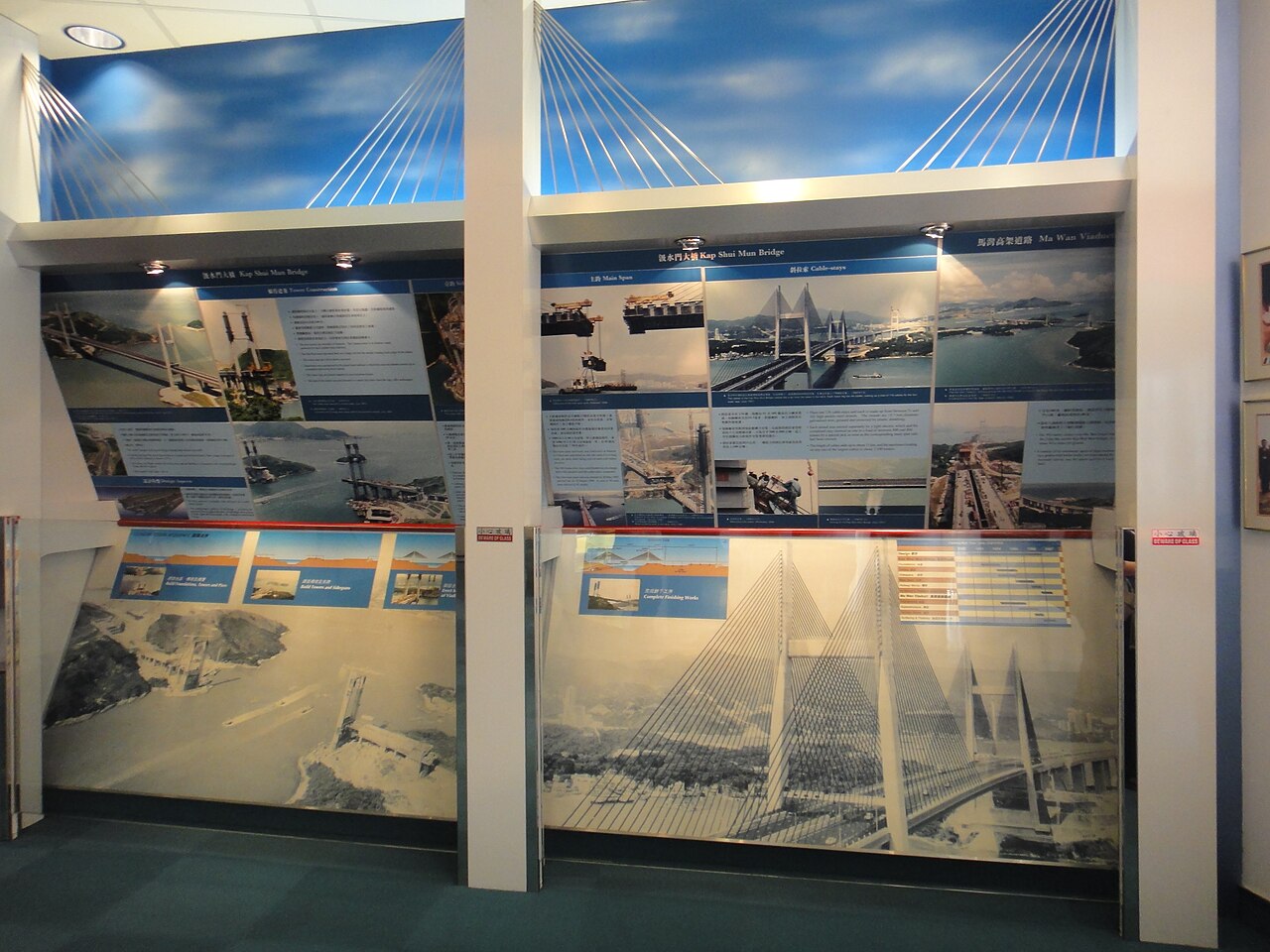
The facility comprises an indoor visitors centre and an outdoor viewing platform. The centre presents information about the construction and engineering of the Lantau Link bridges. Exhibits likely cover the design challenges of spanning busy shipping lanes and aviation approaches. The viewing platform offers unobstructed sightlines across the Rambler Channel toward the bridge towers and suspension cables. Interpretive materials may explain the aerodynamic deck designs and seismic resistance features. The exact current exhibition contents and interactive elements are Not recorded pending review of operator information.
Verificado em 2026-08-26

.jpg)
Quanto tempo dedicar
A typical visit to the Lantau Link Visitors Centre and Viewing Platform requires approximately thirty to sixty minutes. This duration accommodates time at the indoor exhibition space and the outdoor viewing area. Photography enthusiasts may extend their stay to capture changing light conditions on the bridge structures. The compact nature of the facility means visitors can combine this stop with other Lantau Island or Tsing Yi area attractions. Transit connections to nearby destinations including Tung Chung and the airport should be factored into overall itinerary planning.
Verificado em 2026-08-26

Temporada e multidões
Visitors should consult official sources before planning their trip. Weather visibility significantly affects the viewing experience, as the platform's purpose is observing distant bridge structures. Clear atmospheric conditions following rain or during autumn and winter months typically offer superior visibility in Hong Kong. Summer humidity and haze can obscure views. Evening visits may provide opportunities to observe illuminated bridge lighting, though confirmation of evening access is Not recorded pending review of current operational arrangements. Check the operator's own site for the travel date before relying on a schedule or fare.
Verificado em 2026-08-26
Ingressos
The facility's public infrastructure association suggests possible free or low-cost entry, though this cannot be assumed. Visitors should verify current ticketing arrangements through official channels before visiting. Any special access requirements, group booking procedures, or facility maintenance closures are Not recorded pending review. The centre's management under transport or tourism authorities may affect pricing policy. Budget-conscious travellers should prepare for either free public access or modest admission fees based on comparable Hong Kong visitor facilities. Check the operator's own site for the travel date before relying on a schedule or fare.
Verificado em 2026-08-26

Chegando lá
The centre is located in the Tsing Yi area near the Lantau Link infrastructure. Public transport options include MTR services to Tsing Yi station followed by connecting bus routes. Multiple bus lines serve the vicinity of the visitors centre. Taxi and private vehicle access utilise the same road network serving the bridges themselves. Visitors travelling from Hong Kong International Airport or Tung Chung may find the centre accessible via northbound transport. Specific bus route numbers, walking distances from stops, and precise transfer instructions are Not recorded pending review of current transport schedules.
Verificado em 2026-08-26

O que observar
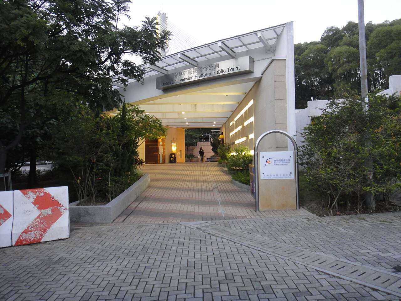
The outdoor viewing platform exposes visitors to weather elements including strong winds channelled through the Rambler Corridor. Appropriate clothing for exposed conditions is advisable. The facility's proximity to major transport infrastructure means visitors should remain within designated areas and follow all safety signage. Photography from the platform may be affected by vibration from heavy traffic on nearby roads. Visitors with mobility considerations should verify accessibility provisions as Not recorded pending review. The centre's relatively remote location requires planning for limited nearby food, beverage, and restroom facilities compared to central Hong Kong attractions.
Verificado em 2026-08-26
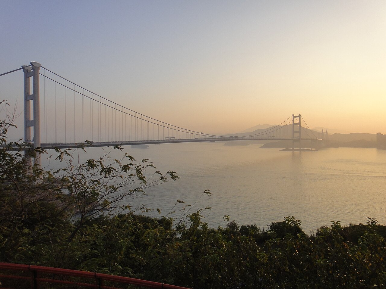

Fotografia
The viewing platform offers distinctive photographic opportunities capturing the Tsing Ma Bridge's 1,377-metre main span, though precise measurements should be verified. Wide-angle lenses accommodate the bridge's scale from the observation distance. Telephoto lenses compress perspectives of the suspension towers against the surrounding hills. Best results typically occur during clear visibility conditions. Sunrise and sunset positions relative to the bridge alignment vary seasonally. Tripod use policies are Not recorded pending review. Night photography of illuminated bridge structures may be possible if evening access is permitted, though current lighting schedules and access hours are Not recorded pending review.
Verificado em 2026-08-26
Perguntas comuns
Is the Lantau Link Visitors Centre free to enter for Lantau Link Visitors Centre and Viewing Platform in Hong Kong?
Visitors should verify current arrangements through official sources before visiting. Check the operator's own site for the travel date before relying on a schedule or fare.
What are the opening hours for Lantau Link Visitors Centre and Viewing Platform in Hong Kong?
Visitors must consult official channels for current operational times before planning their visit. Check the operator's own site for the travel date before relying on a schedule or fare.
Can I see the airport from the viewing platform for Lantau Link Visitors Centre and Viewing Platform in Hong Kong?
The platform faces toward the Lantau Link bridges and Rambler Channel. Specific sightlines toward Hong Kong International Airport infrastructure are Not recorded pending review of the exact viewing angles available.
Is the facility accessible by wheelchair for Lantau Link Visitors Centre and Viewing Platform in Hong Kong?
Accessibility provisions including ramp access, elevator availability, and restroom facilities are Not recorded pending review. Visitors with mobility requirements should contact the operator directly before visiting.
How does this compare to the Lantau Island cable car or Big Buddha for Lantau Link Visitors Centre and Viewing Platform in Hong Kong?
The visitors centre offers infrastructure-focused observation distinct from the cultural and natural attractions at Ngong Ping. It suits engineering interest and complementing broader Lantau itineraries rather than replacing peak or monastery visits.
Are there restaurants or shops at the centre for Lantau Link Visitors Centre and Viewing Platform in Hong Kong?
On-site food, beverage, and retail facilities are Not recorded pending review. The facility's specialised nature and location suggest limited amenity provision compared to major tourist destinations. Visitors should plan accordingly.
Onde está
A carregar o mapa interativo…
Não foi possível carregar o mapa interativo.
Perto
Encaixe isso em um plano
Links externos
Última atualização:
Fonte: Colaboradores do OpenStreetMap, Wikidata ·