자연 명소 · 쿠스코
Laguna Sibinacocha
사진

- 오늘
- 운영 시간 미등록
- 방문 기간
- 1시간
- 접근성
- 미등록
- 가격
- 미등록
- 위상
- 높음
- 순위
- 2,497 중 85 순위
Laguna Sibinacocha 소개
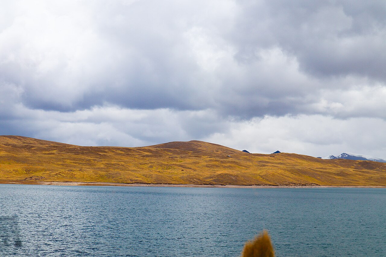
Lake Sibinacocha is a large high-Andean lake in the Urubamba basin of southern Peru. Peru's National Water Authority inventory records a surface area of about 28.11 square kilometres, making it one of the major glacial lakes identified in that basin. Scientific work places the lake at roughly 4,860 metres above sea level. Sibinacocha is both a natural watershed and a regulated water body associated with dam and hydropower infrastructure; it should not be presented as an ordinary roadside lake or a developed recreation park with assumed public facilities.
2026-08-28를 확인했습니다. · 소스
안에 무엇이 들어있나요?
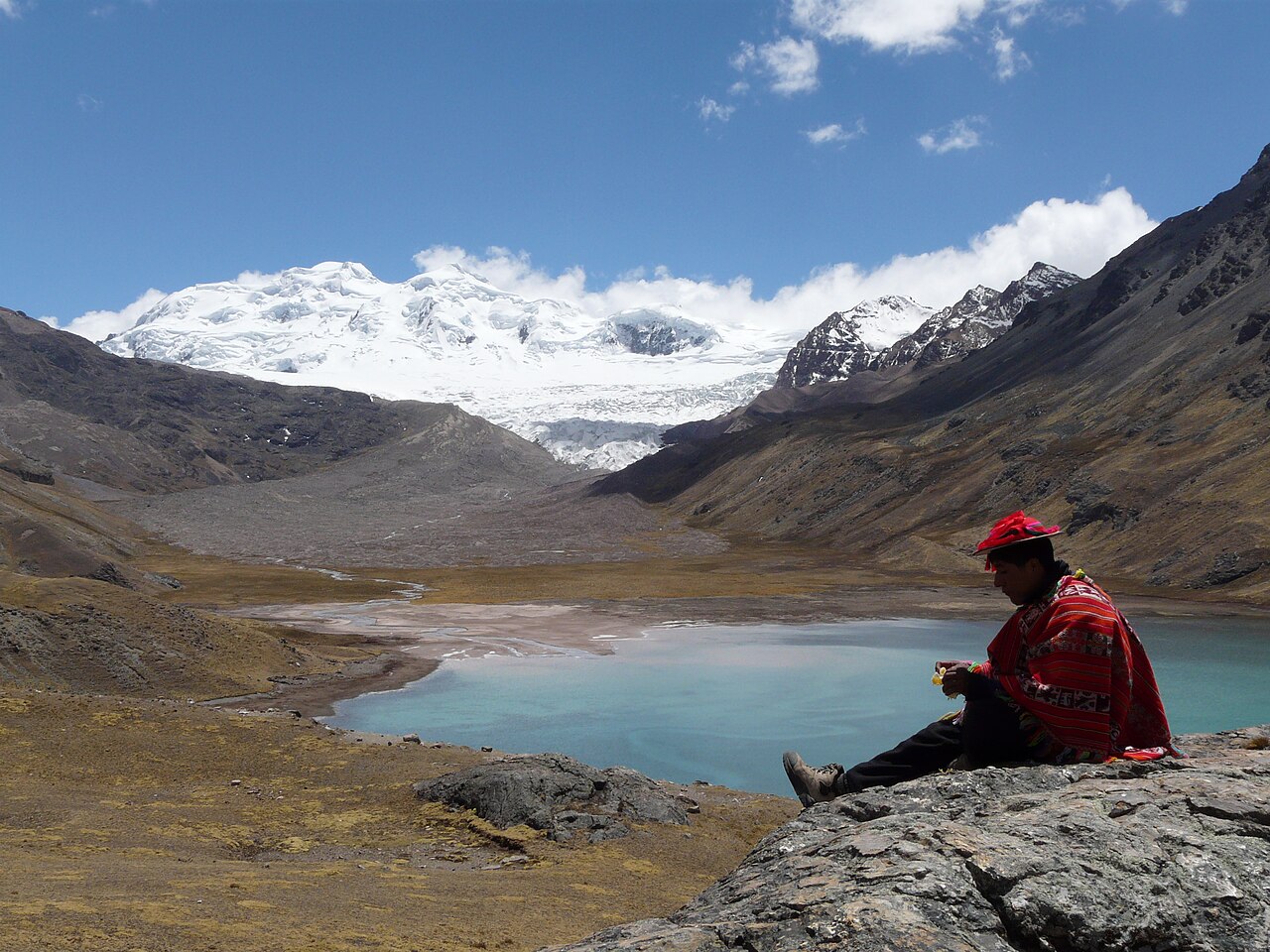
The visitor experience, where lawful access is available, is the lake basin itself: broad water, puna terrain, glaciated mountain context, wetlands, and water-control infrastructure. There is no recorded promenade, museum, marked scenic loop, beach service, staffed interpretation centre, or formal sequence of attractions. The National Water Authority treats Sibinacocha as part of Peru's glacier-and-lake inventory, while government environmental documentation addresses the dam and auxiliary components. That combination matters: natural-looking shorelines may also belong to an operational water system, so structures, channels, and restricted areas are not sightseeing props.
2026-08-28를 확인했습니다. · 소스
권장 관람 시간
No operator-issued visit duration is recorded. Reaching a remote lake at approximately 4,860 metres is likely to consume much more time than the database's category-default one-hour stop, but a reliable duration cannot be stated without a verified route and transport plan. A shore observation, scientific field visit, trekking approach, and vehicle-supported visit are different activities. Build timing around acclimatisation, access permission, weather, daylight, and a conservative return margin. If those elements cannot be confirmed, the honest itinerary choice is to omit Sibinacocha rather than compress it into a nominal Cusco excursion.
2026-08-28를 확인했습니다. · 소스

계절과 군중
Official visitor seasons and daily access hours are Not recorded. High-altitude weather, cloud, wind, precipitation, and road condition can determine whether a journey is practical even when the lake itself has no gate. Seek current information from local authorities and any infrastructure operator before departure, and avoid treating a seasonal travel blog as an access notice. The lake's elevation increases the consequences of cold, exposure, and delayed travel. Clear daylight is preferable for orientation, but no month or hour is recommended here because an operator-backed visitor calendar was not found.
2026-08-28를 확인했습니다. · 소스
티켓
No official admission price, reservation platform, visitor permit fee, or tour inclusion is recorded for Lake Sibinacocha. The lake's relationship with water infrastructure means the absence of a public ticket page cannot be read as permission to approach every shore or installation. Private transport, community access, guiding, and any infrastructure authorisation may involve separate arrangements, but no amount is verified. Ask providers to distinguish transport and guiding charges from legal access. Do not purchase a package that cannot identify its route, permissions, safety plan, and responsible operator.
2026-08-28를 확인했습니다. · 소스
가는 방법
Lake Sibinacocha is a remote high-Andean destination, not a walkable extension of Cusco city. The reviewed official sources identify the lake and its basin but do not publish a visitor-ready public-transport route, maintained trailhead, parking plan, or guaranteed road approach. Coordinates alone are insufficient because tracks may serve communities or infrastructure rather than tourists. Use a locally verified route, confirm whether the planned shore is accessible, and establish fuel, communications, weather, and return contingencies. A trip should not proceed when a transport provider cannot explain the lawful access point and emergency plan.
2026-08-28를 확인했습니다. · 소스

주의할 점
Extreme altitude, cold exposure, rapidly changing weather, remoteness, uncertain communications, and proximity to operational water infrastructure are the central concerns. Do not approach dams, control structures, channels, or signed restricted areas, and do not enter the water on the assumption that a calm surface means safe conditions. Toilets, potable water, shelter, rescue coverage, medical support, and accessible paths are Not recorded. Acclimatise before travel, carry suitable personal protection, and turn back early when conditions deteriorate. Leave no waste and avoid disturbing wetlands, wildlife, livestock, or community land around the basin.
2026-08-28를 확인했습니다. · 소스
사진
Wide views can show the scale of Sibinacocha against the high-Andean basin, while a longer lens can isolate mountain, wetland, and shoreline details without entering sensitive ground. No official tripod, drone, or commercial-photography policy is recorded. Water infrastructure and community areas may carry restrictions that are not visible on a general map, so permission should be obtained before aerial or professional work. Keep equipment away from control structures and avoid walking onto unstable banks for a reflection shot. Photography should never delay the return plan at this altitude or imply access to a restricted facility.
2026-08-28를 확인했습니다. · 소스
일반적인 질문
How large is Lake Sibinacocha?
Peru’s National Water Authority inventory records a surface area of about 28.11 square kilometres.
How high is Lake Sibinacocha?
Scientific institutional research places the lake at roughly 4,860 metres above sea level.
Is Lake Sibinacocha close to central Cusco?
No. It is a remote high-Andean lake requiring separate transport, access verification, and substantial altitude planning.
Are opening hours or tickets recorded?
No official visitor hours, admission price, or reservation system was verified.
Can I approach the dam and water-control structures?
Do not enter operational or signed restricted areas; confirm lawful access with the responsible local authority or operator.
Is one hour enough for Lake Sibinacocha?
The database duration is only a category default. Real timing depends on the verified route, transport, acclimatisation, weather, and return plan.
그것이 어디에 있는가
인터랙티브 지도를 불러오는 중…
인터랙티브 지도를 불러올 수 없습니다.
주변
계획에 맞추세요
외부 링크
마지막 업데이트:
출처: OpenStreetMap 기여자, Wikidata ·